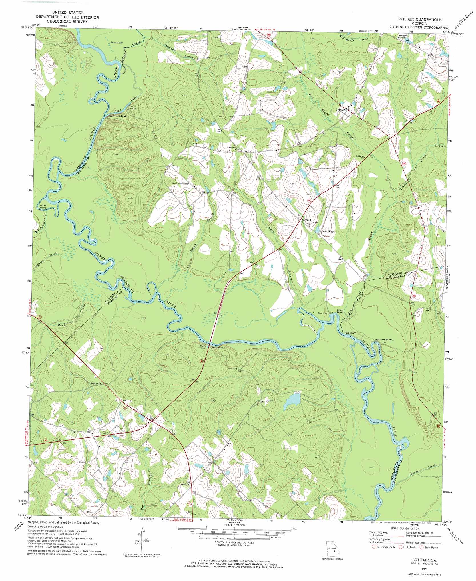
Lothair Topo Map Georgia
To zoom in, hover over the map of Lothair
USGS Topo Quad 32082c6 - 1:24,000 scale
| Topo Map Name: | Lothair |
| USGS Topo Quad ID: | 32082c6 |
| Print Size: | ca. 21 1/4" wide x 27" high |
| Southeast Coordinates: | 32.25° N latitude / 82.625° W longitude |
| Map Center Coordinates: | 32.3125° N latitude / 82.6875° W longitude |
| U.S. State: | GA |
| Filename: | o32082c6.jpg |
| Download Map JPG Image: | Lothair topo map 1:24,000 scale |
| Map Type: | Topographic |
| Topo Series: | 7.5´ |
| Map Scale: | 1:24,000 |
| Source of Map Images: | United States Geological Survey (USGS) |
| Alternate Map Versions: |
Lothair GA 1971, updated 1973 Download PDF Buy paper map Lothair GA 2011 Download PDF Buy paper map Lothair GA 2014 Download PDF Buy paper map |
1:24,000 Topo Quads surrounding Lothair
Dublin |
East Dublin |
Scott |
Adrian |
Norristown |
Rentz |
Minter |
Rockledge |
Soperton North |
Covena |
Five Points |
Lowery |
Lothair |
Soperton South |
Oak Park Sw |
Mcrae Nw |
Alamo |
Glenwood |
Mount Vernon |
Vidalia |
Mcrae |
Scotland |
Jordan |
Uvalda |
Alston |
> Back to 32082a1 at 1:100,000 scale
> Back to 32082a1 at 1:250,000 scale
> Back to U.S. Topo Maps home
Lothair topo map: Gazetteer
Lothair: Cliffs
Berry Hill Bluff elevation 63m 206′Bonnie Clabber Bluff elevation 42m 137′
Red Bluff elevation 37m 121′
Silver Bluff elevation 40m 131′
Williams Bluff elevation 43m 141′
Lothair: Dams
Horseshoe Pond Dam elevation 53m 173′Lothair: Populated Places
Barnhill elevation 62m 203′Lothair elevation 66m 216′
Lothair: Reservoirs
Horseshoe Pond elevation 53m 173′Lake Ginger elevation 55m 180′
Palm Lake elevation 43m 141′
Lothair: Streams
Bass Branch elevation 39m 127′Boggy Branch elevation 39m 127′
Buck Creek elevation 41m 134′
Cypress Creek elevation 36m 118′
Dead River elevation 42m 137′
Little Red Bluff Creek elevation 45m 147′
Mercer Creek elevation 42m 137′
Oconee Branch elevation 45m 147′
Pitts Creek elevation 42m 137′
Red Bluff Creek elevation 38m 124′
Whitewater Creek elevation 42m 137′
Lothair: Swamps
Barwick Pond elevation 42m 137′Lothair digital topo map on disk
Buy this Lothair topo map showing relief, roads, GPS coordinates and other geographical features, as a high-resolution digital map file on DVD:
South Carolina, Western North Carolina & Northeastern Georgia
Buy digital topo maps: South Carolina, Western North Carolina & Northeastern Georgia