Nunez Topo Map Georgia
To zoom in, hover over the map of Nunez
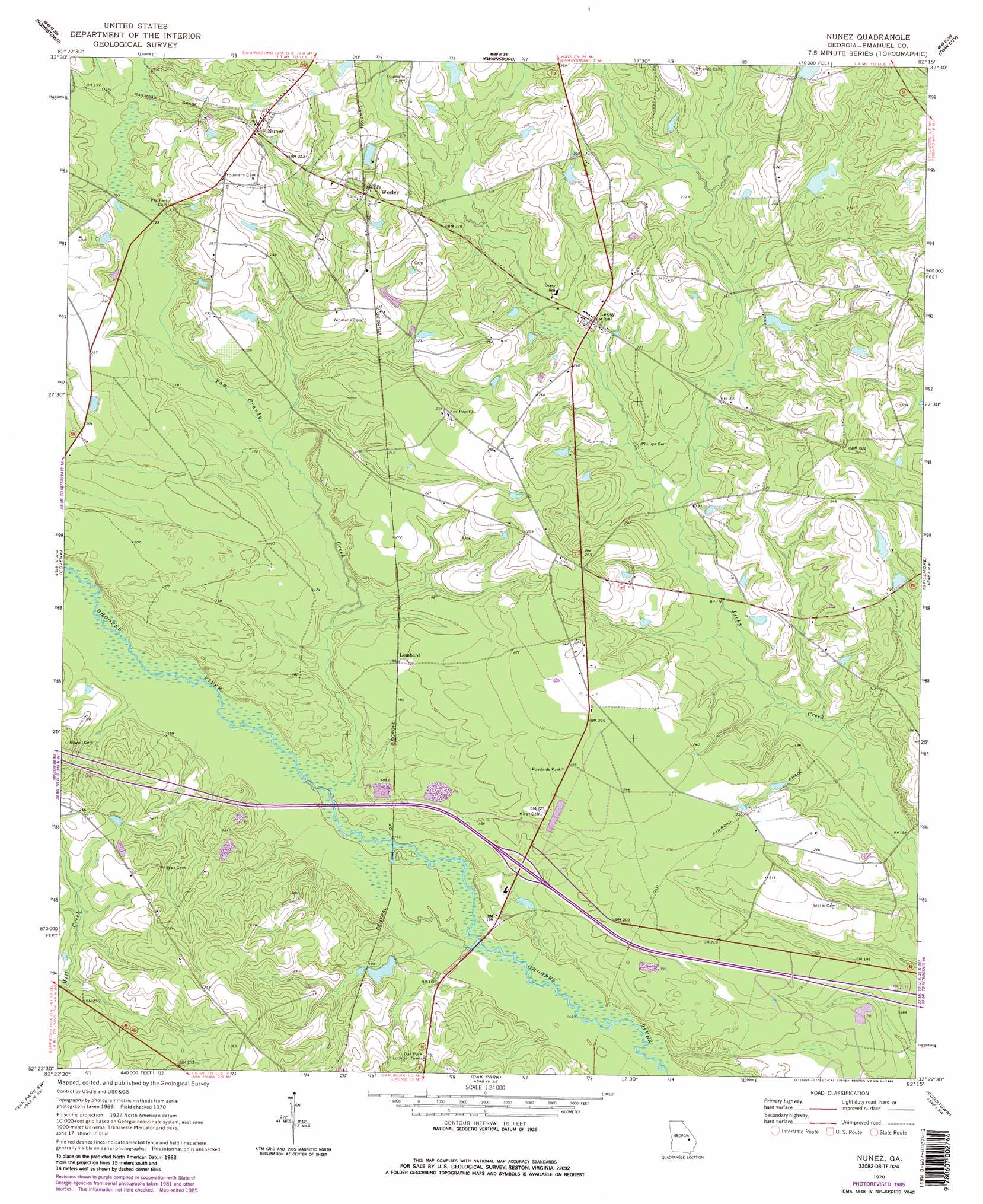
USGS Topo Quad 32082d3 - 1:24,000 scale
| Topo Map Name: | Nunez |
| USGS Topo Quad ID: | 32082d3 |
| Print Size: | ca. 21 1/4" wide x 27" high |
| Southeast Coordinates: | 32.375° N latitude / 82.25° W longitude |
| Map Center Coordinates: | 32.4375° N latitude / 82.3125° W longitude |
| U.S. State: | GA |
| Filename: | o32082d3.jpg |
| Download Map JPG Image: | Nunez topo map 1:24,000 scale |
| Map Type: | Topographic |
| Topo Series: | 7.5´ |
| Map Scale: | 1:24,000 |
| Source of Map Images: | United States Geological Survey (USGS) |
| Alternate Map Versions: |
Nunez GA 1970, updated 1973 Download PDF Buy paper map Nunez GA 1970, updated 1986 Download PDF Buy paper map Nunez GA 2011 Download PDF Buy paper map Nunez GA 2014 Download PDF Buy paper map |
1:24,000 Topo Quads surrounding Nunez
Kite |
Dellwood |
Summertown |
Canoochee |
Garfield |
Adrian |
Norristown |
Swainsboro |
Twin City |
Twin City Se |
Soperton North |
Covena |
Nunez |
Stillmore |
Metter |
Soperton South |
Oak Park Sw |
Oak Park |
Cobbtown |
Metter Se |
Mount Vernon |
Vidalia |
Lyons |
Ohoopee |
Collins |
> Back to 32082a1 at 1:100,000 scale
> Back to 32082a1 at 1:250,000 scale
> Back to U.S. Topo Maps home
Nunez topo map: Gazetteer
Nunez: Crossings
Exit 21 elevation 55m 180′Nunez: Dams
Gainer Corporation Dam elevation 54m 177′Rountree Dam elevation 66m 216′
Youmans Lake Dam elevation 69m 226′
Nunez: Populated Places
Lexsy elevation 64m 209′Lombard elevation 60m 196′
Nunez elevation 76m 249′
Wesley elevation 72m 236′
Nunez: Reservoirs
Gainer Corporation Lake elevation 54m 177′Rountree Lake elevation 66m 216′
Youmans Lake elevation 69m 226′
Nunez: Streams
Open Creek elevation 57m 187′Reedy Branch elevation 58m 190′
Yam Grandy Creek elevation 46m 150′
Nunez digital topo map on disk
Buy this Nunez topo map showing relief, roads, GPS coordinates and other geographical features, as a high-resolution digital map file on DVD:
South Carolina, Western North Carolina & Northeastern Georgia
Buy digital topo maps: South Carolina, Western North Carolina & Northeastern Georgia