Norristown Topo Map Georgia
To zoom in, hover over the map of Norristown
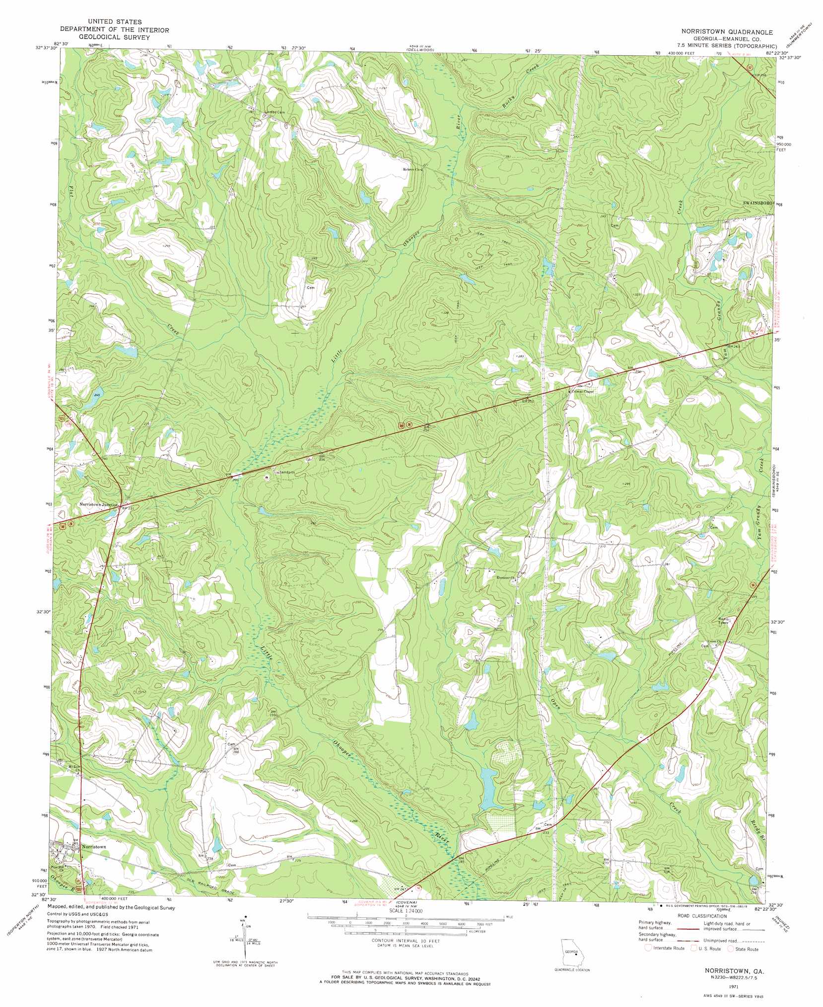
USGS Topo Quad 32082e4 - 1:24,000 scale
| Topo Map Name: | Norristown |
| USGS Topo Quad ID: | 32082e4 |
| Print Size: | ca. 21 1/4" wide x 27" high |
| Southeast Coordinates: | 32.5° N latitude / 82.375° W longitude |
| Map Center Coordinates: | 32.5625° N latitude / 82.4375° W longitude |
| U.S. State: | GA |
| Filename: | o32082e4.jpg |
| Download Map JPG Image: | Norristown topo map 1:24,000 scale |
| Map Type: | Topographic |
| Topo Series: | 7.5´ |
| Map Scale: | 1:24,000 |
| Source of Map Images: | United States Geological Survey (USGS) |
| Alternate Map Versions: |
Norristown GA 1971, updated 1973 Download PDF Buy paper map Norristown GA 2011 Download PDF Buy paper map Norristown GA 2014 Download PDF Buy paper map |
1:24,000 Topo Quads surrounding Norristown
Harrison |
Davisboro Se |
Wadley |
Colemans Lake |
Midville |
Wrightsville |
Kite |
Dellwood |
Summertown |
Canoochee |
Scott |
Adrian |
Norristown |
Swainsboro |
Twin City |
Rockledge |
Soperton North |
Covena |
Nunez |
Stillmore |
Lothair |
Soperton South |
Oak Park Sw |
Oak Park |
Cobbtown |
> Back to 32082e1 at 1:100,000 scale
> Back to 32082a1 at 1:250,000 scale
> Back to U.S. Topo Maps home
Norristown topo map: Gazetteer
Norristown: Dams
Beasley Lake Dam elevation 66m 216′McNeely Lake Dam elevation 78m 255′
Youngblood Lake Dam elevation 63m 206′
Youngblood Lake South Dam elevation 60m 196′
Norristown: Populated Places
Norristown elevation 75m 246′Norristown Junction elevation 71m 232′
Norristown: Reservoirs
Beasley Lake elevation 66m 216′McNeely Lake elevation 78m 255′
Youngblood Lake elevation 63m 206′
Youngblood Lake South elevation 60m 196′
Norristown: Streams
Flat Creek elevation 63m 206′Flat Creek elevation 57m 187′
Rocky Creek elevation 63m 206′
Norristown digital topo map on disk
Buy this Norristown topo map showing relief, roads, GPS coordinates and other geographical features, as a high-resolution digital map file on DVD:
South Carolina, Western North Carolina & Northeastern Georgia
Buy digital topo maps: South Carolina, Western North Carolina & Northeastern Georgia