Canoochee Topo Map Georgia
To zoom in, hover over the map of Canoochee
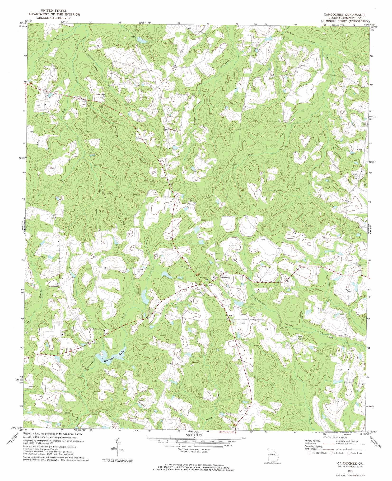
USGS Topo Quad 32082f2 - 1:24,000 scale
| Topo Map Name: | Canoochee |
| USGS Topo Quad ID: | 32082f2 |
| Print Size: | ca. 21 1/4" wide x 27" high |
| Southeast Coordinates: | 32.625° N latitude / 82.125° W longitude |
| Map Center Coordinates: | 32.6875° N latitude / 82.1875° W longitude |
| U.S. State: | GA |
| Filename: | o32082f2.jpg |
| Download Map JPG Image: | Canoochee topo map 1:24,000 scale |
| Map Type: | Topographic |
| Topo Series: | 7.5´ |
| Map Scale: | 1:24,000 |
| Source of Map Images: | United States Geological Survey (USGS) |
| Alternate Map Versions: |
Canoochee GA 1971, updated 1974 Download PDF Buy paper map Canoochee GA 2011 Download PDF Buy paper map Canoochee GA 2014 Download PDF Buy paper map |
1:24,000 Topo Quads surrounding Canoochee
Louisville South |
Old Town |
Scotts Corner |
Bellevue |
Perkins |
Wadley |
Colemans Lake |
Midville |
Birdsville |
Millen |
Dellwood |
Summertown |
Canoochee |
Garfield |
Four Points |
Norristown |
Swainsboro |
Twin City |
Twin City Se |
Portal |
Covena |
Nunez |
Stillmore |
Metter |
Pulaski |
> Back to 32082e1 at 1:100,000 scale
> Back to 32082a1 at 1:250,000 scale
> Back to U.S. Topo Maps home
Canoochee topo map: Gazetteer
Canoochee: Dams
Durden Dam elevation 85m 278′Overstreet Lake Dam elevation 79m 259′
Overstreet Pond Dam elevation 79m 259′
Canoochee: Populated Places
Canoochee elevation 108m 354′Canoochee: Reservoirs
Durden Farm Pond elevation 85m 278′Overstreet Lake elevation 79m 259′
Overstreet Pond elevation 79m 259′
Canoochee digital topo map on disk
Buy this Canoochee topo map showing relief, roads, GPS coordinates and other geographical features, as a high-resolution digital map file on DVD:
South Carolina, Western North Carolina & Northeastern Georgia
Buy digital topo maps: South Carolina, Western North Carolina & Northeastern Georgia