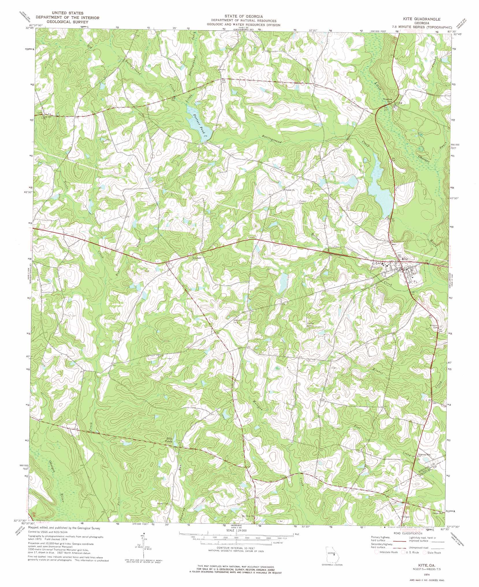
Kite Topo Map Georgia
To zoom in, hover over the map of Kite
USGS Topo Quad 32082f5 - 1:24,000 scale
| Topo Map Name: | Kite |
| USGS Topo Quad ID: | 32082f5 |
| Print Size: | ca. 21 1/4" wide x 27" high |
| Southeast Coordinates: | 32.625° N latitude / 82.5° W longitude |
| Map Center Coordinates: | 32.6875° N latitude / 82.5625° W longitude |
| U.S. State: | GA |
| Filename: | o32082f5.jpg |
| Download Map JPG Image: | Kite topo map 1:24,000 scale |
| Map Type: | Topographic |
| Topo Series: | 7.5´ |
| Map Scale: | 1:24,000 |
| Source of Map Images: | United States Geological Survey (USGS) |
| Alternate Map Versions: |
Kite GA 1974, updated 1976 Download PDF Buy paper map Kite GA 2011 Download PDF Buy paper map Kite GA 2014 Download PDF Buy paper map |
1:24,000 Topo Quads surrounding Kite
Sandersville |
Riddleville |
Davisboro |
Louisville South |
Old Town |
Irwins Crossroads |
Harrison |
Davisboro Se |
Wadley |
Colemans Lake |
Lovett |
Wrightsville |
Kite |
Dellwood |
Summertown |
East Dublin |
Scott |
Adrian |
Norristown |
Swainsboro |
Minter |
Rockledge |
Soperton North |
Covena |
Nunez |
> Back to 32082e1 at 1:100,000 scale
> Back to 32082a1 at 1:250,000 scale
> Back to U.S. Topo Maps home
Kite topo map: Gazetteer
Kite: Dams
Josey Pond Dam elevation 84m 275′Meeks Pond Dam elevation 82m 269′
Rayonair Pond Dam elevation 74m 242′
Kite: Populated Places
Kite elevation 76m 249′Kite: Reservoirs
Fortner Pond elevation 84m 275′Josey Pond elevation 84m 275′
Meeks Pond elevation 82m 269′
Pills Ponds elevation 91m 298′
Rayonair Pond elevation 74m 242′
Kite: Streams
Battleground Creek elevation 69m 226′Bear Creek elevation 81m 265′
Big Battleground Creek elevation 84m 275′
Holten Creek elevation 68m 223′
Little Battleground Creek elevation 84m 275′
Swain Creek elevation 71m 232′
Kite digital topo map on disk
Buy this Kite topo map showing relief, roads, GPS coordinates and other geographical features, as a high-resolution digital map file on DVD:
South Carolina, Western North Carolina & Northeastern Georgia
Buy digital topo maps: South Carolina, Western North Carolina & Northeastern Georgia