West Of Eastman Topo Map Georgia
To zoom in, hover over the map of West Of Eastman
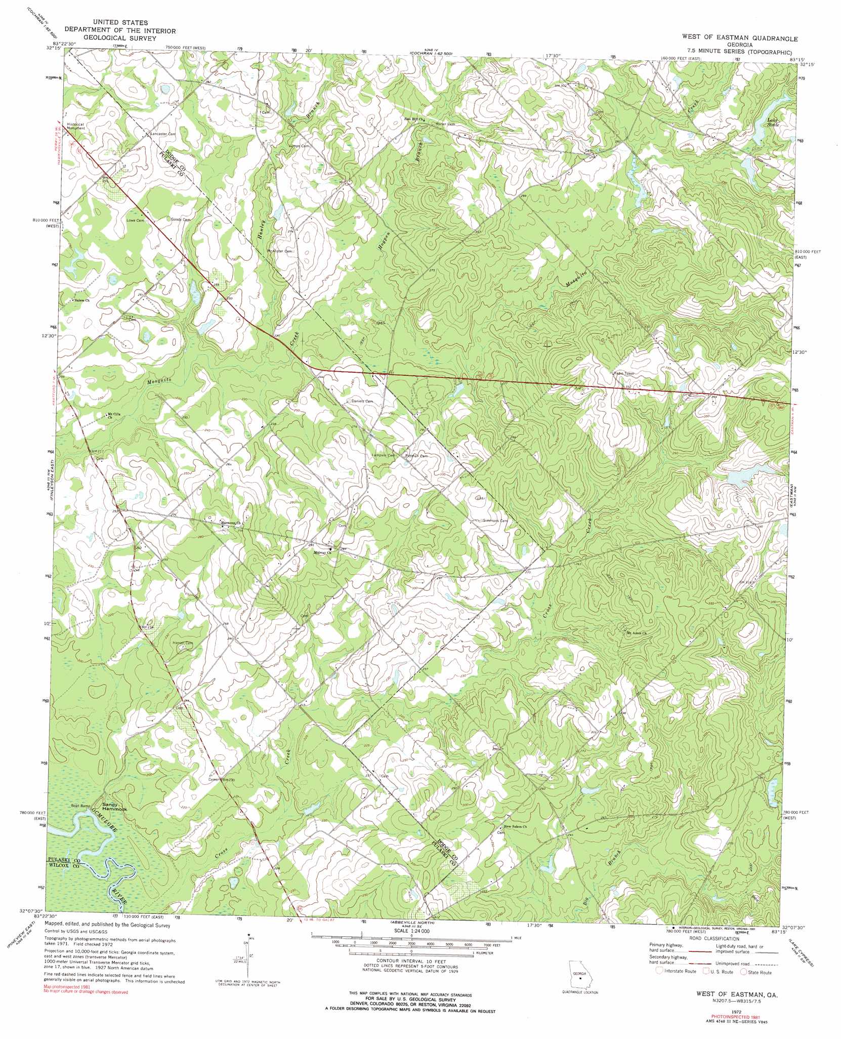
USGS Topo Quad 32083b3 - 1:24,000 scale
| Topo Map Name: | West Of Eastman |
| USGS Topo Quad ID: | 32083b3 |
| Print Size: | ca. 21 1/4" wide x 27" high |
| Southeast Coordinates: | 32.125° N latitude / 83.25° W longitude |
| Map Center Coordinates: | 32.1875° N latitude / 83.3125° W longitude |
| U.S. State: | GA |
| Filename: | o32083b3.jpg |
| Download Map JPG Image: | West Of Eastman topo map 1:24,000 scale |
| Map Type: | Topographic |
| Topo Series: | 7.5´ |
| Map Scale: | 1:24,000 |
| Source of Map Images: | United States Geological Survey (USGS) |
| Alternate Map Versions: |
West Of Eastman GA 1972, updated 1975 Download PDF Buy paper map West of Eastman GA 2011 Download PDF Buy paper map West of Eastman GA 2014 Download PDF Buy paper map |
1:24,000 Topo Quads surrounding West Of Eastman
Hayneville |
Westlake |
Cochran |
Chester |
Dexter |
Klondike |
Hawkinsville |
Empire |
Yonkers |
Cadwell |
Finleyson West |
Finleyson East |
West Of Eastman |
Eastman |
Jay Bird Springs |
Pineview West |
Pineview East |
Abbeville North |
Lake Cypress |
Milan |
Pitts |
Rochelle |
Abbeville South |
Rhine |
Cooks Still |
> Back to 32083a1 at 1:100,000 scale
> Back to 32082a1 at 1:250,000 scale
> Back to U.S. Topo Maps home
West Of Eastman topo map: Gazetteer
West Of Eastman: Dams
Bennett Pond Dam elevation 78m 255′Franklin Pond Dam elevation 89m 291′
Hadden Lake Dam elevation 75m 246′
Hardy Lake Dam elevation 76m 249′
Lake Steele Dam elevation 87m 285′
West Of Eastman: Islands
Sandy Hammock elevation 61m 200′West Of Eastman: Reservoirs
Bennett Pond elevation 78m 255′Franklin Pond elevation 89m 291′
Hadden Lake elevation 75m 246′
Hardy Lake elevation 76m 249′
Lake Steele elevation 87m 285′
West Of Eastman: Streams
Cross Creek elevation 60m 196′Hanley Branch elevation 67m 219′
Hogpen Branch elevation 70m 229′
West Of Eastman digital topo map on disk
Buy this West Of Eastman topo map showing relief, roads, GPS coordinates and other geographical features, as a high-resolution digital map file on DVD:
South Carolina, Western North Carolina & Northeastern Georgia
Buy digital topo maps: South Carolina, Western North Carolina & Northeastern Georgia