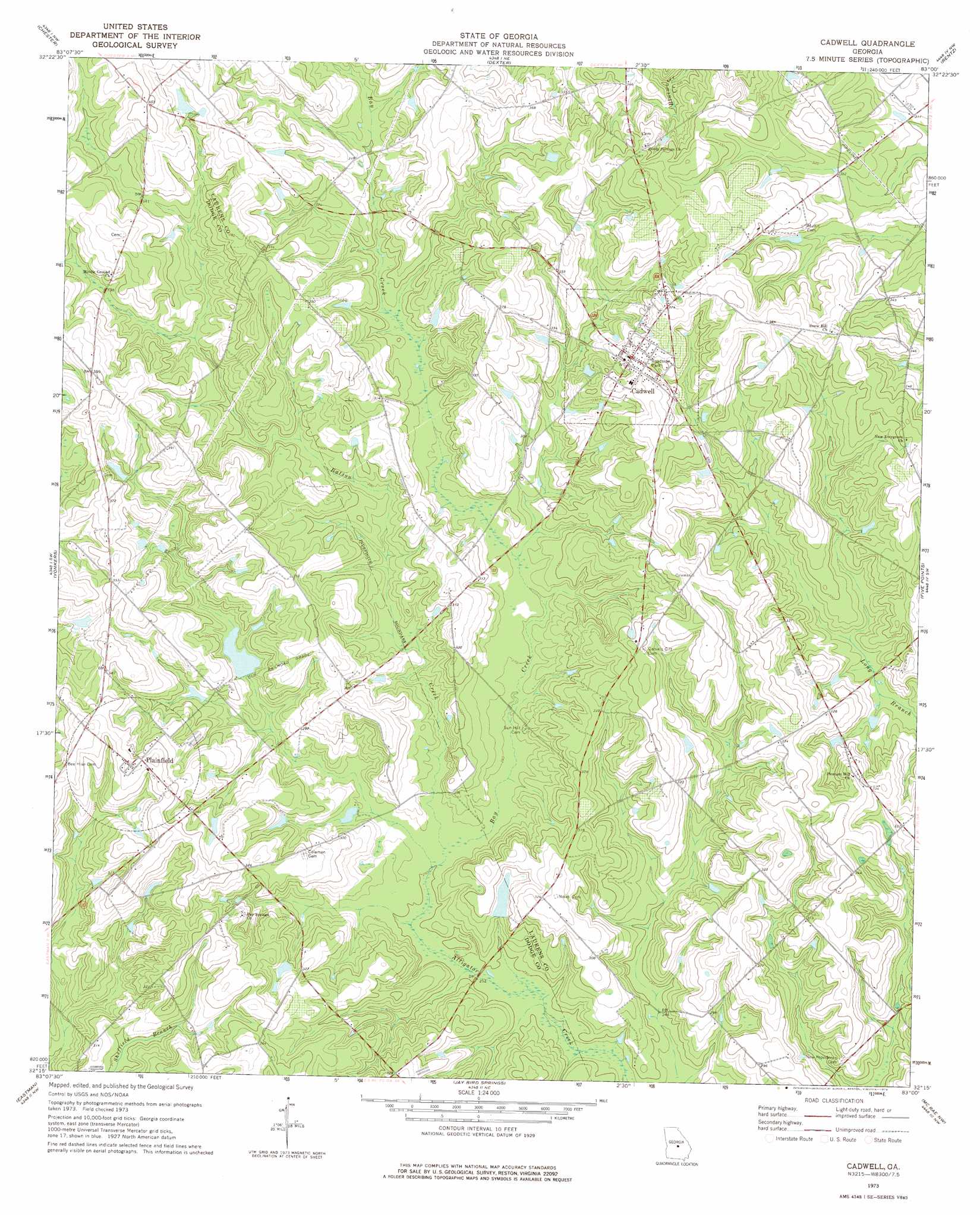
Cadwell Topo Map Georgia
To zoom in, hover over the map of Cadwell
USGS Topo Quad 32083c1 - 1:24,000 scale
| Topo Map Name: | Cadwell |
| USGS Topo Quad ID: | 32083c1 |
| Print Size: | ca. 21 1/4" wide x 27" high |
| Southeast Coordinates: | 32.25° N latitude / 83° W longitude |
| Map Center Coordinates: | 32.3125° N latitude / 83.0625° W longitude |
| U.S. State: | GA |
| Filename: | o32083c1.jpg |
| Download Map JPG Image: | Cadwell topo map 1:24,000 scale |
| Map Type: | Topographic |
| Topo Series: | 7.5´ |
| Map Scale: | 1:24,000 |
| Source of Map Images: | United States Geological Survey (USGS) |
| Alternate Map Versions: |
Cadwell GA 1973, updated 1976 Download PDF Buy paper map Cadwell GA 2011 Download PDF Buy paper map Cadwell GA 2014 Download PDF Buy paper map |
1:24,000 Topo Quads surrounding Cadwell
Danville West |
Danville East |
Dudley |
Dublin |
East Dublin |
Cochran |
Chester |
Dexter |
Rentz |
Minter |
Empire |
Yonkers |
Cadwell |
Five Points |
Lowery |
West Of Eastman |
Eastman |
Jay Bird Springs |
Mcrae Nw |
Alamo |
Abbeville North |
Lake Cypress |
Milan |
Mcrae |
Scotland |
> Back to 32083a1 at 1:100,000 scale
> Back to 32082a1 at 1:250,000 scale
> Back to U.S. Topo Maps home
Cadwell topo map: Gazetteer
Cadwell: Dams
Bryan Lake Dam elevation 97m 318′Jones Pond Dam elevation 87m 285′
McCollogh Pond Dam elevation 82m 269′
Whittle Lake Dam elevation 106m 347′
Cadwell: Populated Places
Batson elevation 94m 308′Beehive (historical) elevation 116m 380′
Cadwell elevation 110m 360′
Horne elevation 101m 331′
Mukerson elevation 99m 324′
Plainfield elevation 111m 364′
Cadwell: Reservoirs
Bryan Lake elevation 97m 318′Jones Pond elevation 87m 285′
McCollogh Pond elevation 82m 269′
Whittle Lake elevation 106m 347′
Cadwell: Streams
Batson Creek elevation 77m 252′Bay Creek elevation 77m 252′
Cadwell digital topo map on disk
Buy this Cadwell topo map showing relief, roads, GPS coordinates and other geographical features, as a high-resolution digital map file on DVD:
South Carolina, Western North Carolina & Northeastern Georgia
Buy digital topo maps: South Carolina, Western North Carolina & Northeastern Georgia