Marshallville Sw Topo Map Georgia
To zoom in, hover over the map of Marshallville Sw
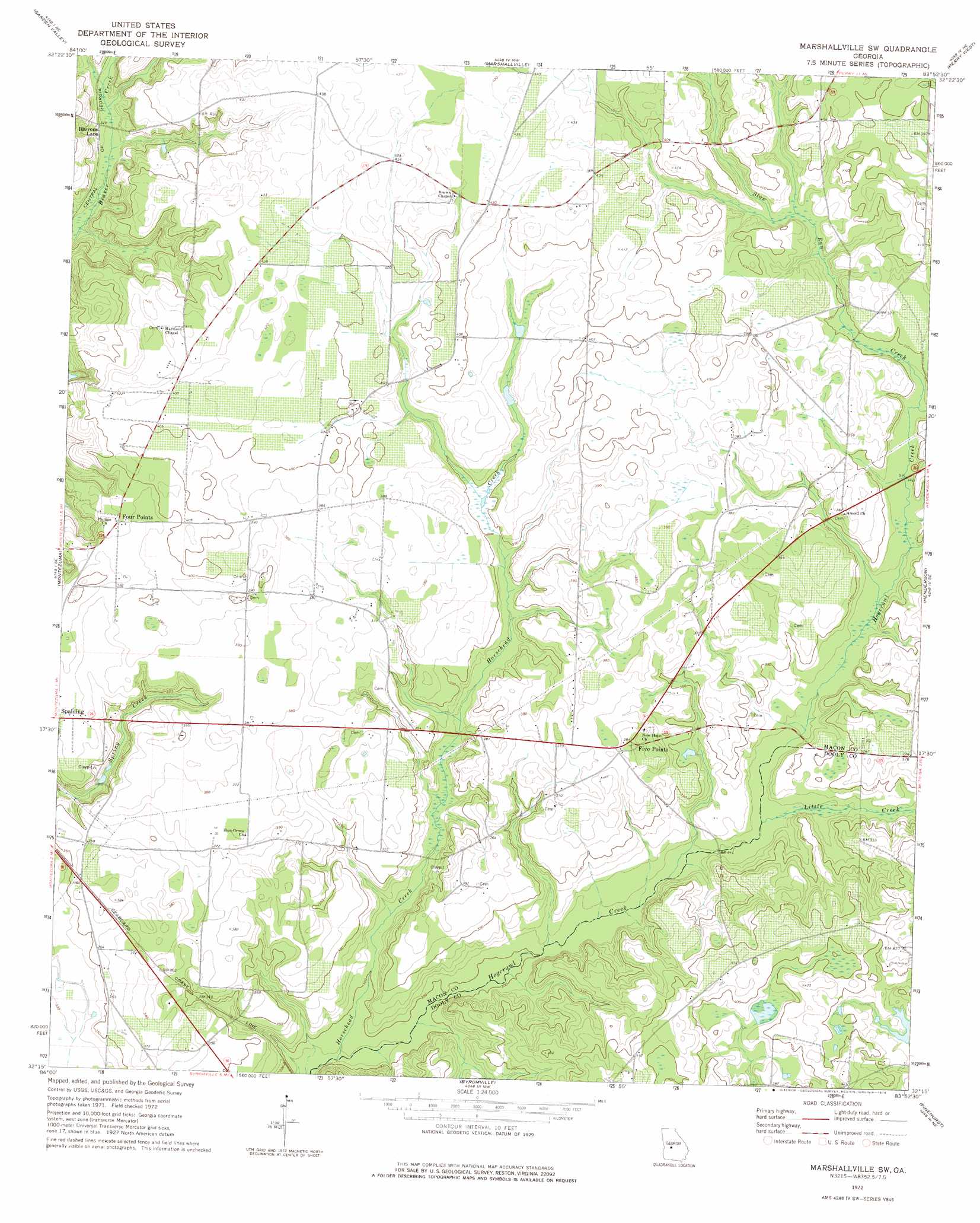
USGS Topo Quad 32083c8 - 1:24,000 scale
| Topo Map Name: | Marshallville Sw |
| USGS Topo Quad ID: | 32083c8 |
| Print Size: | ca. 21 1/4" wide x 27" high |
| Southeast Coordinates: | 32.25° N latitude / 83.875° W longitude |
| Map Center Coordinates: | 32.3125° N latitude / 83.9375° W longitude |
| U.S. State: | GA |
| Filename: | o32083c8.jpg |
| Download Map JPG Image: | Marshallville Sw topo map 1:24,000 scale |
| Map Type: | Topographic |
| Topo Series: | 7.5´ |
| Map Scale: | 1:24,000 |
| Source of Map Images: | United States Geological Survey (USGS) |
| Alternate Map Versions: |
Marshallville SW GA 1972, updated 1974 Download PDF Buy paper map Marshallville SW GA 2011 Download PDF Buy paper map Marshallville SW GA 2014 Download PDF Buy paper map |
1:24,000 Topo Quads surrounding Marshallville Sw
Butler East |
Reynolds |
Fort Valley West |
Fort Valley East |
Warner Robins Sw |
Ideal North |
Garden Valley |
Marshallville |
Perry West |
Perry East |
Ideal South |
Montezuma |
Marshallville Sw |
Henderson |
Unadilla |
Andersonville |
Pennington |
Byromville |
Pinehurst |
Pineview Nw |
Americus |
Methvins |
Drayton |
Vienna |
Pineview Sw |
> Back to 32083a1 at 1:100,000 scale
> Back to 32082a1 at 1:250,000 scale
> Back to U.S. Topo Maps home
Marshallville Sw topo map: Gazetteer
Marshallville Sw: Dams
C E Thompson Dam Two elevation 117m 383′Horsehead Creek Lake Dam elevation 106m 347′
Marshallville Sw: Populated Places
Barrons Lane elevation 99m 324′Fields elevation 110m 360′
Five Points elevation 119m 390′
Four Points elevation 119m 390′
Spalding elevation 117m 383′
Marshallville Sw: Reservoirs
Horsehead Creek Lake elevation 106m 347′Marshallville Sw: Streams
Horsehead Creek elevation 88m 288′Little Creek elevation 95m 311′
Slow Run Creek elevation 103m 337′
Marshallville Sw digital topo map on disk
Buy this Marshallville Sw topo map showing relief, roads, GPS coordinates and other geographical features, as a high-resolution digital map file on DVD:
South Carolina, Western North Carolina & Northeastern Georgia
Buy digital topo maps: South Carolina, Western North Carolina & Northeastern Georgia