Dudley Topo Map Georgia
To zoom in, hover over the map of Dudley
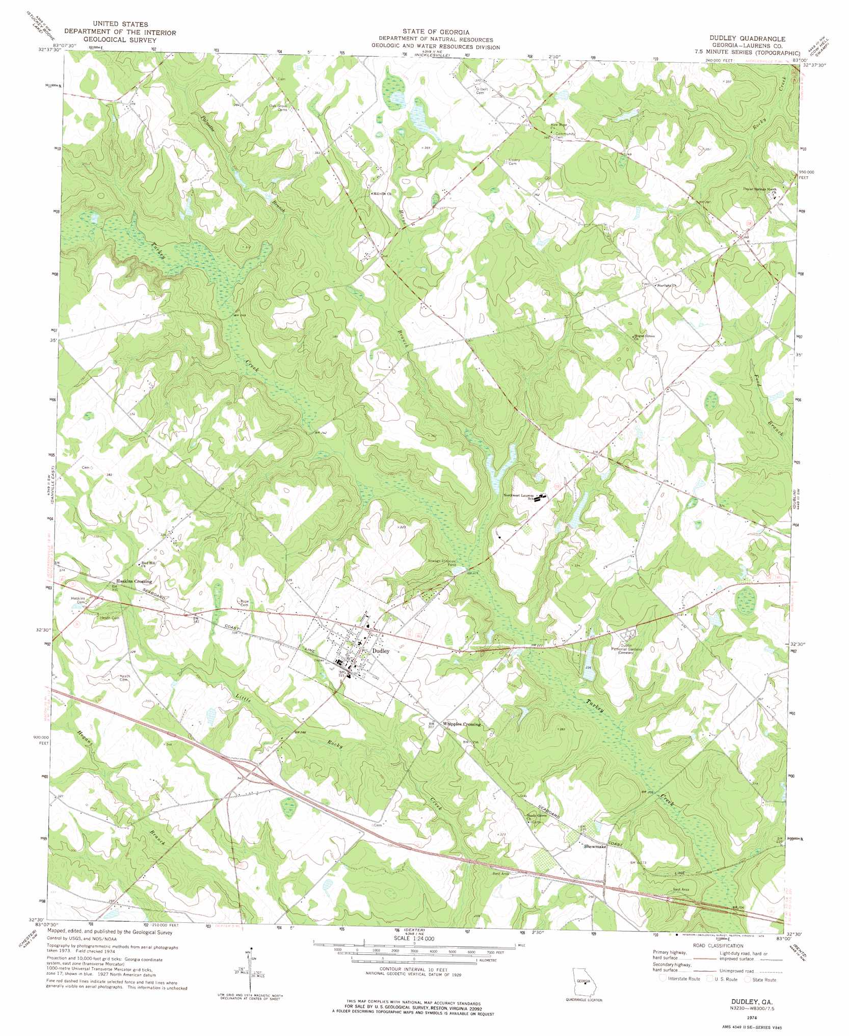
USGS Topo Quad 32083e1 - 1:24,000 scale
| Topo Map Name: | Dudley |
| USGS Topo Quad ID: | 32083e1 |
| Print Size: | ca. 21 1/4" wide x 27" high |
| Southeast Coordinates: | 32.5° N latitude / 83° W longitude |
| Map Center Coordinates: | 32.5625° N latitude / 83.0625° W longitude |
| U.S. State: | GA |
| Filename: | o32083e1.jpg |
| Download Map JPG Image: | Dudley topo map 1:24,000 scale |
| Map Type: | Topographic |
| Topo Series: | 7.5´ |
| Map Scale: | 1:24,000 |
| Source of Map Images: | United States Geological Survey (USGS) |
| Alternate Map Versions: |
Dudley GA 1974, updated 1976 Download PDF Buy paper map Dudley GA 2011 Download PDF Buy paper map Dudley GA 2014 Download PDF Buy paper map |
1:24,000 Topo Quads surrounding Dudley
Massey Hill |
Irwinton |
Toomsboro |
Oconee |
Irwins Crossroads |
Jeffersonville |
Stuckey Boone Lake |
Nicklesville |
Cow Hell Swamp |
Lovett |
Danville West |
Danville East |
Dudley |
Dublin |
East Dublin |
Cochran |
Chester |
Dexter |
Rentz |
Minter |
Empire |
Yonkers |
Cadwell |
Five Points |
Lowery |
> Back to 32083e1 at 1:100,000 scale
> Back to 32082a1 at 1:250,000 scale
> Back to U.S. Topo Maps home
Dudley topo map: Gazetteer
Dudley: Crossings
Exit 12 elevation 97m 318′Dudley: Dams
Hogan Lake Dam elevation 92m 301′Lord Lake Dam elevation 71m 232′
McLees Lake Dam elevation 83m 272′
Dudley: Populated Places
Bender (historical) elevation 108m 354′Dudley elevation 102m 334′
Haskins Crossing elevation 107m 351′
Shewmake elevation 84m 275′
Whipples Crossing elevation 92m 301′
Dudley: Reservoirs
Lord Lake elevation 71m 232′McDonald and Segars Lake elevation 92m 301′
McLees Lake elevation 83m 272′
Dudley: Streams
Horse Branch elevation 67m 219′Palmetto Branch elevation 76m 249′
Dudley digital topo map on disk
Buy this Dudley topo map showing relief, roads, GPS coordinates and other geographical features, as a high-resolution digital map file on DVD:
South Carolina, Western North Carolina & Northeastern Georgia
Buy digital topo maps: South Carolina, Western North Carolina & Northeastern Georgia