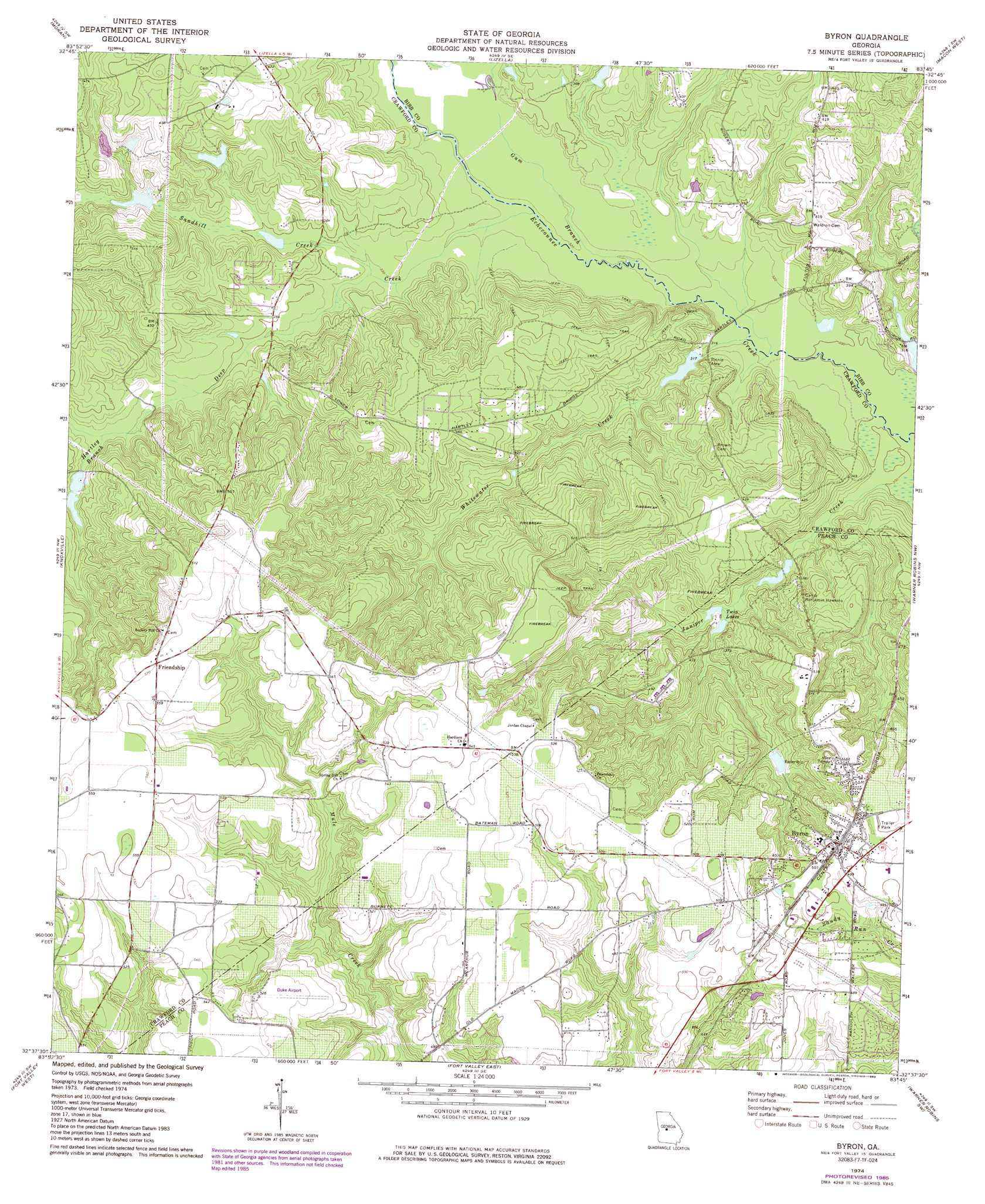
Byron Topo Map Georgia
To zoom in, hover over the map of Byron
USGS Topo Quad 32083f7 - 1:24,000 scale
| Topo Map Name: | Byron |
| USGS Topo Quad ID: | 32083f7 |
| Print Size: | ca. 21 1/4" wide x 27" high |
| Southeast Coordinates: | 32.625° N latitude / 83.75° W longitude |
| Map Center Coordinates: | 32.6875° N latitude / 83.8125° W longitude |
| U.S. State: | GA |
| Filename: | o32083f7.jpg |
| Download Map JPG Image: | Byron topo map 1:24,000 scale |
| Map Type: | Topographic |
| Topo Series: | 7.5´ |
| Map Scale: | 1:24,000 |
| Source of Map Images: | United States Geological Survey (USGS) |
| Alternate Map Versions: |
Byron GA 1974, updated 1976 Download PDF Buy paper map Byron GA 1974, updated 1985 Download PDF Buy paper map Byron GA 2011 Download PDF Buy paper map Byron GA 2014 Download PDF Buy paper map |
1:24,000 Topo Quads surrounding Byron
Strouds |
Smarr |
Bolingbroke |
Macon Nw |
Macon Ne |
Culloden |
Moran |
Lizella |
Macon West |
Macon East |
Roberta |
Knoxville |
Byron |
Warner Robins Nw |
Warner Robins Ne |
Reynolds |
Fort Valley West |
Fort Valley East |
Warner Robins Sw |
Warner Robins Se |
Garden Valley |
Marshallville |
Perry West |
Perry East |
Hayneville |
> Back to 32083e1 at 1:100,000 scale
> Back to 32082a1 at 1:250,000 scale
> Back to U.S. Topo Maps home
Byron topo map: Gazetteer
Byron: Airports
Duke Airport elevation 159m 521′Byron: Bridges
Hartley Bridges elevation 94m 308′Byron: Dams
Kraftsman Association Lake Dam elevation 107m 351′Merritt Lake Dam elevation 117m 383′
Newberry Lake Dam elevation 107m 351′
South Lake Dam elevation 99m 324′
Byron: Populated Places
Alpine Heights elevation 155m 508′Byron elevation 155m 508′
Echeconnee Acres elevation 114m 374′
Friendship elevation 174m 570′
Hidden Forest elevation 145m 475′
Byron: Reservoirs
Kraftsman Association Lake elevation 107m 351′Merritt Lake elevation 117m 383′
Newberry Lake elevation 107m 351′
Scout Lake elevation 99m 324′
Twin Lakes elevation 102m 334′
Byron: Streams
Deep Creek elevation 97m 318′Gum Branch elevation 94m 308′
Hartley Branch elevation 111m 364′
Sandhill Creek elevation 100m 328′
Whitewater Creek elevation 93m 305′
Byron digital topo map on disk
Buy this Byron topo map showing relief, roads, GPS coordinates and other geographical features, as a high-resolution digital map file on DVD:
South Carolina, Western North Carolina & Northeastern Georgia
Buy digital topo maps: South Carolina, Western North Carolina & Northeastern Georgia