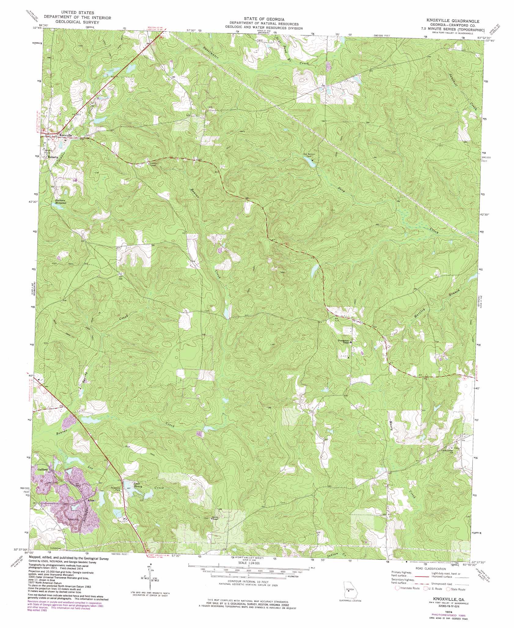
Knoxville Topo Map Georgia
To zoom in, hover over the map of Knoxville
USGS Topo Quad 32083f8 - 1:24,000 scale
| Topo Map Name: | Knoxville |
| USGS Topo Quad ID: | 32083f8 |
| Print Size: | ca. 21 1/4" wide x 27" high |
| Southeast Coordinates: | 32.625° N latitude / 83.875° W longitude |
| Map Center Coordinates: | 32.6875° N latitude / 83.9375° W longitude |
| U.S. State: | GA |
| Filename: | o32083f8.jpg |
| Download Map JPG Image: | Knoxville topo map 1:24,000 scale |
| Map Type: | Topographic |
| Topo Series: | 7.5´ |
| Map Scale: | 1:24,000 |
| Source of Map Images: | United States Geological Survey (USGS) |
| Alternate Map Versions: |
Knoxville GA 1974, updated 1976 Download PDF Buy paper map Knoxville GA 1974, updated 1986 Download PDF Buy paper map Knoxville GA 2011 Download PDF Buy paper map Knoxville GA 2014 Download PDF Buy paper map |
1:24,000 Topo Quads surrounding Knoxville
Yatesville |
Strouds |
Smarr |
Bolingbroke |
Macon Nw |
Logtown |
Culloden |
Moran |
Lizella |
Macon West |
Fickling Mill |
Roberta |
Knoxville |
Byron |
Warner Robins Nw |
Butler East |
Reynolds |
Fort Valley West |
Fort Valley East |
Warner Robins Sw |
Ideal North |
Garden Valley |
Marshallville |
Perry West |
Perry East |
> Back to 32083e1 at 1:100,000 scale
> Back to 32082a1 at 1:250,000 scale
> Back to U.S. Topo Maps home
Knoxville topo map: Gazetteer
Knoxville: Dams
Hortman Lake Dam elevation 137m 449′Hortmans Mill Pond Dam elevation 125m 410′
J K Hogan Dam elevation 131m 429′
Lake Henry Dam elevation 124m 406′
Lindsey Lake Dam elevation 123m 403′
Knoxville: Populated Places
Allon elevation 145m 475′Knoxville elevation 150m 492′
Knoxville: Post Offices
Knoxville Post Office elevation 150m 492′Knoxville: Reservoirs
Hortman Lake elevation 137m 449′Hortmans Mill Pond elevation 125m 410′
Hortons Millpond elevation 123m 403′
Lake Henry elevation 124m 406′
Lindsey Lake elevation 123m 403′
Knoxville: Streams
Dent Pond Branch elevation 139m 456′Lee Creek elevation 110m 360′
Spring Creek elevation 110m 360′
Knoxville digital topo map on disk
Buy this Knoxville topo map showing relief, roads, GPS coordinates and other geographical features, as a high-resolution digital map file on DVD:
South Carolina, Western North Carolina & Northeastern Georgia
Buy digital topo maps: South Carolina, Western North Carolina & Northeastern Georgia