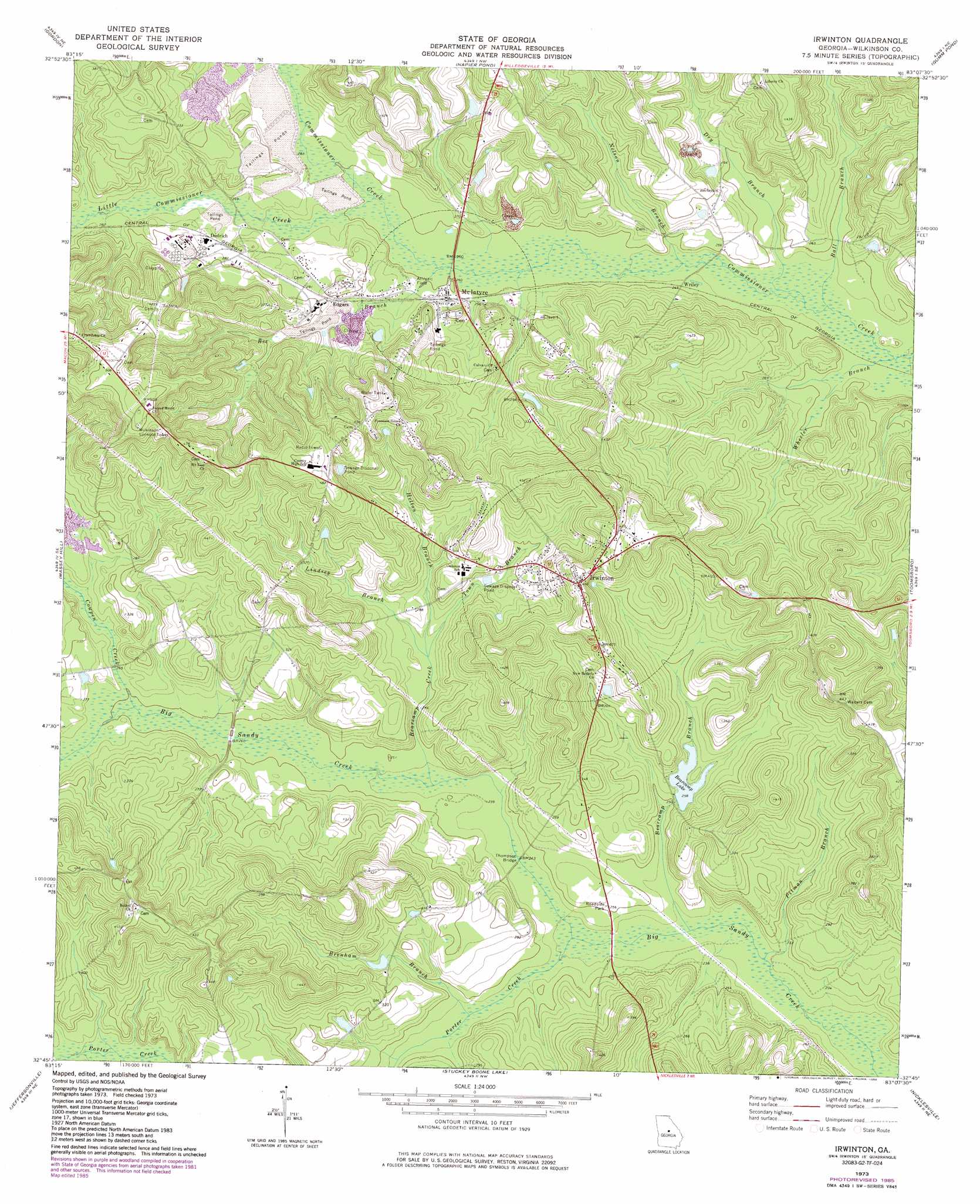
Irwinton Topo Map Georgia
To zoom in, hover over the map of Irwinton
USGS Topo Quad 32083g2 - 1:24,000 scale
| Topo Map Name: | Irwinton |
| USGS Topo Quad ID: | 32083g2 |
| Print Size: | ca. 21 1/4" wide x 27" high |
| Southeast Coordinates: | 32.75° N latitude / 83.125° W longitude |
| Map Center Coordinates: | 32.8125° N latitude / 83.1875° W longitude |
| U.S. State: | GA |
| Filename: | o32083g2.jpg |
| Download Map JPG Image: | Irwinton topo map 1:24,000 scale |
| Map Type: | Topographic |
| Topo Series: | 7.5´ |
| Map Scale: | 1:24,000 |
| Source of Map Images: | United States Geological Survey (USGS) |
| Alternate Map Versions: |
Irwinton GA 1973, updated 1977 Download PDF Buy paper map Irwinton GA 1973, updated 1986 Download PDF Buy paper map Irwinton GA 2011 Download PDF Buy paper map Irwinton GA 2014 Download PDF Buy paper map |
1:24,000 Topo Quads surrounding Irwinton
Haddock |
Browns Crossing |
Milledgeville |
Friendship |
Deepstep |
James |
Gordon |
Napier Pond |
Gumm Pond |
Tabernacle |
Dry Branch |
Massey Hill |
Irwinton |
Toomsboro |
Oconee |
Marion |
Jeffersonville |
Stuckey Boone Lake |
Nicklesville |
Cow Hell Swamp |
Tarversville |
Danville West |
Danville East |
Dudley |
Dublin |
> Back to 32083e1 at 1:100,000 scale
> Back to 32082a1 at 1:250,000 scale
> Back to U.S. Topo Maps home
Irwinton topo map: Gazetteer
Irwinton: Bridges
Thompson Bridge elevation 72m 236′Irwinton: Dams
Bearcamp Lake Dam elevation 76m 249′Irwinton: Lakes
Bearcamp Lake elevation 76m 249′Irwinton: Populated Places
Dedrich elevation 87m 285′Edgars elevation 90m 295′
Irwinton elevation 130m 426′
McIntyre elevation 79m 259′
Wriley elevation 75m 246′
Irwinton: Streams
Ball Branch elevation 72m 236′Bearcamp Branch elevation 69m 226′
Brenham Branch elevation 72m 236′
Cowpen Creek elevation 76m 249′
Dry Branch elevation 72m 236′
Helton Branch elevation 78m 255′
Lindsey Branch elevation 78m 255′
Little Commissioner Creek elevation 76m 249′
Nelson Branch elevation 73m 239′
Pitman Branch elevation 69m 226′
Porter Creek elevation 69m 226′
Town Branch elevation 78m 255′
Wheeler Branch elevation 70m 229′
Irwinton digital topo map on disk
Buy this Irwinton topo map showing relief, roads, GPS coordinates and other geographical features, as a high-resolution digital map file on DVD:
South Carolina, Western North Carolina & Northeastern Georgia
Buy digital topo maps: South Carolina, Western North Carolina & Northeastern Georgia