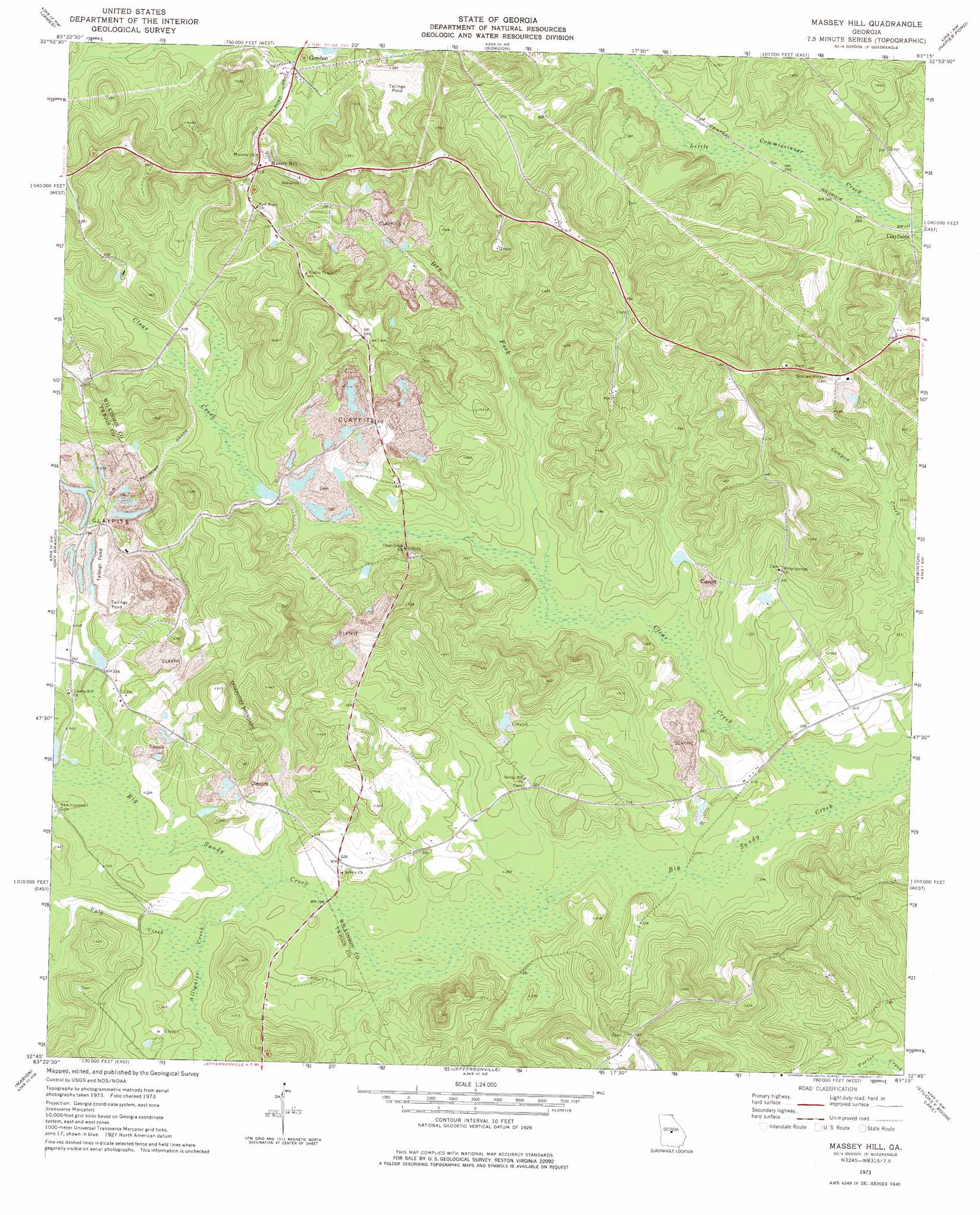
Massey Hill Topo Map Georgia
To zoom in, hover over the map of Massey Hill
USGS Topo Quad 32083g3 - 1:24,000 scale
| Topo Map Name: | Massey Hill |
| USGS Topo Quad ID: | 32083g3 |
| Print Size: | ca. 21 1/4" wide x 27" high |
| Southeast Coordinates: | 32.75° N latitude / 83.25° W longitude |
| Map Center Coordinates: | 32.8125° N latitude / 83.3125° W longitude |
| U.S. State: | GA |
| Filename: | o32083g3.jpg |
| Download Map JPG Image: | Massey Hill topo map 1:24,000 scale |
| Map Type: | Topographic |
| Topo Series: | 7.5´ |
| Map Scale: | 1:24,000 |
| Source of Map Images: | United States Geological Survey (USGS) |
| Alternate Map Versions: |
Massey Hill GA 1973, updated 1977 Download PDF Buy paper map Massey Hill GA 2011 Download PDF Buy paper map Massey Hill GA 2014 Download PDF Buy paper map |
1:24,000 Topo Quads surrounding Massey Hill
Gray |
Haddock |
Browns Crossing |
Milledgeville |
Friendship |
Macon Ne |
James |
Gordon |
Napier Pond |
Gumm Pond |
Macon East |
Dry Branch |
Massey Hill |
Irwinton |
Toomsboro |
Warner Robins Ne |
Marion |
Jeffersonville |
Stuckey Boone Lake |
Nicklesville |
Warner Robins Se |
Tarversville |
Danville West |
Danville East |
Dudley |
> Back to 32083e1 at 1:100,000 scale
> Back to 32082a1 at 1:250,000 scale
> Back to U.S. Topo Maps home
Massey Hill topo map: Gazetteer
Massey Hill: Bridges
H A Fountain Bridge elevation 87m 285′Massey Hill: Dams
Freeport Kaolin Tailings Pond Dam elevation 110m 360′Massey Hill: Populated Places
Clayfields elevation 85m 278′Massey Hill elevation 156m 511′
Massey Hill: Reservoirs
Freeport Kaolin Tailings Pond elevation 110m 360′Massey Hill: Streams
Alligator Creek elevation 87m 285′Clear Creek elevation 78m 255′
Dry Fork elevation 89m 291′
Ugly Creek elevation 89m 291′
Massey Hill digital topo map on disk
Buy this Massey Hill topo map showing relief, roads, GPS coordinates and other geographical features, as a high-resolution digital map file on DVD:
South Carolina, Western North Carolina & Northeastern Georgia
Buy digital topo maps: South Carolina, Western North Carolina & Northeastern Georgia