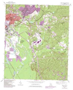
Macon East Topo Map Georgia
To zoom in, hover over the map of Macon East
USGS Topo Quad 32083g5 - 1:24,000 scale
| Topo Map Name: | Macon East |
| USGS Topo Quad ID: | 32083g5 |
| Print Size: | ca. 21 1/4" wide x 27" high |
| Southeast Coordinates: | 32.75° N latitude / 83.5° W longitude |
| Map Center Coordinates: | 32.8125° N latitude / 83.5625° W longitude |
| U.S. State: | GA |
| Filename: | o32083g5.jpg |
| Download Map JPG Image: | Macon East topo map 1:24,000 scale |
| Map Type: | Topographic |
| Topo Series: | 7.5´ |
| Map Scale: | 1:24,000 |
| Source of Map Images: | United States Geological Survey (USGS) |
| Alternate Map Versions: |
Macon East GA 1956, updated 1958 Download PDF Buy paper map Macon East GA 1956, updated 1970 Download PDF Buy paper map Macon East GA 1956, updated 1973 Download PDF Buy paper map Macon East GA 1956, updated 1986 Download PDF Buy paper map Macon East GA 2011 Download PDF Buy paper map Macon East GA 2014 Download PDF Buy paper map |
1:24,000 Topo Quads surrounding Macon East
> Back to 32083e1 at 1:100,000 scale
> Back to 32082a1 at 1:250,000 scale
> Back to U.S. Topo Maps home
Macon East topo map: Gazetteer
Macon East: Airports
Herbert Smart Downtown Airport elevation 130m 426′Macon East: Crossings
Exit 3 elevation 92m 301′Exit 4 elevation 91m 298′
Interchange 5 elevation 88m 288′
Macon East: Dams
Baker Lake Dam elevation 116m 380′Cauley Lake Dam elevation 118m 387′
Edwards Lake Dam elevation 93m 305′
Lakeside Dam elevation 96m 314′
Sawyer Lake Dam elevation 102m 334′
Stone Lake Dam elevation 86m 282′
Macon East: Lakes
Black Lake elevation 85m 278′Macon East: Parks
Conner Park elevation 97m 318′Georgia State Fairgrounds elevation 85m 278′
Lakeside Park elevation 99m 324′
Ocmulgee National Monument elevation 93m 305′
Macon East: Pillars
Ocmulgee National Monument elevation 85m 278′Macon East: Populated Places
Belvedere Manor elevation 141m 462′Bridgeman elevation 128m 419′
Bristol Forest elevation 120m 393′
Cross Keys elevation 98m 321′
Crystal Springs elevation 139m 456′
Duresville elevation 135m 442′
East Macon elevation 140m 459′
Franklinton elevation 104m 341′
Groveland elevation 129m 423′
Heritage Acres elevation 135m 442′
Highland Hills elevation 114m 374′
Kings Park elevation 137m 449′
Lake Arrowhead elevation 134m 439′
Lakeside elevation 116m 380′
Lakeside Hill elevation 119m 390′
Lanier Heights elevation 117m 383′
Mogul elevation 100m 328′
Morningside elevation 114m 374′
Sanders elevation 88m 288′
Shirlington elevation 113m 370′
Smithsonia elevation 95m 311′
Sunnydale Acres elevation 102m 334′
Tanglewood elevation 134m 439′
Terrell elevation 142m 465′
Thornton Heights elevation 136m 446′
Van Buren (historical) elevation 146m 479′
Weaver Heights elevation 153m 501′
Wheeler Heights elevation 132m 433′
Whispering Pines elevation 115m 377′
Wood Valley elevation 116m 380′
Macon East: Reservoirs
Baker Lake elevation 116m 380′Cauley Lake elevation 118m 387′
Edwards Lake elevation 93m 305′
Lake Arrowhead elevation 116m 380′
Lakeside Reservoir elevation 96m 314′
Sawyer Lake elevation 102m 334′
Stone Lake elevation 86m 282′
Walker Lakes elevation 84m 275′
Macon East: Streams
Boggy Branch elevation 86m 282′Dry Bone Creek elevation 91m 298′
Hall Branch elevation 94m 308′
Swift Creek elevation 82m 269′
Walnut Creek elevation 85m 278′
Macon East: Summits
Andrews Hill elevation 180m 590′Lamar Mounds elevation 90m 295′
Macon East digital topo map on disk
Buy this Macon East topo map showing relief, roads, GPS coordinates and other geographical features, as a high-resolution digital map file on DVD:
South Carolina, Western North Carolina & Northeastern Georgia
Buy digital topo maps: South Carolina, Western North Carolina & Northeastern Georgia


