Bolingbroke Topo Map Georgia
To zoom in, hover over the map of Bolingbroke
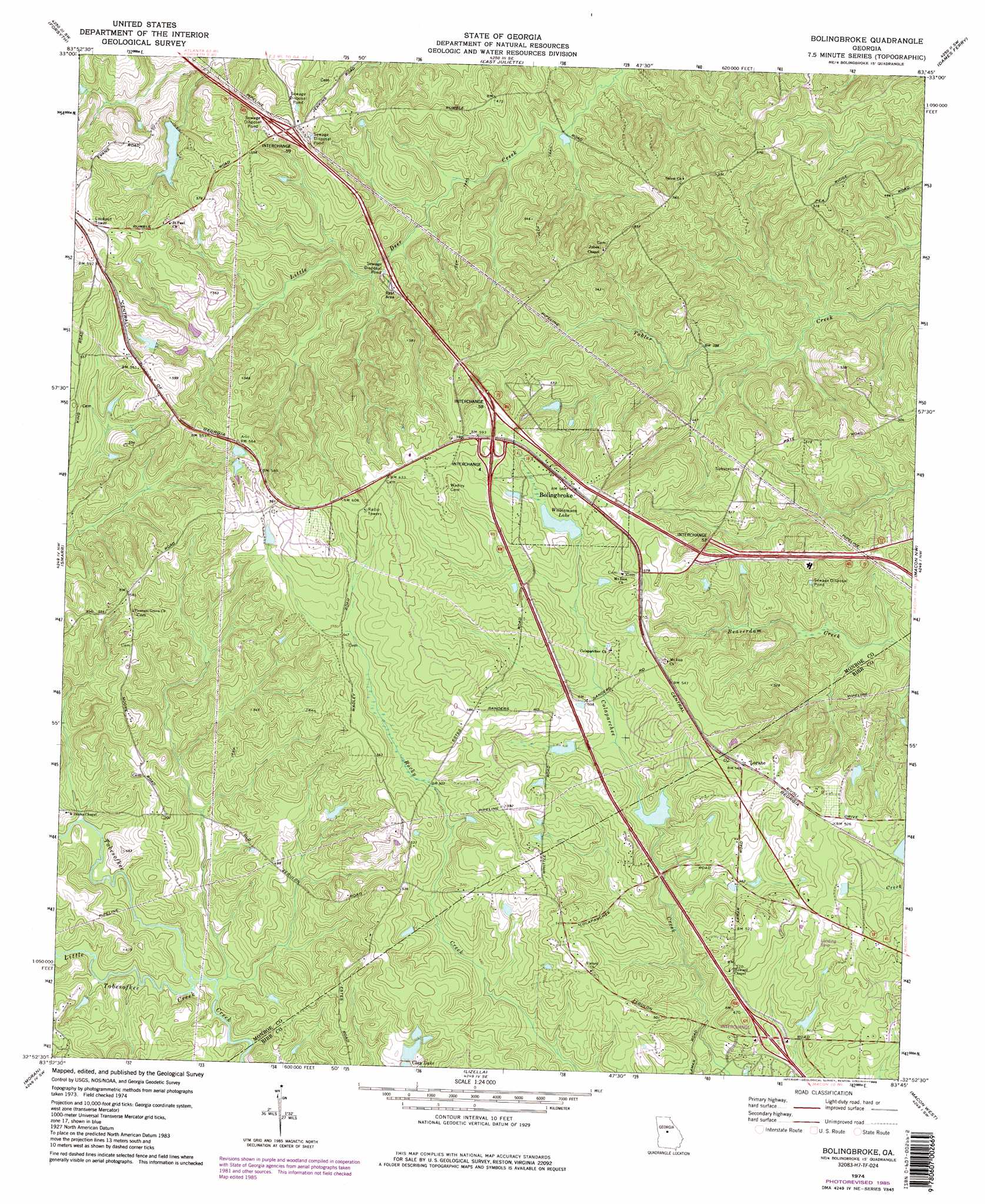
USGS Topo Quad 32083h7 - 1:24,000 scale
| Topo Map Name: | Bolingbroke |
| USGS Topo Quad ID: | 32083h7 |
| Print Size: | ca. 21 1/4" wide x 27" high |
| Southeast Coordinates: | 32.875° N latitude / 83.75° W longitude |
| Map Center Coordinates: | 32.9375° N latitude / 83.8125° W longitude |
| U.S. State: | GA |
| Filename: | o32083h7.jpg |
| Download Map JPG Image: | Bolingbroke topo map 1:24,000 scale |
| Map Type: | Topographic |
| Topo Series: | 7.5´ |
| Map Scale: | 1:24,000 |
| Source of Map Images: | United States Geological Survey (USGS) |
| Alternate Map Versions: |
Bolingbroke GA 1974, updated 1976 Download PDF Buy paper map Bolingbroke GA 1974, updated 1985 Download PDF Buy paper map Bolingbroke GA 1974, updated 1985 Download PDF Buy paper map Bolingbroke GA 2011 Download PDF Buy paper map Bolingbroke GA 2014 Download PDF Buy paper map |
1:24,000 Topo Quads surrounding Bolingbroke
High Falls |
Indian Springs |
Berner |
Hillsboro |
Stanfordville |
Johnstonville |
Forsyth |
East Juliette |
Dames Ferry |
Gray |
Strouds |
Smarr |
Bolingbroke |
Macon Nw |
Macon Ne |
Culloden |
Moran |
Lizella |
Macon West |
Macon East |
Roberta |
Knoxville |
Byron |
Warner Robins Nw |
Warner Robins Ne |
> Back to 32083e1 at 1:100,000 scale
> Back to 32082a1 at 1:250,000 scale
> Back to U.S. Topo Maps home
Bolingbroke topo map: Gazetteer
Bolingbroke: Crossings
Exit 3 elevation 136m 446′Exit 4 elevation 183m 600′
Exit 5 elevation 178m 583′
Exit 57 elevation 173m 567′
Exit 58 elevation 177m 580′
Exit 59 elevation 169m 554′
Bolingbroke: Dams
Clay Lake North Dam elevation 142m 465′Evans Lake Dam elevation 151m 495′
Lamon Lake Dam elevation 142m 465′
Mceacherns Lake Dam elevation 139m 456′
Bolingbroke: Lakes
Williamson Lake elevation 163m 534′Bolingbroke: Populated Places
Bolingbroke elevation 173m 567′Lorane elevation 166m 544′
Rivoli Plantation elevation 162m 531′
Bolingbroke: Post Offices
Bolingbroke Post Office elevation 173m 567′Bolingbroke: Reservoirs
Clay Lake North elevation 142m 465′Evans Lake elevation 151m 495′
Lamon Lake elevation 142m 465′
Mceacherns Lake elevation 139m 456′
Bolingbroke: Streams
Colaparchee Creek elevation 120m 393′Little Tobesofkee Creek elevation 116m 380′
Bolingbroke digital topo map on disk
Buy this Bolingbroke topo map showing relief, roads, GPS coordinates and other geographical features, as a high-resolution digital map file on DVD:
South Carolina, Western North Carolina & Northeastern Georgia
Buy digital topo maps: South Carolina, Western North Carolina & Northeastern Georgia