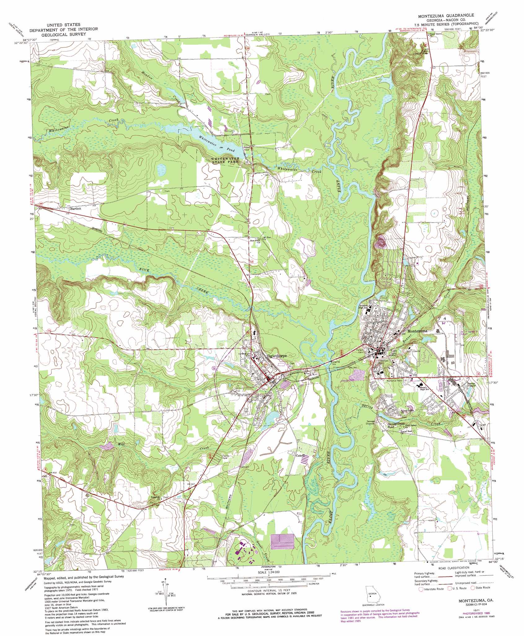
Montezuma Topo Map Georgia
To zoom in, hover over the map of Montezuma
USGS Topo Quad 32084c1 - 1:24,000 scale
| Topo Map Name: | Montezuma |
| USGS Topo Quad ID: | 32084c1 |
| Print Size: | ca. 21 1/4" wide x 27" high |
| Southeast Coordinates: | 32.25° N latitude / 84° W longitude |
| Map Center Coordinates: | 32.3125° N latitude / 84.0625° W longitude |
| U.S. State: | GA |
| Filename: | o32084c1.jpg |
| Download Map JPG Image: | Montezuma topo map 1:24,000 scale |
| Map Type: | Topographic |
| Topo Series: | 7.5´ |
| Map Scale: | 1:24,000 |
| Source of Map Images: | United States Geological Survey (USGS) |
| Alternate Map Versions: |
Montezuma GA 1971, updated 1974 Download PDF Buy paper map Montezuma GA 1971, updated 1986 Download PDF Buy paper map Montezuma GA 2011 Download PDF Buy paper map Montezuma GA 2014 Download PDF Buy paper map |
1:24,000 Topo Quads surrounding Montezuma
Butler West |
Butler East |
Reynolds |
Fort Valley West |
Fort Valley East |
Rupert |
Ideal North |
Garden Valley |
Marshallville |
Perry West |
Ellaville North |
Ideal South |
Montezuma |
Marshallville Sw |
Henderson |
Ellaville South |
Andersonville |
Pennington |
Byromville |
Pinehurst |
Lake Collins |
Americus |
Methvins |
Drayton |
Vienna |
> Back to 32084a1 at 1:100,000 scale
> Back to 32084a1 at 1:250,000 scale
> Back to U.S. Topo Maps home
Montezuma topo map: Gazetteer
Montezuma: Airports
Dr C P Savage Senior Airport elevation 102m 334′Montezuma: Dams
Chase Lake Dam elevation 90m 295′Cole Dam elevation 92m 301′
Spring Creek Pond Dam elevation 86m 282′
Whitewater Pond Dam elevation 87m 285′
Montezuma: Lakes
Whitewater Pond elevation 87m 285′Montezuma: Parks
Whitewater State Park elevation 86m 282′Montezuma: Populated Places
Bartlett elevation 105m 344′Cutoff elevation 92m 301′
Montezuma elevation 100m 328′
Oglethorpe elevation 91m 298′
Travelers Rest elevation 98m 321′
Montezuma: Post Offices
Montezuma Post Office elevation 86m 282′Oglethorpe Post Office elevation 92m 301′
Montezuma: Reservoirs
Chase Lake elevation 90m 295′Cole Lake elevation 92m 301′
Spring Creek Pond elevation 86m 282′
Montezuma: Streams
Beaver Creek elevation 79m 259′Buck Creek elevation 80m 262′
Meadow Creek elevation 87m 285′
Mill Creek elevation 79m 259′
Spring Creek elevation 79m 259′
Town Creek elevation 85m 278′
Whitewater Creek elevation 82m 269′
Montezuma digital topo map on disk
Buy this Montezuma topo map showing relief, roads, GPS coordinates and other geographical features, as a high-resolution digital map file on DVD:
Gulf Coast (LA, MS, AL, FL) & Southwestern Georgia
Buy digital topo maps: Gulf Coast (LA, MS, AL, FL) & Southwestern Georgia
 & Southwestern Georgia map DVD")