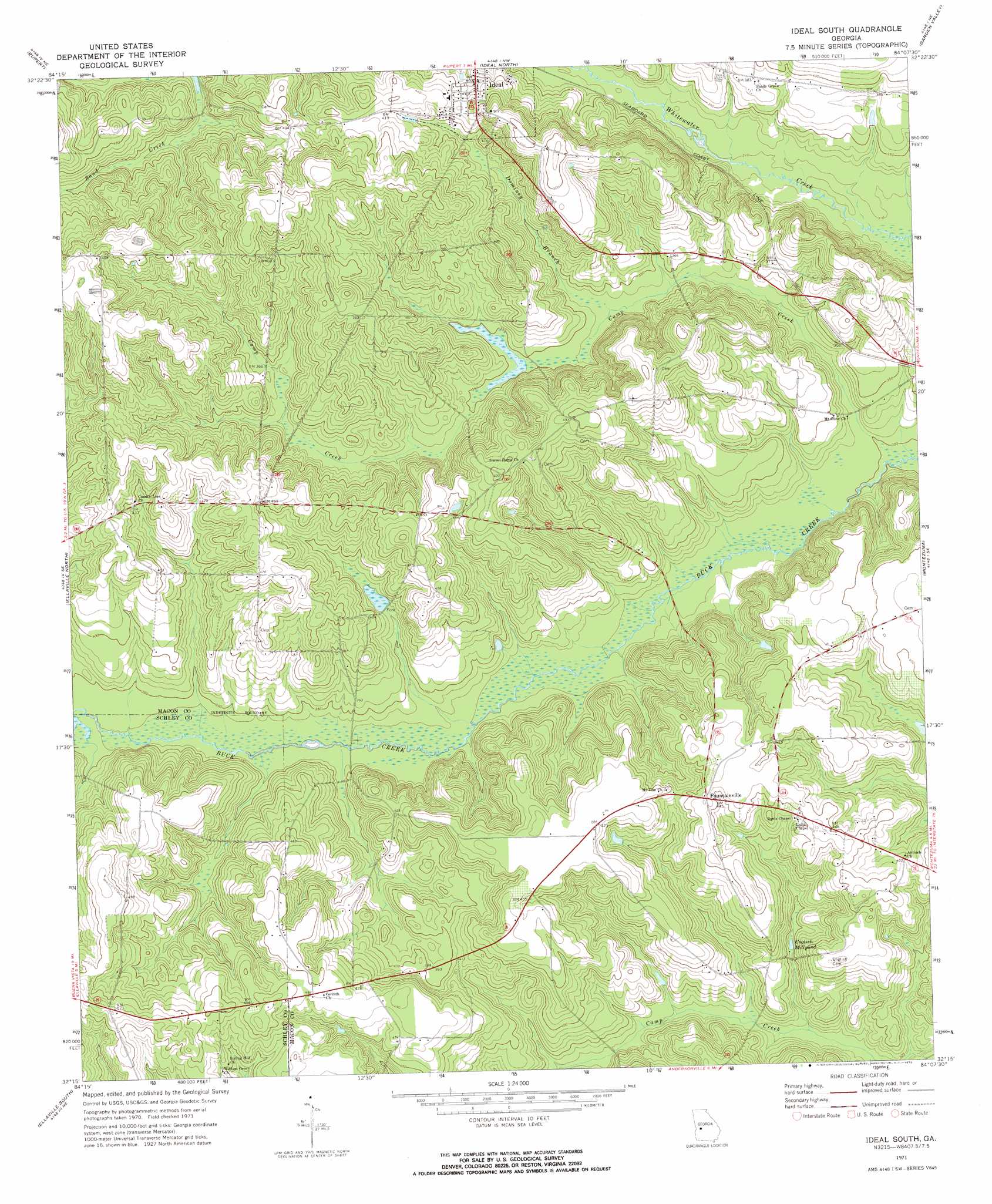
Ideal South Topo Map Georgia
To zoom in, hover over the map of Ideal South
USGS Topo Quad 32084c2 - 1:24,000 scale
| Topo Map Name: | Ideal South |
| USGS Topo Quad ID: | 32084c2 |
| Print Size: | ca. 21 1/4" wide x 27" high |
| Southeast Coordinates: | 32.25° N latitude / 84.125° W longitude |
| Map Center Coordinates: | 32.3125° N latitude / 84.1875° W longitude |
| U.S. State: | GA |
| Filename: | o32084c2.jpg |
| Download Map JPG Image: | Ideal South topo map 1:24,000 scale |
| Map Type: | Topographic |
| Topo Series: | 7.5´ |
| Map Scale: | 1:24,000 |
| Source of Map Images: | United States Geological Survey (USGS) |
| Alternate Map Versions: |
Ideal South GA 1971, updated 1973 Download PDF Buy paper map Ideal South GA 2011 Download PDF Buy paper map Ideal South GA 2014 Download PDF Buy paper map |
1:24,000 Topo Quads surrounding Ideal South
Junction City |
Butler West |
Butler East |
Reynolds |
Fort Valley West |
Tazewell North |
Rupert |
Ideal North |
Garden Valley |
Marshallville |
Tazewell South |
Ellaville North |
Ideal South |
Montezuma |
Marshallville Sw |
Draneville |
Ellaville South |
Andersonville |
Pennington |
Byromville |
Plains |
Lake Collins |
Americus |
Methvins |
Drayton |
> Back to 32084a1 at 1:100,000 scale
> Back to 32084a1 at 1:250,000 scale
> Back to U.S. Topo Maps home
Ideal South topo map: Gazetteer
Ideal South: Dams
Kennedy Lake Dam elevation 107m 351′Ideal South: Populated Places
Fountainville elevation 141m 462′Ideal elevation 139m 456′
Ideal South: Reservoirs
English Millpond elevation 102m 334′Kennedy Lake elevation 107m 351′
Ideal South: Streams
Camp Creek elevation 90m 295′Dominey Branch elevation 103m 337′
Ideal South digital topo map on disk
Buy this Ideal South topo map showing relief, roads, GPS coordinates and other geographical features, as a high-resolution digital map file on DVD:
Gulf Coast (LA, MS, AL, FL) & Southwestern Georgia
Buy digital topo maps: Gulf Coast (LA, MS, AL, FL) & Southwestern Georgia
 & Southwestern Georgia map DVD")