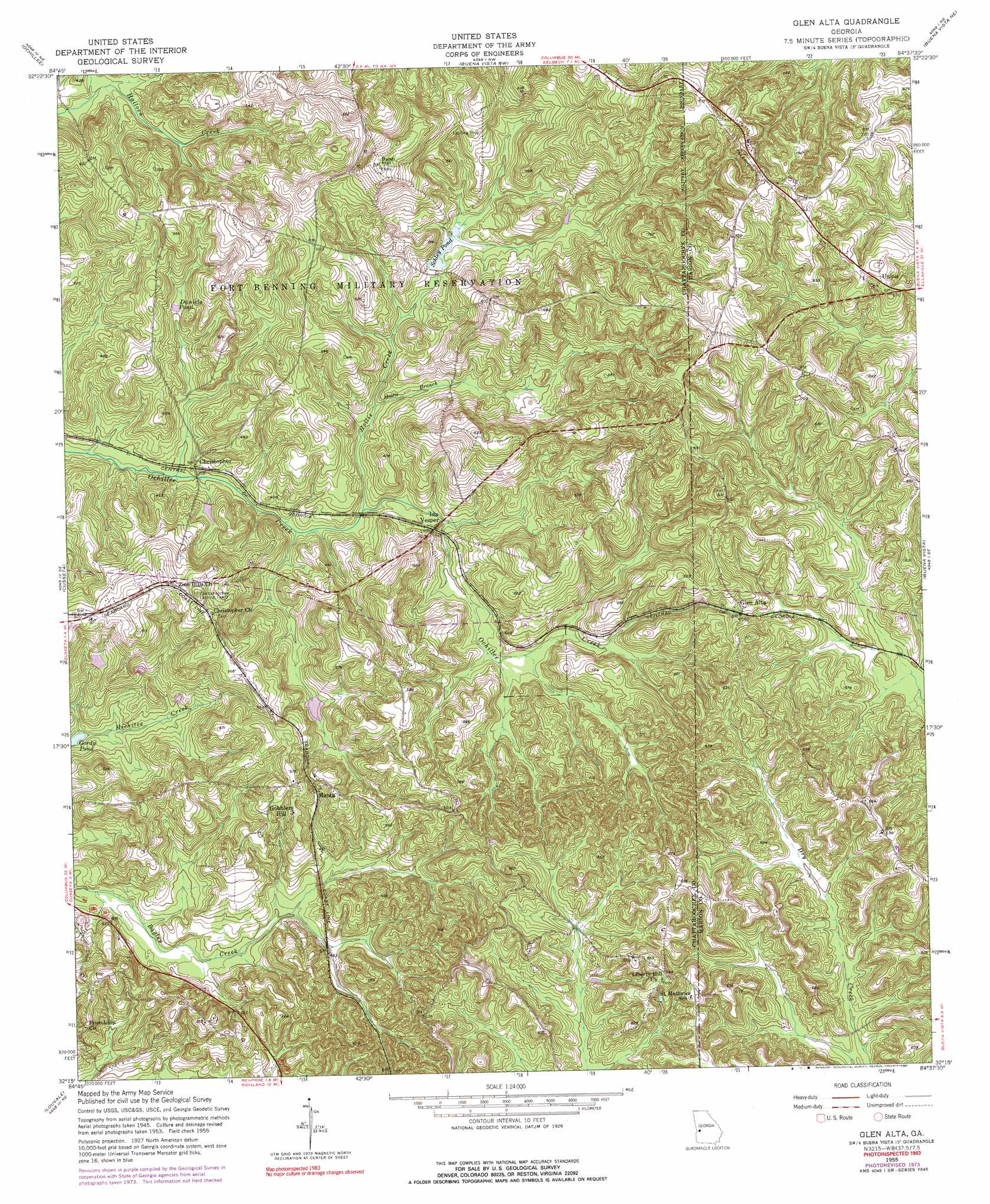
Glen Alta Topo Map Georgia
To zoom in, hover over the map of Glen Alta
USGS Topo Quad 32084c6 - 1:24,000 scale
| Topo Map Name: | Glen Alta |
| USGS Topo Quad ID: | 32084c6 |
| Print Size: | ca. 21 1/4" wide x 27" high |
| Southeast Coordinates: | 32.25° N latitude / 84.625° W longitude |
| Map Center Coordinates: | 32.3125° N latitude / 84.6875° W longitude |
| U.S. State: | GA |
| Filename: | o32084c6.jpg |
| Download Map JPG Image: | Glen Alta topo map 1:24,000 scale |
| Map Type: | Topographic |
| Topo Series: | 7.5´ |
| Map Scale: | 1:24,000 |
| Source of Map Images: | United States Geological Survey (USGS) |
| Alternate Map Versions: |
Glen Alta GA 1949 Download PDF Buy paper map Glen Alta GA 1955, updated 1959 Download PDF Buy paper map Glen Alta GA 1955, updated 1974 Download PDF Buy paper map Glen Alta GA 1955, updated 1991 Download PDF Buy paper map Glen Alta GA 2011 Download PDF Buy paper map Glen Alta GA 2014 Download PDF Buy paper map |
1:24,000 Topo Quads surrounding Glen Alta
Fortson |
Midland |
Upatoi |
Geneva |
Junction City |
Columbus |
Ochillee |
Buena Vista Nw |
Buena Vista Ne |
Tazewell North |
Fort Benning |
Cusseta |
Glen Alta |
Buena Vista |
Tazewell South |
Union |
Louvale |
Brooklyn |
Church Hill |
Draneville |
Lumpkin Sw |
Lumpkin |
Richland |
Preston |
Plains |
> Back to 32084a1 at 1:100,000 scale
> Back to 32084a1 at 1:250,000 scale
> Back to U.S. Topo Maps home
Glen Alta topo map: Gazetteer
Glen Alta: Dams
Anderson Lake Dam elevation 119m 390′Bagley Lake Dam elevation 131m 429′
Gordy Pond Dam elevation 108m 354′
Glen Alta: Lakes
Daniels Pond elevation 122m 400′Glen Alta: Populated Places
Christopher elevation 116m 380′Glen Alta elevation 171m 561′
Gobblers Hill elevation 148m 485′
Ida Vesper elevation 122m 400′
Manta elevation 158m 518′
Union elevation 208m 682′
Glen Alta: Reservoirs
Anderson Lake elevation 119m 390′Bagley Lake elevation 131m 429′
Schley Pond elevation 128m 419′
Glen Alta: Streams
Hollis Branch elevation 114m 374′Hollis Creek elevation 109m 357′
Glen Alta: Summits
Bush Hill elevation 212m 695′Glen Alta digital topo map on disk
Buy this Glen Alta topo map showing relief, roads, GPS coordinates and other geographical features, as a high-resolution digital map file on DVD:
Gulf Coast (LA, MS, AL, FL) & Southwestern Georgia
Buy digital topo maps: Gulf Coast (LA, MS, AL, FL) & Southwestern Georgia
 & Southwestern Georgia map DVD")