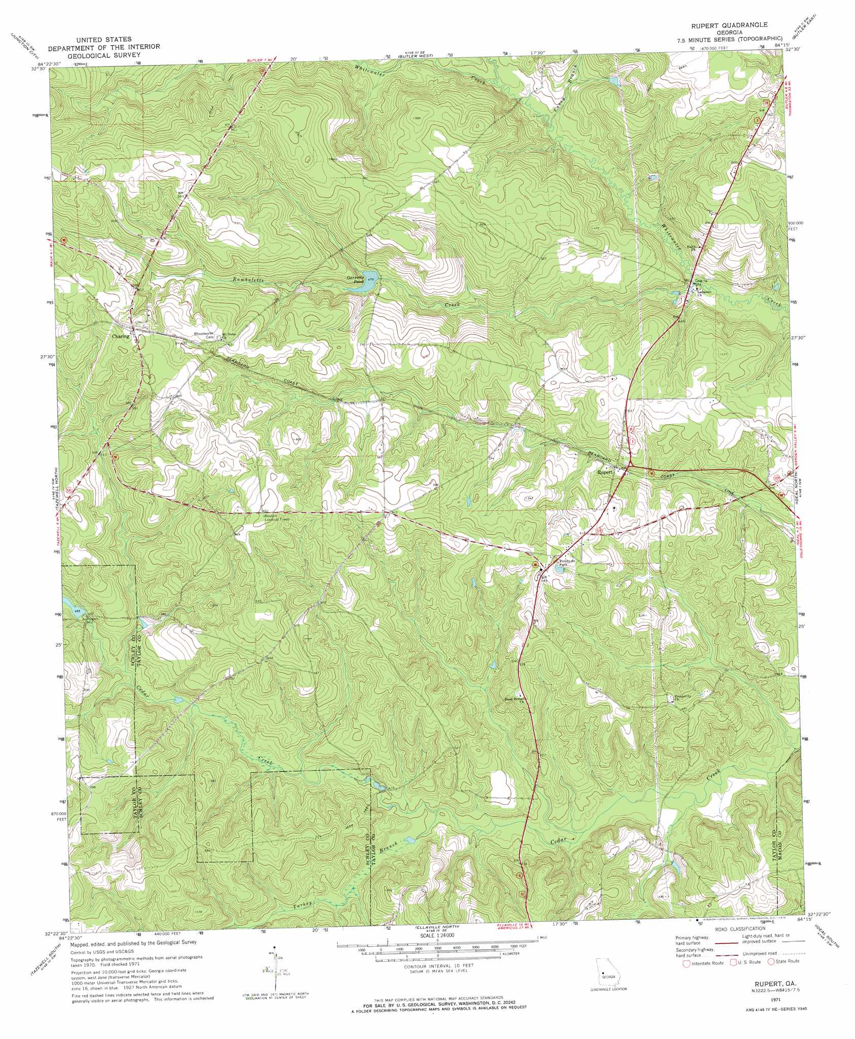
Rupert Topo Map Georgia
To zoom in, hover over the map of Rupert
USGS Topo Quad 32084d3 - 1:24,000 scale
| Topo Map Name: | Rupert |
| USGS Topo Quad ID: | 32084d3 |
| Print Size: | ca. 21 1/4" wide x 27" high |
| Southeast Coordinates: | 32.375° N latitude / 84.25° W longitude |
| Map Center Coordinates: | 32.4375° N latitude / 84.3125° W longitude |
| U.S. State: | GA |
| Filename: | o32084d3.jpg |
| Download Map JPG Image: | Rupert topo map 1:24,000 scale |
| Map Type: | Topographic |
| Topo Series: | 7.5´ |
| Map Scale: | 1:24,000 |
| Source of Map Images: | United States Geological Survey (USGS) |
| Alternate Map Versions: |
Rupert GA 1971, updated 1973 Download PDF Buy paper map Rupert GA 1971, updated 1985 Download PDF Buy paper map Rupert GA 2011 Download PDF Buy paper map Rupert GA 2014 Download PDF Buy paper map |
1:24,000 Topo Quads surrounding Rupert
Talbotton |
Baldwinville |
Prattsburg |
Fickling Mill |
Roberta |
Geneva |
Junction City |
Butler West |
Butler East |
Reynolds |
Buena Vista Ne |
Tazewell North |
Rupert |
Ideal North |
Garden Valley |
Buena Vista |
Tazewell South |
Ellaville North |
Ideal South |
Montezuma |
Church Hill |
Draneville |
Ellaville South |
Andersonville |
Pennington |
> Back to 32084a1 at 1:100,000 scale
> Back to 32084a1 at 1:250,000 scale
> Back to U.S. Topo Maps home
Rupert topo map: Gazetteer
Rupert: Dams
Garretts Pond Dam elevation 144m 472′Rogers Mill Dam elevation 137m 449′
Wells Lake Dam elevation 145m 475′
Rupert: Populated Places
Charing elevation 196m 643′Rupert elevation 134m 439′
Rupert: Post Offices
Charing Post Office (historical) elevation 195m 639′Rupert Post Office elevation 166m 544′
Rupert: Reservoirs
Garretts Pond elevation 144m 472′Rogers Mill Lake elevation 137m 449′
Wells Lake elevation 145m 475′
Rupert: Streams
Caney Branch elevation 116m 380′Little Whitewater Creek elevation 118m 387′
Rambulette Creek elevation 111m 364′
Turkey Branch elevation 119m 390′
Rupert digital topo map on disk
Buy this Rupert topo map showing relief, roads, GPS coordinates and other geographical features, as a high-resolution digital map file on DVD:
Gulf Coast (LA, MS, AL, FL) & Southwestern Georgia
Buy digital topo maps: Gulf Coast (LA, MS, AL, FL) & Southwestern Georgia
 & Southwestern Georgia map DVD")