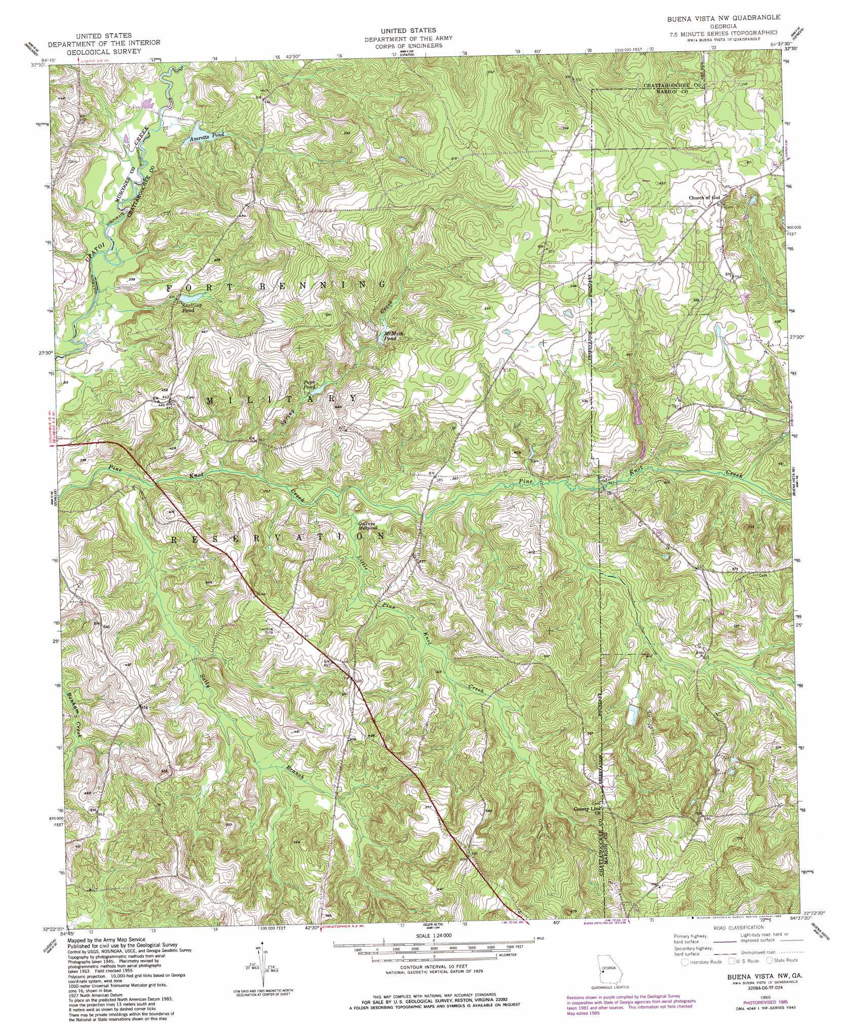
Buena Vista Nw Topo Map Georgia
To zoom in, hover over the map of Buena Vista Nw
USGS Topo Quad 32084d6 - 1:24,000 scale
| Topo Map Name: | Buena Vista Nw |
| USGS Topo Quad ID: | 32084d6 |
| Print Size: | ca. 21 1/4" wide x 27" high |
| Southeast Coordinates: | 32.375° N latitude / 84.625° W longitude |
| Map Center Coordinates: | 32.4375° N latitude / 84.6875° W longitude |
| U.S. State: | GA |
| Filename: | o32084d6.jpg |
| Download Map JPG Image: | Buena Vista Nw topo map 1:24,000 scale |
| Map Type: | Topographic |
| Topo Series: | 7.5´ |
| Map Scale: | 1:24,000 |
| Source of Map Images: | United States Geological Survey (USGS) |
| Alternate Map Versions: |
Buena Vista NW GA 1949 Download PDF Buy paper map Buena Vista NW GA 1955, updated 1959 Download PDF Buy paper map Buena Vista NW GA 1955, updated 1973 Download PDF Buy paper map Buena Vista NW GA 1955, updated 1986 Download PDF Buy paper map Buena Vista NW GA 2011 Download PDF Buy paper map Buena Vista NW GA 2014 Download PDF Buy paper map |
1:24,000 Topo Quads surrounding Buena Vista Nw
Mulberry Grove |
Cataula |
Waverly Hall |
Talbotton |
Baldwinville |
Fortson |
Midland |
Upatoi |
Geneva |
Junction City |
Columbus |
Ochillee |
Buena Vista Nw |
Buena Vista Ne |
Tazewell North |
Fort Benning |
Cusseta |
Glen Alta |
Buena Vista |
Tazewell South |
Union |
Louvale |
Brooklyn |
Church Hill |
Draneville |
> Back to 32084a1 at 1:100,000 scale
> Back to 32084a1 at 1:250,000 scale
> Back to U.S. Topo Maps home
Buena Vista Nw topo map: Gazetteer
Buena Vista Nw: Dams
Willietts Lake Dam elevation 111m 364′Buena Vista Nw: Reservoirs
Averetts Pond elevation 103m 337′McMath Pond elevation 116m 380′
Pope Pond elevation 108m 354′
Snelling Pond elevation 102m 334′
Willetts Lake elevation 111m 364′
Woodruff Pond elevation 112m 367′
Buena Vista Nw: Streams
Little Pine Knot Creek elevation 91m 298′Peachtree Branch elevation 102m 334′
Sally Branch elevation 94m 308′
Spring Creek elevation 88m 288′
Buena Vista Nw: Swamps
Gallups Millpond elevation 100m 328′Buena Vista Nw digital topo map on disk
Buy this Buena Vista Nw topo map showing relief, roads, GPS coordinates and other geographical features, as a high-resolution digital map file on DVD:
Gulf Coast (LA, MS, AL, FL) & Southwestern Georgia
Buy digital topo maps: Gulf Coast (LA, MS, AL, FL) & Southwestern Georgia
 & Southwestern Georgia map DVD")