Strouds Topo Map Georgia
To zoom in, hover over the map of Strouds
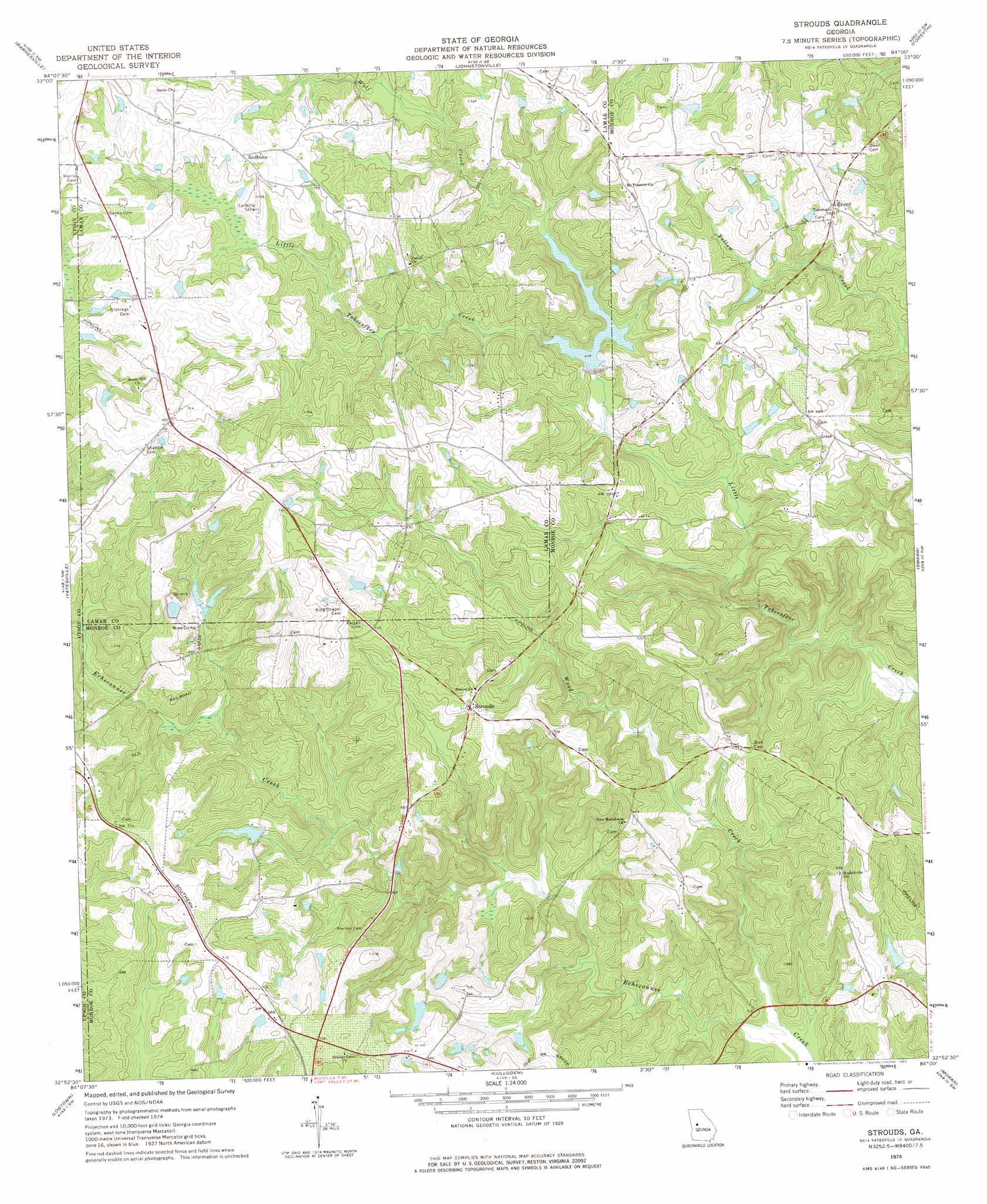
USGS Topo Quad 32084h1 - 1:24,000 scale
| Topo Map Name: | Strouds |
| USGS Topo Quad ID: | 32084h1 |
| Print Size: | ca. 21 1/4" wide x 27" high |
| Southeast Coordinates: | 32.875° N latitude / 84° W longitude |
| Map Center Coordinates: | 32.9375° N latitude / 84.0625° W longitude |
| U.S. State: | GA |
| Filename: | o32084h1.jpg |
| Download Map JPG Image: | Strouds topo map 1:24,000 scale |
| Map Type: | Topographic |
| Topo Series: | 7.5´ |
| Map Scale: | 1:24,000 |
| Source of Map Images: | United States Geological Survey (USGS) |
| Alternate Map Versions: |
Strouds GA 1974, updated 1976 Download PDF Buy paper map Strouds GA 2011 Download PDF Buy paper map Strouds GA 2014 Download PDF Buy paper map |
1:24,000 Topo Quads surrounding Strouds
Griffin South |
Orchard Hill |
High Falls |
Indian Springs |
Berner |
Zebulon |
Barnesville |
Johnstonville |
Forsyth |
East Juliette |
Thomaston |
Yatesville |
Strouds |
Smarr |
Bolingbroke |
Lincoln Park |
Logtown |
Culloden |
Moran |
Lizella |
Prattsburg |
Fickling Mill |
Roberta |
Knoxville |
Byron |
> Back to 32084e1 at 1:100,000 scale
> Back to 32084a1 at 1:250,000 scale
> Back to U.S. Topo Maps home
Strouds topo map: Gazetteer
Strouds: Airports
Redbone Farm Airport elevation 230m 754′Strouds: Dams
Abercrombie Lake Dam elevation 160m 524′Mangham Lake Dam elevation 224m 734′
Pierson Lake Dam elevation 197m 646′
Pierson Lake Dam elevation 190m 623′
Pippin Lake Dam elevation 212m 695′
Tobesofkee Creek Structure Number 70 Dam elevation 190m 623′
Strouds: Populated Places
Brent elevation 214m 702′Horns Crossroads elevation 230m 754′
Redbone elevation 234m 767′
Strouds elevation 217m 711′
Strouds: Reservoirs
Abercrombie Lake elevation 160m 524′Mangham Lake elevation 224m 734′
Pierson Lake elevation 197m 646′
Pierson Lake elevation 190m 623′
Pippin Lake elevation 212m 695′
Tobesofkee Creek Structure Number 70 elevation 190m 623′
Strouds: Streams
Mountain Branch elevation 169m 554′Wolf Creek elevation 187m 613′
Wood Creek elevation 143m 469′
Strouds digital topo map on disk
Buy this Strouds topo map showing relief, roads, GPS coordinates and other geographical features, as a high-resolution digital map file on DVD:
Gulf Coast (LA, MS, AL, FL) & Southwestern Georgia
Buy digital topo maps: Gulf Coast (LA, MS, AL, FL) & Southwestern Georgia
 & Southwestern Georgia map DVD")