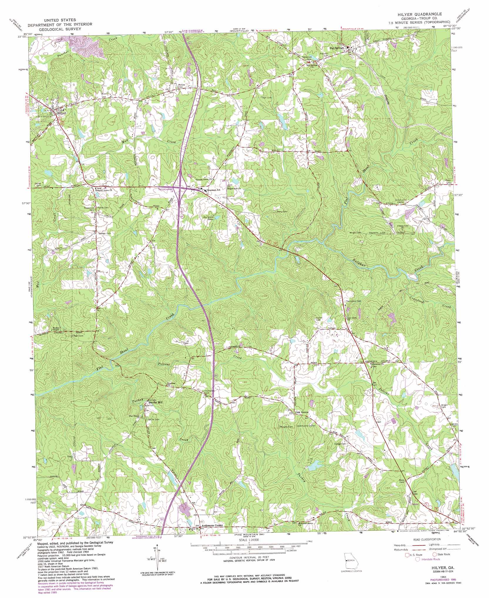
Hilyer Topo Map Georgia
To zoom in, hover over the map of Hilyer
USGS Topo Quad 32084h8 - 1:24,000 scale
| Topo Map Name: | Hilyer |
| USGS Topo Quad ID: | 32084h8 |
| Print Size: | ca. 21 1/4" wide x 27" high |
| Southeast Coordinates: | 32.875° N latitude / 84.875° W longitude |
| Map Center Coordinates: | 32.9375° N latitude / 84.9375° W longitude |
| U.S. State: | GA |
| Filename: | o32084h8.jpg |
| Download Map JPG Image: | Hilyer topo map 1:24,000 scale |
| Map Type: | Topographic |
| Topo Series: | 7.5´ |
| Map Scale: | 1:24,000 |
| Source of Map Images: | United States Geological Survey (USGS) |
| Alternate Map Versions: |
Hilyer GA 1964, updated 1966 Download PDF Buy paper map Hilyer GA 1964, updated 1986 Download PDF Buy paper map Hilyer GA 2011 Download PDF Buy paper map Hilyer GA 2014 Download PDF Buy paper map |
1:24,000 Topo Quads surrounding Hilyer
Glenn |
Hillcrest |
Hogansville |
Grantville |
Luthersville |
Abbottsford |
La Grange |
Mountville |
Odessadale |
Greenville |
Lanett North |
Cannonville |
Hilyer |
Durand |
Warm Springs |
Lanett South |
Whitesville |
Pine Mountain Sw |
Pine Mountain |
Shiloh |
Beulah |
Bartletts Ferry Dam |
Mulberry Grove |
Cataula |
Waverly Hall |
> Back to 32084e1 at 1:100,000 scale
> Back to 32084a1 at 1:250,000 scale
> Back to U.S. Topo Maps home
Hilyer topo map: Gazetteer
Hilyer: Crossings
Interchange 14 elevation 257m 843′Hilyer: Dams
Champion Lake Dam elevation 244m 800′Edmondson Lake Dam elevation 231m 757′
Floyd Dam elevation 239m 784′
Floyd Dam elevation 244m 800′
Livingston Dam elevation 233m 764′
Ouvre Lake Dam elevation 227m 744′
Hilyer: Mines
LaGrange Quarry elevation 230m 754′Hilyer: Populated Places
Andersons Corner elevation 259m 849′Big Springs elevation 239m 784′
Hilyer elevation 242m 793′
Oak Grove elevation 254m 833′
Pleasant Grove elevation 229m 751′
Smiths Mill elevation 202m 662′
Troup Factory (historical) elevation 207m 679′
Hilyer: Reservoirs
Champion Lake elevation 244m 800′Edmondson Lake elevation 231m 757′
Floyd Lake elevation 244m 800′
Floyd Lake elevation 239m 784′
Hambrick Lake elevation 238m 780′
Livingston Lake elevation 233m 764′
Ouvre Lake elevation 227m 744′
Hilyer: Streams
Crawford Creek elevation 213m 698′Polecat Creek elevation 193m 633′
Sulphur Creek elevation 200m 656′
Turkey Creek elevation 193m 633′
Hilyer digital topo map on disk
Buy this Hilyer topo map showing relief, roads, GPS coordinates and other geographical features, as a high-resolution digital map file on DVD:
Gulf Coast (LA, MS, AL, FL) & Southwestern Georgia
Buy digital topo maps: Gulf Coast (LA, MS, AL, FL) & Southwestern Georgia
 & Southwestern Georgia map DVD")