Creek Stand Topo Map Alabama
To zoom in, hover over the map of Creek Stand
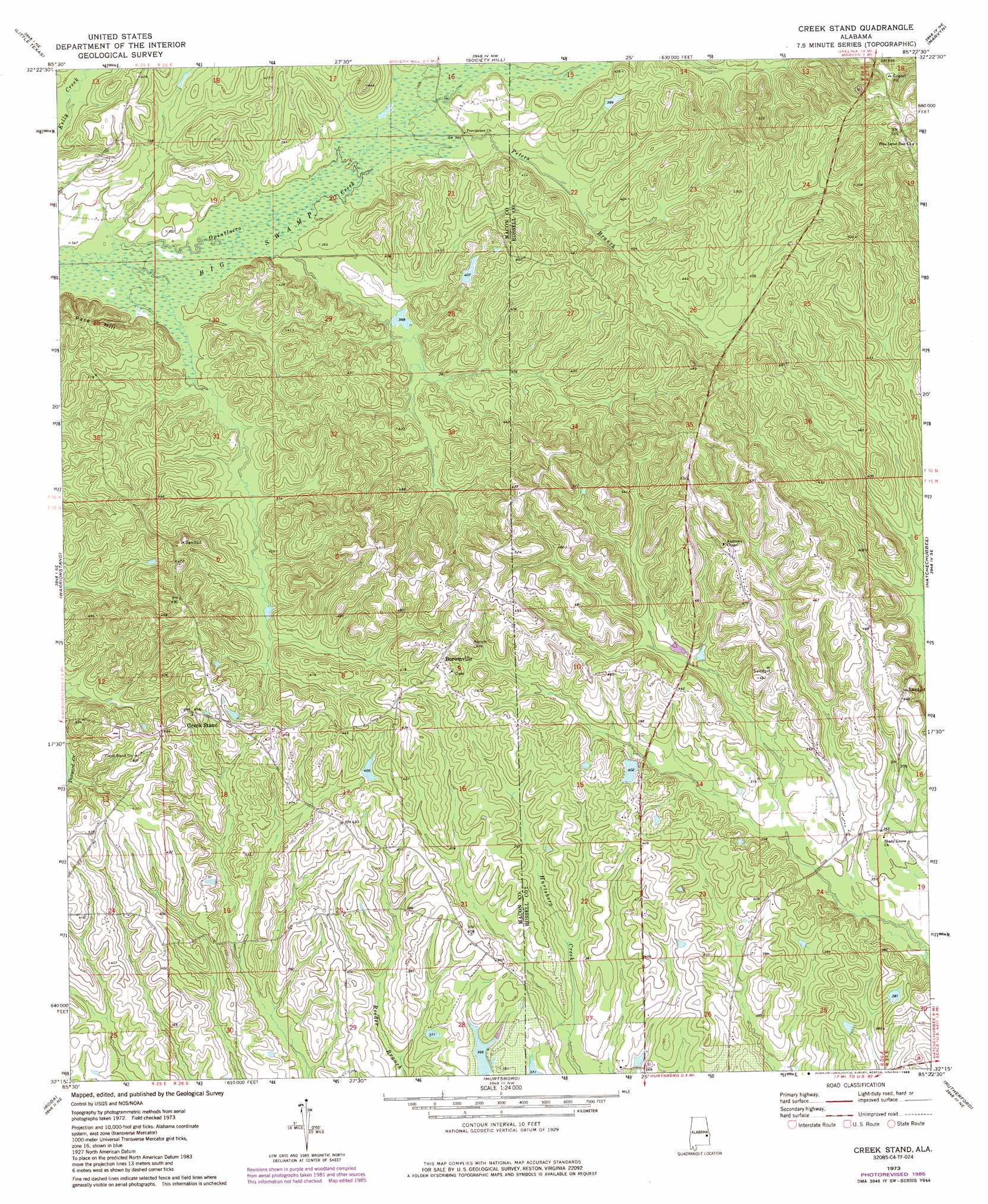
USGS Topo Quad 32085c4 - 1:24,000 scale
| Topo Map Name: | Creek Stand |
| USGS Topo Quad ID: | 32085c4 |
| Print Size: | ca. 21 1/4" wide x 27" high |
| Southeast Coordinates: | 32.25° N latitude / 85.375° W longitude |
| Map Center Coordinates: | 32.3125° N latitude / 85.4375° W longitude |
| U.S. State: | AL |
| Filename: | o32085c4.jpg |
| Download Map JPG Image: | Creek Stand topo map 1:24,000 scale |
| Map Type: | Topographic |
| Topo Series: | 7.5´ |
| Map Scale: | 1:24,000 |
| Source of Map Images: | United States Geological Survey (USGS) |
| Alternate Map Versions: |
Creek Stand AL 1973, updated 1975 Download PDF Buy paper map Creek Stand AL 1973, updated 1985 Download PDF Buy paper map Creek Stand AL 2011 Download PDF Buy paper map Creek Stand AL 2014 Download PDF Buy paper map |
1:24,000 Topo Quads surrounding Creek Stand
Notasulga |
Loachapoka |
Auburn |
Parkers Crossroads |
Bleecker |
Tuskegee |
Little Texas |
Society Hill |
Marvyn |
Crawford |
Davisville |
Warriorstand |
Creek Stand |
Hatchechubbee |
Seale |
Union Springs |
Roba |
Hurtsboro |
Rutherford |
Pittsview |
Aberfoil |
Midway |
Comer |
Batesville |
Howe |
> Back to 32085a1 at 1:100,000 scale
> Back to 32084a1 at 1:250,000 scale
> Back to U.S. Topo Maps home
Creek Stand topo map: Gazetteer
Creek Stand: Dams
Loyds Dam elevation 112m 367′Creek Stand: Populated Places
Boromville elevation 149m 488′Creek Stand elevation 136m 446′
Creek Stand: Ridges
Pace Hill elevation 130m 426′Creek Stand: Streams
Peters Branch elevation 108m 354′Creek Stand digital topo map on disk
Buy this Creek Stand topo map showing relief, roads, GPS coordinates and other geographical features, as a high-resolution digital map file on DVD:
Gulf Coast (LA, MS, AL, FL) & Southwestern Georgia
Buy digital topo maps: Gulf Coast (LA, MS, AL, FL) & Southwestern Georgia
 & Southwestern Georgia map DVD")