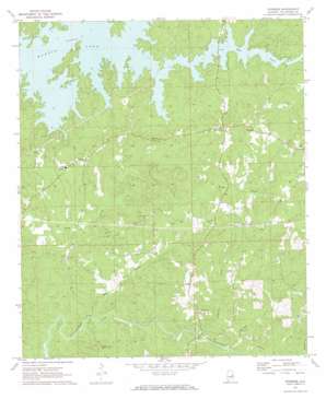
Ponders Topo Map Alabama
To zoom in, hover over the map of Ponders
USGS Topo Quad 32085f7 - 1:24,000 scale
| Topo Map Name: | Ponders |
| USGS Topo Quad ID: | 32085f7 |
| Print Size: | ca. 21 1/4" wide x 27" high |
| Southeast Coordinates: | 32.625° N latitude / 85.75° W longitude |
| Map Center Coordinates: | 32.6875° N latitude / 85.8125° W longitude |
| U.S. State: | AL |
| Filename: | o32085f7.jpg |
| Download Map JPG Image: | Ponders topo map 1:24,000 scale |
| Map Type: | Topographic |
| Topo Series: | 7.5´ |
| Map Scale: | 1:24,000 |
| Source of Map Images: | United States Geological Survey (USGS) |
| Alternate Map Versions: |
Ponders AL 1971, updated 1973 Download PDF Buy paper map Ponders AL 1971, updated 1973 Download PDF Buy paper map Ponders AL 2011 Download PDF Buy paper map Ponders AL 2014 Download PDF Buy paper map |
1:24,000 Topo Quads surrounding Ponders
> Back to 32085e1 at 1:100,000 scale
> Back to 32084a1 at 1:250,000 scale
> Back to U.S. Topo Maps home
Ponders topo map: Gazetteer
Ponders: Parks
Maxwell-Gunter Recreation Area elevation 208m 682′Ponders: Populated Places
Bama Park elevation 156m 511′Barnesville elevation 192m 629′
Blue Creek elevation 158m 518′
Ponders elevation 214m 702′
Sardis elevation 210m 688′
Still Waters elevation 183m 600′
Union elevation 177m 580′
Walnut Hill elevation 211m 692′
Ponders: Streams
Blue Creek elevation 149m 488′Buck Creek elevation 109m 357′
Copper Creek elevation 149m 488′
Ledbetter Creek elevation 116m 380′
Mitchell Creek elevation 115m 377′
Ponders digital topo map on disk
Buy this Ponders topo map showing relief, roads, GPS coordinates and other geographical features, as a high-resolution digital map file on DVD:
Gulf Coast (LA, MS, AL, FL) & Southwestern Georgia
Buy digital topo maps: Gulf Coast (LA, MS, AL, FL) & Southwestern Georgia


