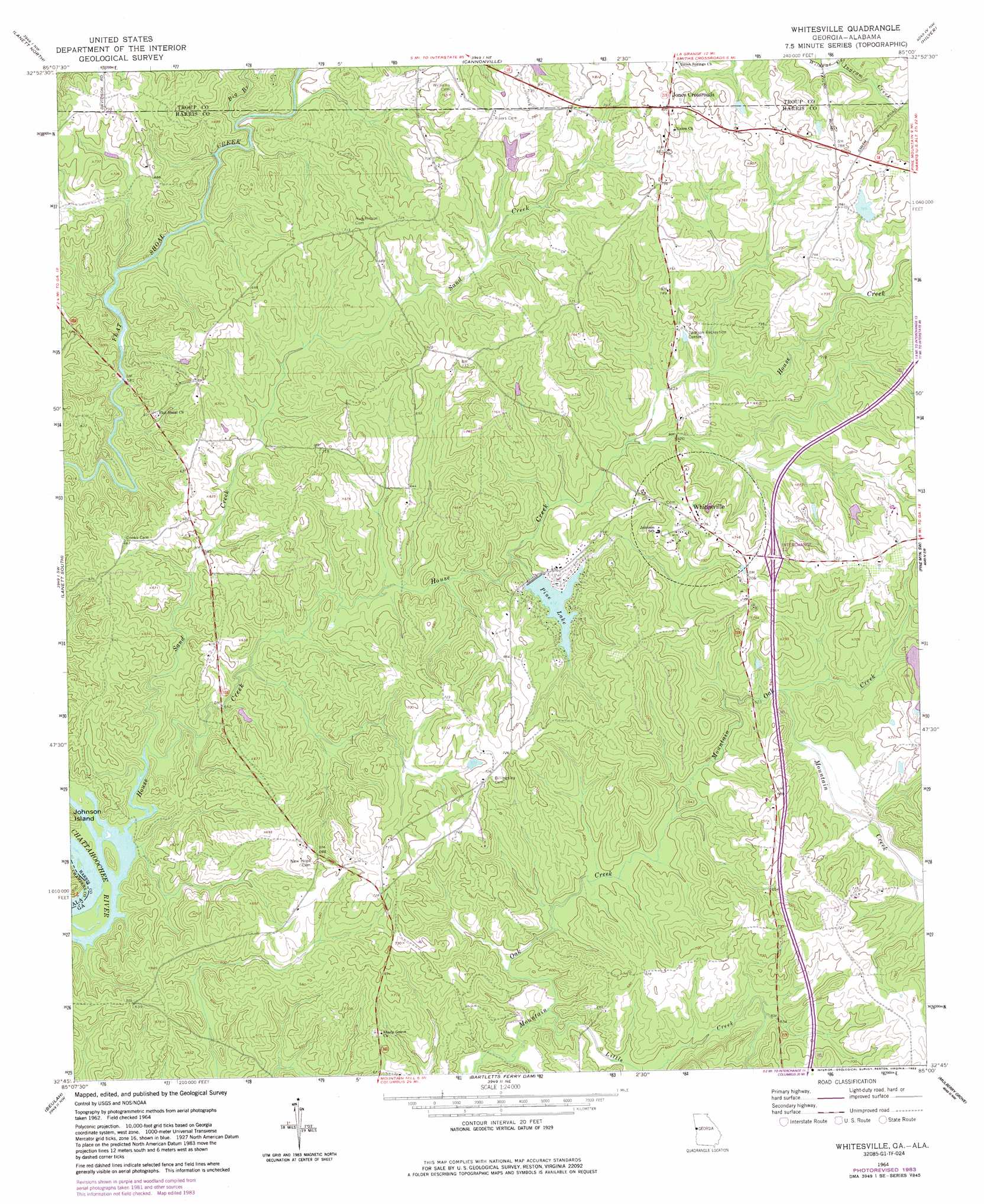
Whitesville Topo Map Georgia
To zoom in, hover over the map of Whitesville
USGS Topo Quad 32085g1 - 1:24,000 scale
| Topo Map Name: | Whitesville |
| USGS Topo Quad ID: | 32085g1 |
| Print Size: | ca. 21 1/4" wide x 27" high |
| Southeast Coordinates: | 32.75° N latitude / 85° W longitude |
| Map Center Coordinates: | 32.8125° N latitude / 85.0625° W longitude |
| U.S. States: | GA, AL |
| Filename: | o32085g1.jpg |
| Download Map JPG Image: | Whitesville topo map 1:24,000 scale |
| Map Type: | Topographic |
| Topo Series: | 7.5´ |
| Map Scale: | 1:24,000 |
| Source of Map Images: | United States Geological Survey (USGS) |
| Alternate Map Versions: |
Whitesville GA 1964, updated 1965 Download PDF Buy paper map Whitesville GA 1964, updated 1983 Download PDF Buy paper map Whitesville GA 2011 Download PDF Buy paper map Whitesville GA 2014 Download PDF Buy paper map |
1:24,000 Topo Quads surrounding Whitesville
Five Points |
Abbottsford |
La Grange |
Mountville |
Odessadale |
Fredonia |
Lanett North |
Cannonville |
Hilyer |
Durand |
Cusseta |
Lanett South |
Whitesville |
Pine Mountain Sw |
Pine Mountain |
Opelika East |
Beulah |
Bartletts Ferry Dam |
Mulberry Grove |
Cataula |
Parkers Crossroads |
Bleecker |
Smiths Station |
Fortson |
Midland |
> Back to 32085e1 at 1:100,000 scale
> Back to 32084a1 at 1:250,000 scale
> Back to U.S. Topo Maps home
Whitesville topo map: Gazetteer
Whitesville: Bridges
Flat Shoals Bridge elevation 164m 538′Whitesville: Crossings
Interchange 12 elevation 211m 692′Whitesville: Dams
Avery Lake Dam elevation 234m 767′Callaway Enterprises Lake Dam elevation 193m 633′
Whitesville: Populated Places
Jones Crossroads elevation 250m 820′New Hope elevation 211m 692′
Pine Lake elevation 195m 639′
Shady Grove elevation 205m 672′
Whitesville elevation 223m 731′
Whitesville: Reservoirs
Avery Lake elevation 234m 767′Callaway Enterprises Lake elevation 193m 633′
Pine Lake elevation 187m 613′
Whitesville: Streams
Big Branch elevation 176m 577′House Creek elevation 160m 524′
Ingram Creek elevation 213m 698′
Little Creek elevation 177m 580′
Mountain Creek elevation 187m 613′
Sand Creek elevation 164m 538′
Whitesville digital topo map on disk
Buy this Whitesville topo map showing relief, roads, GPS coordinates and other geographical features, as a high-resolution digital map file on DVD:
Gulf Coast (LA, MS, AL, FL) & Southwestern Georgia
Buy digital topo maps: Gulf Coast (LA, MS, AL, FL) & Southwestern Georgia
 & Southwestern Georgia map DVD")