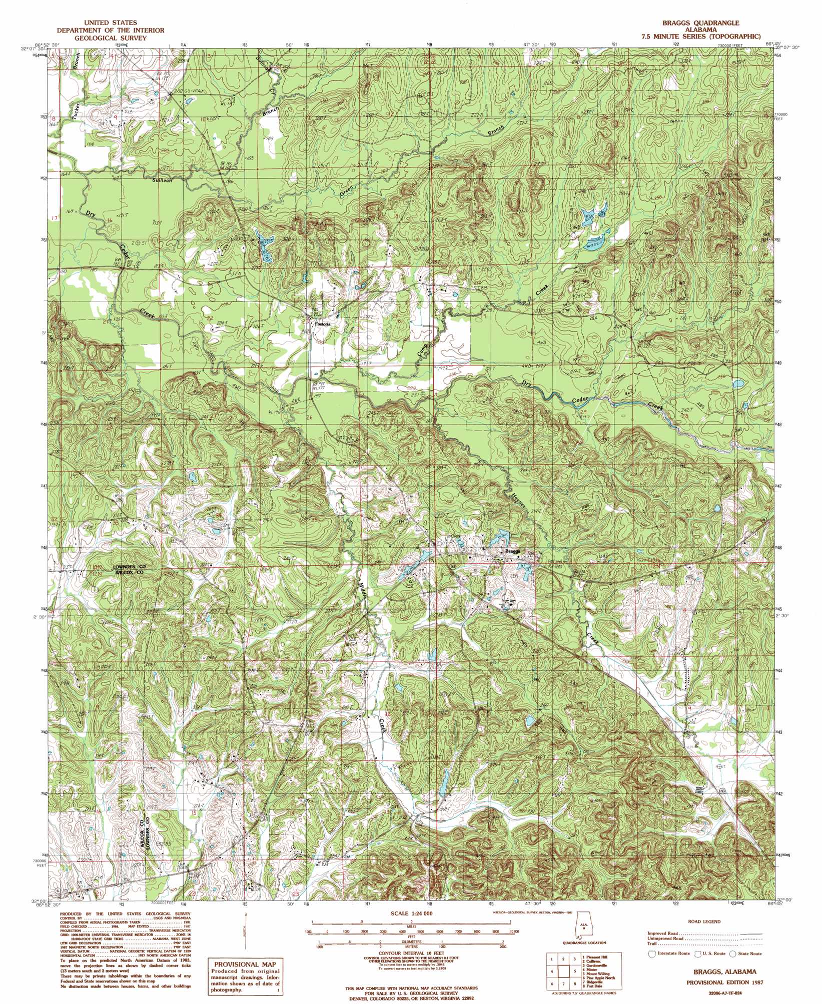
Braggs Topo Map Alabama
To zoom in, hover over the map of Braggs
USGS Topo Quad 32086a7 - 1:24,000 scale
| Topo Map Name: | Braggs |
| USGS Topo Quad ID: | 32086a7 |
| Print Size: | ca. 21 1/4" wide x 27" high |
| Southeast Coordinates: | 32° N latitude / 86.75° W longitude |
| Map Center Coordinates: | 32.0625° N latitude / 86.8125° W longitude |
| U.S. State: | AL |
| Filename: | o32086a7.jpg |
| Download Map JPG Image: | Braggs topo map 1:24,000 scale |
| Map Type: | Topographic |
| Topo Series: | 7.5´ |
| Map Scale: | 1:24,000 |
| Source of Map Images: | United States Geological Survey (USGS) |
| Alternate Map Versions: |
Braggs AL 1987, updated 1987 Download PDF Buy paper map Braggs AL 2011 Download PDF Buy paper map Braggs AL 2014 Download PDF Buy paper map |
1:24,000 Topo Quads surrounding Braggs
Blackwell Bend |
Sardis |
Benton |
White Hall |
Lowndesboro |
Elm Bluff |
Pleasant Hill |
Collirene |
Gordonsville |
Hayneville |
Carlowville |
Minter |
Braggs |
Mount Willing |
Calhoun |
Oak Hill |
Pine Apple North |
Ridgeville |
Fort Dale |
Fort Deposit |
Mcwilliams |
Pine Apple South |
Forest Home |
Greenville West |
Greenville East |
> Back to 32086a1 at 1:100,000 scale
> Back to 32086a1 at 1:250,000 scale
> Back to U.S. Topo Maps home
Braggs topo map: Gazetteer
Braggs: Dams
Container Corporation Lake Dam elevation 62m 203′Florence Cabiniss Lake Dam elevation 76m 249′
Braggs: Populated Places
Braggs elevation 87m 285′Fostoria elevation 72m 236′
Braggs: Post Offices
Braggs Store Post Office (historical) elevation 90m 295′Braggs: Reservoirs
Container Corporation Lake elevation 62m 203′Florence Cabiniss Lake elevation 76m 249′
Quailwood Farms Lakes elevation 75m 246′
Braggs: Streams
Camp Creek elevation 54m 177′Green Branch elevation 52m 170′
Haynes Creek elevation 58m 190′
Middle Creek elevation 58m 190′
Sullivan Branch elevation 49m 160′
Sullivan Creek elevation 58m 190′
Braggs digital topo map on disk
Buy this Braggs topo map showing relief, roads, GPS coordinates and other geographical features, as a high-resolution digital map file on DVD:
Gulf Coast (LA, MS, AL, FL) & Southwestern Georgia
Buy digital topo maps: Gulf Coast (LA, MS, AL, FL) & Southwestern Georgia
 & Southwestern Georgia map DVD")