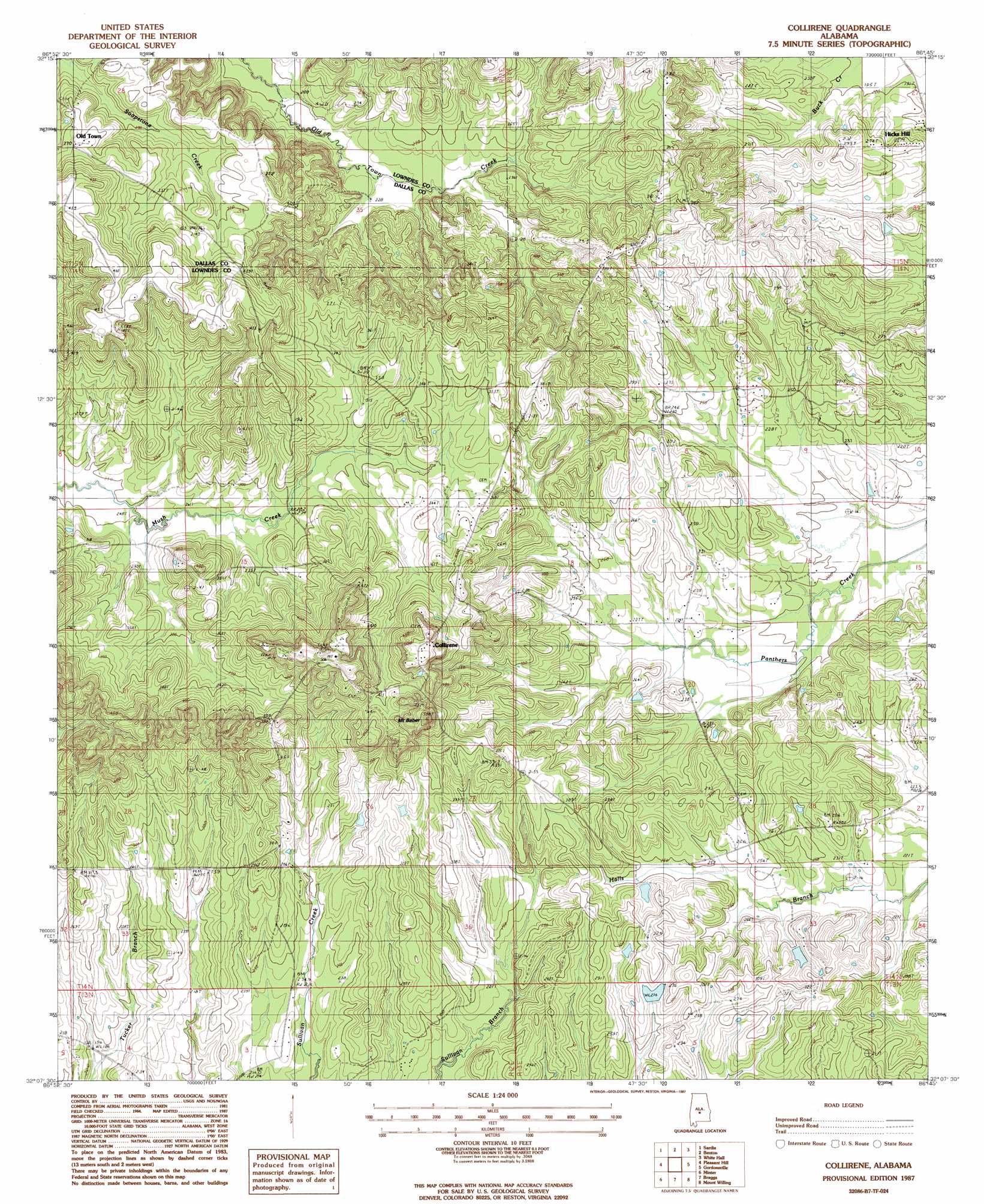
Collirene Topo Map Alabama
To zoom in, hover over the map of Collirene
USGS Topo Quad 32086b7 - 1:24,000 scale
| Topo Map Name: | Collirene |
| USGS Topo Quad ID: | 32086b7 |
| Print Size: | ca. 21 1/4" wide x 27" high |
| Southeast Coordinates: | 32.125° N latitude / 86.75° W longitude |
| Map Center Coordinates: | 32.1875° N latitude / 86.8125° W longitude |
| U.S. State: | AL |
| Filename: | o32086b7.jpg |
| Download Map JPG Image: | Collirene topo map 1:24,000 scale |
| Map Type: | Topographic |
| Topo Series: | 7.5´ |
| Map Scale: | 1:24,000 |
| Source of Map Images: | United States Geological Survey (USGS) |
| Alternate Map Versions: |
Collirene AL 1987, updated 1987 Download PDF Buy paper map Collirene AL 2011 Download PDF Buy paper map Collirene AL 2014 Download PDF Buy paper map |
1:24,000 Topo Quads surrounding Collirene
Selma |
Burnsville |
Durant Bend |
Autaugaville |
Forester |
Blackwell Bend |
Sardis |
Benton |
White Hall |
Lowndesboro |
Elm Bluff |
Pleasant Hill |
Collirene |
Gordonsville |
Hayneville |
Carlowville |
Minter |
Braggs |
Mount Willing |
Calhoun |
Oak Hill |
Pine Apple North |
Ridgeville |
Fort Dale |
Fort Deposit |
> Back to 32086a1 at 1:100,000 scale
> Back to 32086a1 at 1:250,000 scale
> Back to U.S. Topo Maps home
Collirene topo map: Gazetteer
Collirene: Dams
J R Paul Lake Dam elevation 83m 272′Collirene: Populated Places
Collirene elevation 158m 518′Old Town elevation 113m 370′
Collirene: Reservoirs
J R Paul Lake elevation 83m 272′Collirene: Streams
Church Branch elevation 90m 295′Collirene: Summits
Mount Baber elevation 108m 354′Collirene digital topo map on disk
Buy this Collirene topo map showing relief, roads, GPS coordinates and other geographical features, as a high-resolution digital map file on DVD:
Gulf Coast (LA, MS, AL, FL) & Southwestern Georgia
Buy digital topo maps: Gulf Coast (LA, MS, AL, FL) & Southwestern Georgia
 & Southwestern Georgia map DVD")