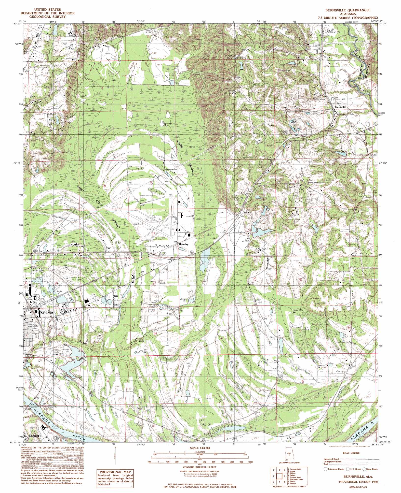
Burnsville Topo Map Alabama
To zoom in, hover over the map of Burnsville
USGS Topo Quad 32086d8 - 1:24,000 scale
| Topo Map Name: | Burnsville |
| USGS Topo Quad ID: | 32086d8 |
| Print Size: | ca. 21 1/4" wide x 27" high |
| Southeast Coordinates: | 32.375° N latitude / 86.875° W longitude |
| Map Center Coordinates: | 32.4375° N latitude / 86.9375° W longitude |
| U.S. State: | AL |
| Filename: | o32086d8.jpg |
| Download Map JPG Image: | Burnsville topo map 1:24,000 scale |
| Map Type: | Topographic |
| Topo Series: | 7.5´ |
| Map Scale: | 1:24,000 |
| Source of Map Images: | United States Geological Survey (USGS) |
| Alternate Map Versions: |
Benton NW AL 1975, updated 1977 Download PDF Buy paper map Burnsville AL 1982, updated 1983 Download PDF Buy paper map Burnsville AL 2011 Download PDF Buy paper map Burnsville AL 2014 Download PDF Buy paper map |
1:24,000 Topo Quads surrounding Burnsville
Sprott |
Buck Creek |
Plantersville |
Pletcher |
Billingsley |
Suttle |
Summerfield |
Jones |
Milton |
Vida |
Marion Junction |
Selma |
Burnsville |
Durant Bend |
Autaugaville |
Orrville |
Blackwell Bend |
Sardis |
Benton |
White Hall |
Tasso |
Elm Bluff |
Pleasant Hill |
Collirene |
Gordonsville |
> Back to 32086a1 at 1:100,000 scale
> Back to 32086a1 at 1:250,000 scale
> Back to U.S. Topo Maps home
Burnsville topo map: Gazetteer
Burnsville: Airports
Selfield Airport elevation 40m 131′Burnsville: Bars
Fish Trap Bar elevation 24m 78′Kornegay Bar elevation 24m 78′
Tipton Bar elevation 24m 78′
Burnsville: Dams
Harper Pond Dam elevation 84m 275′J Friday Number 1 Dam elevation 46m 150′
J Friday Number 2 Dam elevation 55m 180′
Lakeland Farms 12 Acre Lake Dam elevation 94m 308′
Selma Hunting Club Lake Dam elevation 34m 111′
Burnsville: Populated Places
Brantley elevation 40m 131′Burnsville elevation 57m 187′
Lily Grove (historical) elevation 76m 249′
Manila elevation 52m 170′
New Everdale elevation 42m 137′
Burnsville: Reservoirs
Harper Pond elevation 84m 275′J Friday Number 1 Lake elevation 46m 150′
J Friday Number 2 Lake elevation 55m 180′
Lakeland Farms 12 Acre Lake elevation 94m 308′
Selma Hunting Club Lake elevation 34m 111′
Burnsville: Streams
Tarver Creek elevation 27m 88′Burnsville: Swamps
Beech Creek Swamp elevation 37m 121′Blue Gurth Swamp elevation 39m 127′
Burnsville digital topo map on disk
Buy this Burnsville topo map showing relief, roads, GPS coordinates and other geographical features, as a high-resolution digital map file on DVD:
Gulf Coast (LA, MS, AL, FL) & Southwestern Georgia
Buy digital topo maps: Gulf Coast (LA, MS, AL, FL) & Southwestern Georgia
 & Southwestern Georgia map DVD")