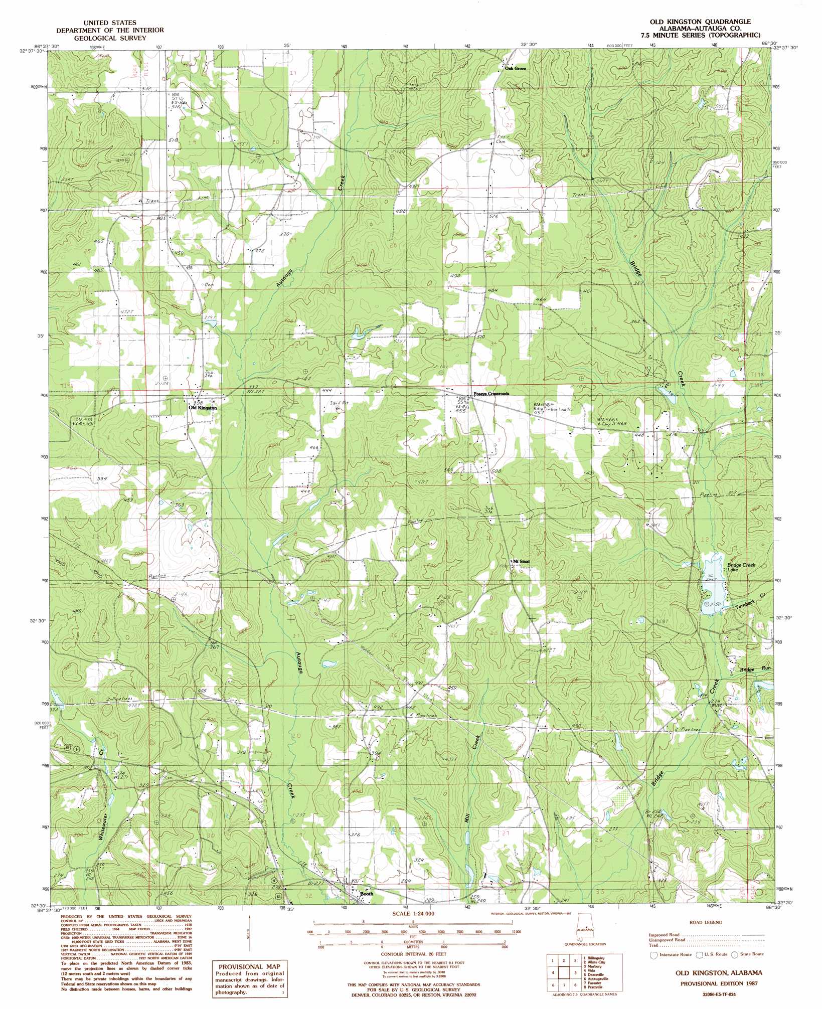
Old Kingston Topo Map Alabama
To zoom in, hover over the map of Old Kingston
USGS Topo Quad 32086e5 - 1:24,000 scale
| Topo Map Name: | Old Kingston |
| USGS Topo Quad ID: | 32086e5 |
| Print Size: | ca. 21 1/4" wide x 27" high |
| Southeast Coordinates: | 32.5° N latitude / 86.5° W longitude |
| Map Center Coordinates: | 32.5625° N latitude / 86.5625° W longitude |
| U.S. State: | AL |
| Filename: | o32086e5.jpg |
| Download Map JPG Image: | Old Kingston topo map 1:24,000 scale |
| Map Type: | Topographic |
| Topo Series: | 7.5´ |
| Map Scale: | 1:24,000 |
| Source of Map Images: | United States Geological Survey (USGS) |
| Alternate Map Versions: |
Billingsley SE AL 1975, updated 1977 Download PDF Buy paper map Old Kingston AL 1987, updated 1987 Download PDF Buy paper map Old Kingston AL 2011 Download PDF Buy paper map Old Kingston AL 2014 Download PDF Buy paper map |
1:24,000 Topo Quads surrounding Old Kingston
Maplesville East |
Clanton West |
Clanton East |
Mitchell Dam |
Richville |
Pletcher |
Billingsley |
White City |
Marbury |
Holtville |
Milton |
Vida |
Old Kingston |
Deatsville |
Elmore |
Durant Bend |
Autaugaville |
Forester |
Prattville |
Montgomery North |
Benton |
White Hall |
Lowndesboro |
Cantelous |
Montgomery South |
> Back to 32086e1 at 1:100,000 scale
> Back to 32086a1 at 1:250,000 scale
> Back to U.S. Topo Maps home
Old Kingston topo map: Gazetteer
Old Kingston: Dams
Bridge Creek Fishing Club Dam elevation 87m 285′Camp Tukabatchee Lake Dam elevation 99m 324′
O'Dell Lake Dam elevation 87m 285′
R M Pendergrass Dam elevation 97m 318′
Old Kingston: Populated Places
Booth elevation 86m 282′Browntown elevation 135m 442′
Gibbons (historical) elevation 110m 360′
Mount Sinai elevation 153m 501′
Oak Grove elevation 168m 551′
Old Kingston elevation 124m 406′
Poseys Crossroads elevation 167m 547′
Old Kingston: Reservoirs
Bridge Creek Lake elevation 85m 278′Camp Tukabatchee Lake elevation 99m 324′
Whirleys Pond elevation 103m 337′
Old Kingston: Streams
Beaver Creek elevation 91m 298′Fox Creek elevation 115m 377′
Little Bridge Run elevation 85m 278′
Turnback Creek elevation 91m 298′
Old Kingston digital topo map on disk
Buy this Old Kingston topo map showing relief, roads, GPS coordinates and other geographical features, as a high-resolution digital map file on DVD:
Gulf Coast (LA, MS, AL, FL) & Southwestern Georgia
Buy digital topo maps: Gulf Coast (LA, MS, AL, FL) & Southwestern Georgia
 & Southwestern Georgia map DVD")