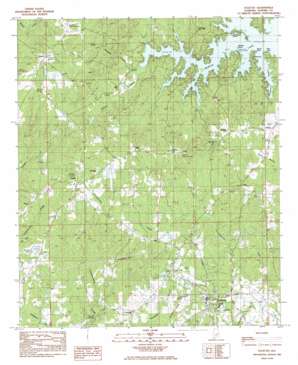
Eclectic Topo Map Alabama
To zoom in, hover over the map of Eclectic
USGS Topo Quad 32086f1 - 1:24,000 scale
| Topo Map Name: | Eclectic |
| USGS Topo Quad ID: | 32086f1 |
| Print Size: | ca. 21 1/4" wide x 27" high |
| Southeast Coordinates: | 32.625° N latitude / 86° W longitude |
| Map Center Coordinates: | 32.6875° N latitude / 86.0625° W longitude |
| U.S. State: | AL |
| Filename: | o32086f1.jpg |
| Download Map JPG Image: | Eclectic topo map 1:24,000 scale |
| Map Type: | Topographic |
| Topo Series: | 7.5´ |
| Map Scale: | 1:24,000 |
| Source of Map Images: | United States Geological Survey (USGS) |
| Alternate Map Versions: |
Eclectic AL 1984, updated 1985 Download PDF Buy paper map Eclectic AL 2011 Download PDF Buy paper map Eclectic AL 2014 Download PDF Buy paper map |
1:24,000 Topo Quads surrounding Eclectic
> Back to 32086e1 at 1:100,000 scale
> Back to 32086a1 at 1:250,000 scale
> Back to U.S. Topo Maps home
Eclectic topo map: Gazetteer
Eclectic: Capes
Neros Point elevation 149m 488′Pine Point elevation 149m 488′
Eclectic: Dams
Blackwell Lake Dam Number One elevation 217m 711′Blackwell Lake Dam Number Two elevation 209m 685′
Danny Davis Lake Dam elevation 156m 511′
Maier Lake Dam elevation 146m 479′
Nolan Davis Lake Dam Number One elevation 165m 541′
Nolen Davis Lake Dam Number Two elevation 172m 564′
Eclectic: Islands
Mariner Island elevation 149m 488′Real Island elevation 162m 531′
Eclectic: Parks
Aaron Park elevation 166m 544′Burt Haynie Stadium elevation 174m 570′
Castleberry Park elevation 172m 564′
Eclectic: Populated Places
Central elevation 194m 636′Cotton elevation 195m 639′
Eclectic elevation 176m 577′
Falkner elevation 196m 643′
Jordan elevation 183m 600′
Kid elevation 168m 551′
Seman elevation 223m 731′
Eclectic: Post Offices
Central Post Office elevation 192m 629′Eclectic Post Office elevation 177m 580′
Eclectic: Reservoirs
Black Well Lake elevation 213m 698′Blackwell Lake Number One elevation 217m 711′
Blackwell Lake Number Two elevation 209m 685′
Danny Davis Lake elevation 156m 511′
Davis Pond elevation 161m 528′
Maier Lake elevation 146m 479′
Nelson Lake elevation 162m 531′
Nolen Davis Lake Number One elevation 165m 541′
Nolen Davis Lake Number Two elevation 172m 564′
Eclectic: Streams
Little Kowaliga Creek elevation 150m 492′Lott Slough elevation 149m 488′
Old Harmony Branch elevation 149m 488′
Stearns Creek elevation 150m 492′
Eclectic digital topo map on disk
Buy this Eclectic topo map showing relief, roads, GPS coordinates and other geographical features, as a high-resolution digital map file on DVD:
Gulf Coast (LA, MS, AL, FL) & Southwestern Georgia
Buy digital topo maps: Gulf Coast (LA, MS, AL, FL) & Southwestern Georgia


