White City Topo Map Alabama
To zoom in, hover over the map of White City
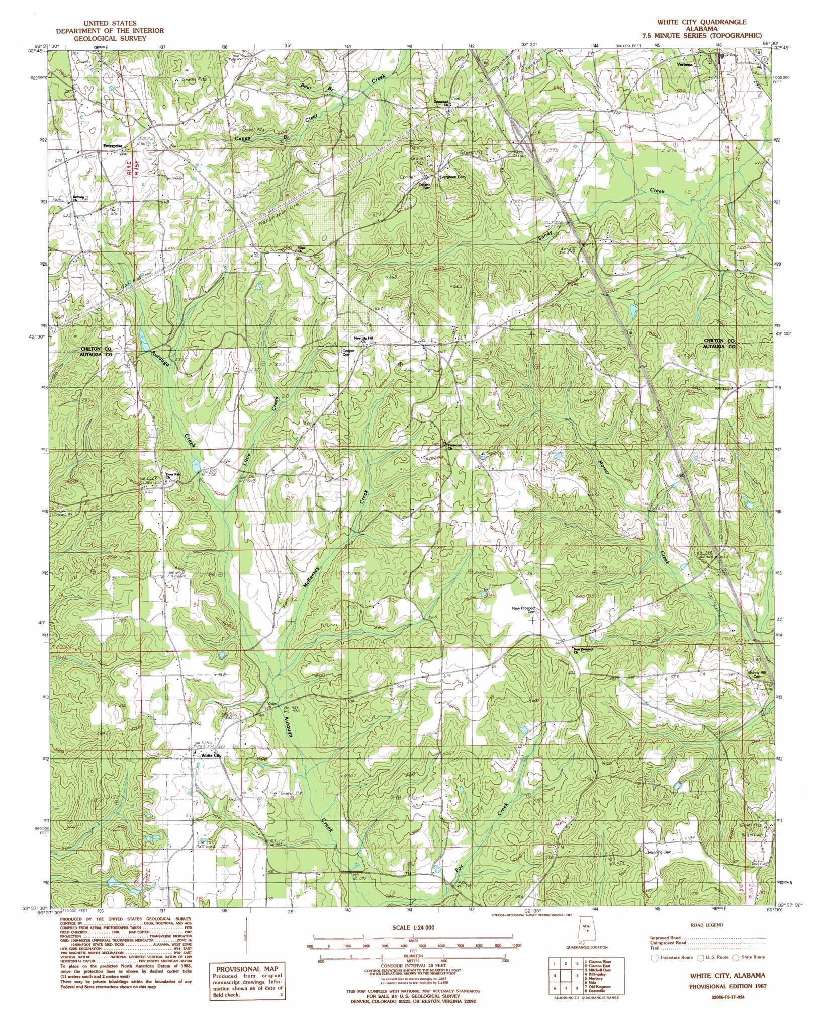
USGS Topo Quad 32086f5 - 1:24,000 scale
| Topo Map Name: | White City |
| USGS Topo Quad ID: | 32086f5 |
| Print Size: | ca. 21 1/4" wide x 27" high |
| Southeast Coordinates: | 32.625° N latitude / 86.5° W longitude |
| Map Center Coordinates: | 32.6875° N latitude / 86.5625° W longitude |
| U.S. State: | AL |
| Filename: | o32086f5.jpg |
| Download Map JPG Image: | White City topo map 1:24,000 scale |
| Map Type: | Topographic |
| Topo Series: | 7.5´ |
| Map Scale: | 1:24,000 |
| Source of Map Images: | United States Geological Survey (USGS) |
| Alternate Map Versions: |
White City AL 1987, updated 1987 Download PDF Buy paper map White City AL 2011 Download PDF Buy paper map White City AL 2014 Download PDF Buy paper map |
1:24,000 Topo Quads surrounding White City
Jemison West |
Jemison East |
Lay Dam |
Mitchell Dam Nw |
Flag Mountain |
Maplesville East |
Clanton West |
Clanton East |
Mitchell Dam |
Richville |
Pletcher |
Billingsley |
White City |
Marbury |
Holtville |
Milton |
Vida |
Old Kingston |
Deatsville |
Elmore |
Durant Bend |
Autaugaville |
Forester |
Prattville |
Montgomery North |
> Back to 32086e1 at 1:100,000 scale
> Back to 32086a1 at 1:250,000 scale
> Back to U.S. Topo Maps home
White City topo map: Gazetteer
White City: Crossings
Interchange 200 elevation 175m 574′White City: Populated Places
Enterprise elevation 203m 666′New Prospect elevation 198m 649′
Verbena elevation 147m 482′
White City elevation 167m 547′
White City: Springs
White Spring elevation 171m 561′White City: Streams
Bear Branch elevation 157m 515′Caney Branch elevation 170m 557′
Little Creek elevation 150m 492′
McKensey Creek elevation 135m 442′
White City digital topo map on disk
Buy this White City topo map showing relief, roads, GPS coordinates and other geographical features, as a high-resolution digital map file on DVD:
Gulf Coast (LA, MS, AL, FL) & Southwestern Georgia
Buy digital topo maps: Gulf Coast (LA, MS, AL, FL) & Southwestern Georgia
 & Southwestern Georgia map DVD")