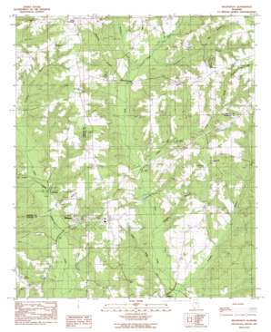
Billingsley Topo Map Alabama
To zoom in, hover over the map of Billingsley
USGS Topo Quad 32086f6 - 1:24,000 scale
| Topo Map Name: | Billingsley |
| USGS Topo Quad ID: | 32086f6 |
| Print Size: | ca. 21 1/4" wide x 27" high |
| Southeast Coordinates: | 32.625° N latitude / 86.625° W longitude |
| Map Center Coordinates: | 32.6875° N latitude / 86.6875° W longitude |
| U.S. State: | AL |
| Filename: | o32086f6.jpg |
| Download Map JPG Image: | Billingsley topo map 1:24,000 scale |
| Map Type: | Topographic |
| Topo Series: | 7.5´ |
| Map Scale: | 1:24,000 |
| Source of Map Images: | United States Geological Survey (USGS) |
| Alternate Map Versions: |
Billingsley AL 1984, updated 1985 Download PDF Buy paper map Billingsley AL 2011 Download PDF Buy paper map Billingsley AL 2014 Download PDF Buy paper map |
1:24,000 Topo Quads surrounding Billingsley
> Back to 32086e1 at 1:100,000 scale
> Back to 32086a1 at 1:250,000 scale
> Back to U.S. Topo Maps home
Billingsley topo map: Gazetteer
Billingsley: Populated Places
Billingsley elevation 113m 370′Haynes elevation 103m 337′
Mulberry elevation 139m 456′
Pools Crossroads elevation 186m 610′
Billingsley: Post Offices
Billingsley Post Office elevation 115m 377′Billingsley: Ranges
Fall Line Hills elevation 122m 400′Billingsley: Reservoirs
White Water Lake elevation 120m 393′Billingsley: Streams
Bee Branch elevation 151m 495′Cowwild Branch elevation 124m 406′
Hurricane Branch elevation 106m 347′
Indian Creek elevation 106m 347′
Kincheon Creek elevation 121m 396′
Pierce Branch elevation 142m 465′
Simmons Branch elevation 120m 393′
Talley Branch elevation 132m 433′
Wheatley Branch elevation 98m 321′
Billingsley digital topo map on disk
Buy this Billingsley topo map showing relief, roads, GPS coordinates and other geographical features, as a high-resolution digital map file on DVD:
Gulf Coast (LA, MS, AL, FL) & Southwestern Georgia
Buy digital topo maps: Gulf Coast (LA, MS, AL, FL) & Southwestern Georgia


