Elm Bluff Topo Map Alabama
To zoom in, hover over the map of Elm Bluff
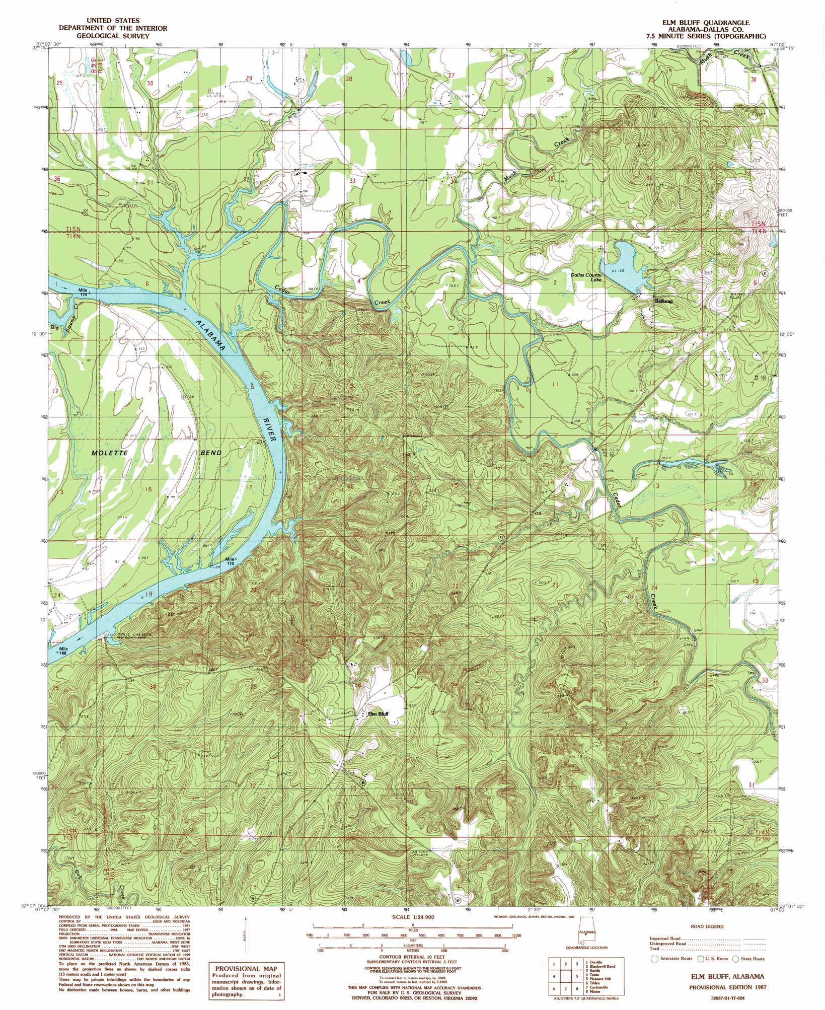
USGS Topo Quad 32087b1 - 1:24,000 scale
| Topo Map Name: | Elm Bluff |
| USGS Topo Quad ID: | 32087b1 |
| Print Size: | ca. 21 1/4" wide x 27" high |
| Southeast Coordinates: | 32.125° N latitude / 87° W longitude |
| Map Center Coordinates: | 32.1875° N latitude / 87.0625° W longitude |
| U.S. State: | AL |
| Filename: | o32087b1.jpg |
| Download Map JPG Image: | Elm Bluff topo map 1:24,000 scale |
| Map Type: | Topographic |
| Topo Series: | 7.5´ |
| Map Scale: | 1:24,000 |
| Source of Map Images: | United States Geological Survey (USGS) |
| Alternate Map Versions: |
Carlowville NE AL 1975, updated 1977 Download PDF Buy paper map Elm Bluff AL 1987, updated 1987 Download PDF Buy paper map Elm Bluff AL 2011 Download PDF Buy paper map Elm Bluff AL 2014 Download PDF Buy paper map |
1:24,000 Topo Quads surrounding Elm Bluff
Browns |
Marion Junction |
Selma |
Burnsville |
Durant Bend |
Safford |
Orrville |
Blackwell Bend |
Sardis |
Benton |
Crumptonia |
Tasso |
Elm Bluff |
Pleasant Hill |
Collirene |
Camden North |
Tilden |
Carlowville |
Minter |
Braggs |
Camden South |
Rosebud |
Oak Hill |
Pine Apple North |
Ridgeville |
> Back to 32087a1 at 1:100,000 scale
> Back to 32086a1 at 1:250,000 scale
> Back to U.S. Topo Maps home
Elm Bluff topo map: Gazetteer
Elm Bluff: Bars
Lower Sister Bar elevation 24m 78′Providence Bar elevation 24m 78′
Upper Sister Bar elevation 24m 78′
Elm Bluff: Bends
Molette Bend elevation 32m 104′Elm Bluff: Cliffs
Elm Bluff elevation 51m 167′Milton Bluff elevation 59m 193′
Elm Bluff: Dams
Dallas County Public Lake Dam elevation 47m 154′Elm Bluff: Parks
Elm Bluff Public Use Area elevation 26m 85′Elm Bluff: Populated Places
Belknap elevation 47m 154′Elm Bluff elevation 110m 360′
Elm Bluff: Post Offices
Elam Bluff Post Office (historical) elevation 96m 314′Elm Bluff: Reservoirs
Dallas County Lake elevation 41m 134′Dallas County Public Lake elevation 47m 154′
Elm Bluff: Streams
Big Swamp Creek elevation 24m 78′Cedar Creek elevation 25m 82′
Mush Creek elevation 27m 88′
Elm Bluff: Swamps
Titi Swamp elevation 34m 111′Elm Bluff digital topo map on disk
Buy this Elm Bluff topo map showing relief, roads, GPS coordinates and other geographical features, as a high-resolution digital map file on DVD:
Gulf Coast (LA, MS, AL, FL) & Southwestern Georgia
Buy digital topo maps: Gulf Coast (LA, MS, AL, FL) & Southwestern Georgia
 & Southwestern Georgia map DVD")