Uniontown East Topo Map Alabama
To zoom in, hover over the map of Uniontown East
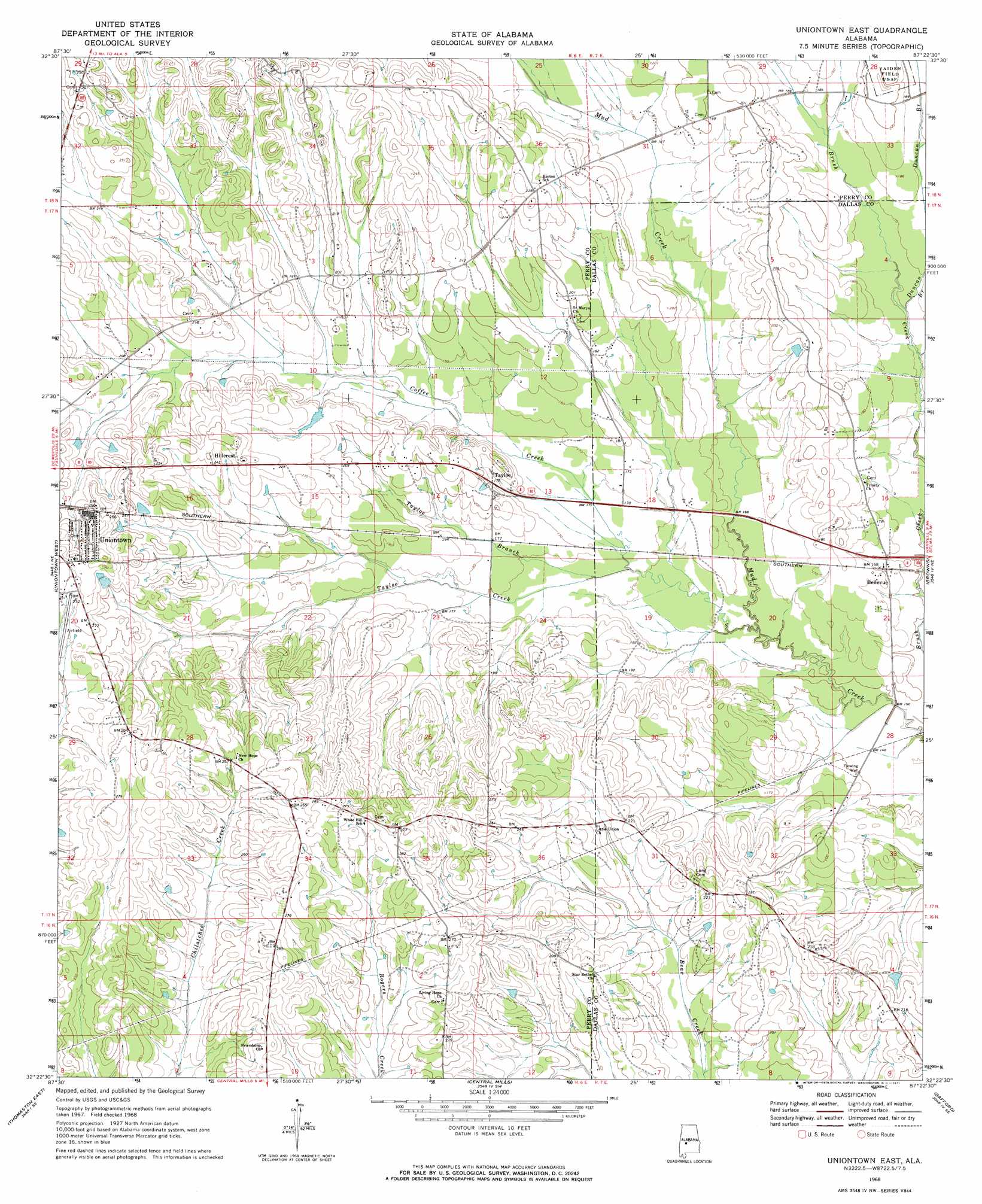
USGS Topo Quad 32087d4 - 1:24,000 scale
| Topo Map Name: | Uniontown East |
| USGS Topo Quad ID: | 32087d4 |
| Print Size: | ca. 21 1/4" wide x 27" high |
| Southeast Coordinates: | 32.375° N latitude / 87.375° W longitude |
| Map Center Coordinates: | 32.4375° N latitude / 87.4375° W longitude |
| U.S. State: | AL |
| Filename: | o32087d4.jpg |
| Download Map JPG Image: | Uniontown East topo map 1:24,000 scale |
| Map Type: | Topographic |
| Topo Series: | 7.5´ |
| Map Scale: | 1:24,000 |
| Source of Map Images: | United States Geological Survey (USGS) |
| Alternate Map Versions: |
Uniontown East AL 1968, updated 1971 Download PDF Buy paper map Uniontown East AL 2011 Download PDF Buy paper map Uniontown East AL 2014 Download PDF Buy paper map |
1:24,000 Topo Quads surrounding Uniontown East
Melton |
Greensboro |
Morgan Springs |
Marion North |
Sprott |
Casemore |
Newbern |
Scott Station |
Marion South |
Suttle |
Gallion |
Uniontown West |
Uniontown East |
Browns |
Marion Junction |
Thomaston West |
Thomaston East |
Central Mills |
Safford |
Orrville |
Magnolia |
Flatwood |
Catherine |
Crumptonia |
Tasso |
> Back to 32087a1 at 1:100,000 scale
> Back to 32086a1 at 1:250,000 scale
> Back to U.S. Topo Maps home
Uniontown East topo map: Gazetteer
Uniontown East: Airports
Uniontown Municipal Airport (historical) elevation 83m 272′Uniontown East: Dams
Marion Weissinger Lake Dam Number 1 elevation 50m 164′Uniontown East: Populated Places
Bellevue elevation 52m 170′Ellawhite elevation 87m 285′
Hillcrest elevation 74m 242′
Tayloe elevation 58m 190′
The Village elevation 86m 282′
Trinity elevation 52m 170′
Uniontown East: Reservoirs
Marion Weissinger Lake Number One elevation 50m 164′Uniontown East: Streams
Coffee Creek elevation 49m 160′Duncan Branch elevation 49m 160′
Smiths Branch elevation 55m 180′
Tayloe Branch elevation 49m 160′
Tayloe Creek elevation 46m 150′
Uniontown East digital topo map on disk
Buy this Uniontown East topo map showing relief, roads, GPS coordinates and other geographical features, as a high-resolution digital map file on DVD:
Gulf Coast (LA, MS, AL, FL) & Southwestern Georgia
Buy digital topo maps: Gulf Coast (LA, MS, AL, FL) & Southwestern Georgia
 & Southwestern Georgia map DVD")