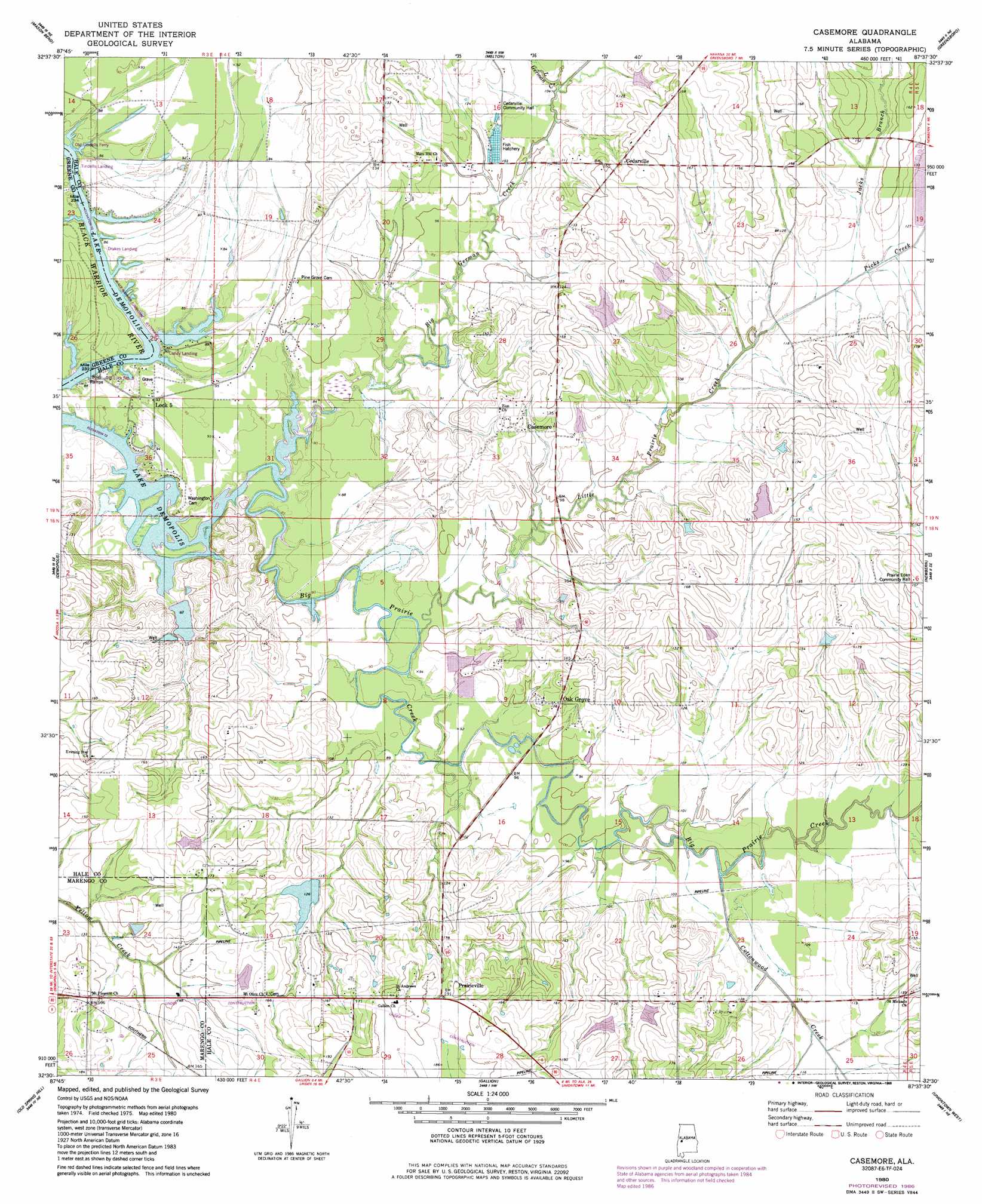
Casemore Topo Map Alabama
To zoom in, hover over the map of Casemore
USGS Topo Quad 32087e6 - 1:24,000 scale
| Topo Map Name: | Casemore |
| USGS Topo Quad ID: | 32087e6 |
| Print Size: | ca. 21 1/4" wide x 27" high |
| Southeast Coordinates: | 32.5° N latitude / 87.625° W longitude |
| Map Center Coordinates: | 32.5625° N latitude / 87.6875° W longitude |
| U.S. State: | AL |
| Filename: | o32087e6.jpg |
| Download Map JPG Image: | Casemore topo map 1:24,000 scale |
| Map Type: | Topographic |
| Topo Series: | 7.5´ |
| Map Scale: | 1:24,000 |
| Source of Map Images: | United States Geological Survey (USGS) |
| Alternate Map Versions: |
Casemore AL 1980, updated 1980 Download PDF Buy paper map Casemore AL 1980, updated 1984 Download PDF Buy paper map Casemore AL 1980, updated 1986 Download PDF Buy paper map Casemore AL 1980, updated 1986 Download PDF Buy paper map Casemore AL 2011 Download PDF Buy paper map Casemore AL 2014 Download PDF Buy paper map |
1:24,000 Topo Quads surrounding Casemore
Eutaw |
Warrior Dam |
Sawyerville |
Ingram |
Hogglesville |
Forkland |
Mason Bend |
Melton |
Greensboro |
Morgan Springs |
Mcdowell |
Demopolis |
Casemore |
Newbern |
Scott Station |
Jefferson |
Old Spring Hill |
Gallion |
Uniontown West |
Uniontown East |
Myrtlewood North |
Linden |
Thomaston West |
Thomaston East |
Central Mills |
> Back to 32087e1 at 1:100,000 scale
> Back to 32086a1 at 1:250,000 scale
> Back to U.S. Topo Maps home
Casemore topo map: Gazetteer
Casemore: Bars
Tindells Bar elevation 23m 75′Casemore: Crossings
Drakes Landing Ferry (historical) elevation 26m 85′Old Tindells Ferry (historical) elevation 23m 75′
Casemore: Dams
Lewis Lawson Dam elevation 29m 95′M J Fitzgerald Dam elevation 42m 137′
Casemore: Parks
Lock Number Five Left Bank Public Use Area elevation 22m 72′Casemore: Populated Places
Casemore elevation 42m 137′Cedarville elevation 43m 141′
Lock Five elevation 28m 91′
Oak Grove elevation 39m 127′
Prairieville elevation 58m 190′
Casemore: Post Offices
Gallion Post Office elevation 63m 206′Casemore: Reservoirs
Fitzgerald Lake elevation 42m 137′Lewis Lawson Pond elevation 29m 95′
Casemore: Streams
Big German Creek elevation 22m 72′Cottonwood Creek elevation 31m 101′
Jacks Branch elevation 34m 111′
Little German Creek elevation 31m 101′
Little Prairie Creek elevation 27m 88′
Picks Creek elevation 34m 111′
Casemore digital topo map on disk
Buy this Casemore topo map showing relief, roads, GPS coordinates and other geographical features, as a high-resolution digital map file on DVD:
Gulf Coast (LA, MS, AL, FL) & Southwestern Georgia
Buy digital topo maps: Gulf Coast (LA, MS, AL, FL) & Southwestern Georgia
 & Southwestern Georgia map DVD")