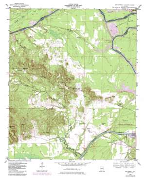
Mcdowell Topo Map Alabama
To zoom in, hover over the map of Mcdowell
USGS Topo Quad 32087e8 - 1:24,000 scale
| Topo Map Name: | Mcdowell |
| USGS Topo Quad ID: | 32087e8 |
| Print Size: | ca. 21 1/4" wide x 27" high |
| Southeast Coordinates: | 32.5° N latitude / 87.875° W longitude |
| Map Center Coordinates: | 32.5625° N latitude / 87.9375° W longitude |
| U.S. State: | AL |
| Filename: | o32087e8.jpg |
| Download Map JPG Image: | Mcdowell topo map 1:24,000 scale |
| Map Type: | Topographic |
| Topo Series: | 7.5´ |
| Map Scale: | 1:24,000 |
| Source of Map Images: | United States Geological Survey (USGS) |
| Alternate Map Versions: |
Mc Dowell AL 1948, updated 1973 Download PDF Buy paper map Mc Dowell AL 1948, updated 1979 Download PDF Buy paper map Mc Dowell AL 1948, updated 1985 Download PDF Buy paper map Mc Dowell AL 1949 Download PDF Buy paper map McDowell AL 2011 Download PDF Buy paper map McDowell AL 2014 Download PDF Buy paper map |
1:24,000 Topo Quads surrounding Mcdowell
> Back to 32087e1 at 1:100,000 scale
> Back to 32086a1 at 1:250,000 scale
> Back to U.S. Topo Maps home
Mcdowell topo map: Gazetteer
Mcdowell: Bars
Arringtons Bar elevation 22m 72′Besteda Bar elevation 26m 85′
Forkland Bar elevation 22m 72′
Greens Bar elevation 22m 72′
McComico Bar elevation 22m 72′
Mussel Shoals Bar elevation 22m 72′
Rattlesnake Bar elevation 22m 72′
Spring Bluff Bar elevation 23m 75′
Mcdowell: Bends
Rattlesnake Bend elevation 26m 85′Twelvemile Bend elevation 26m 85′
Mcdowell: Cliffs
Gardners Bluff elevation 17m 55′Mcdowell: Crossings
McDowell Ferry (historical) elevation 14m 45′Mcdowell: Dams
Demopolis Lock and Dam elevation 14m 45′Mcdowell: Islands
Thompsons Island (historical) elevation 22m 72′Mcdowell: Lakes
Prouts Lake elevation 24m 78′Mcdowell: Parks
Belmont Public Use Area elevation 25m 82′Demopolis State Wildlife Management Area elevation 24m 78′
Mcdowell: Populated Places
Belmont elevation 78m 255′Brownstown elevation 31m 101′
Hall Creek elevation 24m 78′
McDowell elevation 28m 91′
Mcdowell: Reservoirs
Lake Demopolis elevation 14m 45′Mcdowell: Streams
Bottom Creek elevation 34m 111′Cobb Branch elevation 22m 72′
Hall Creek elevation 19m 62′
Hayes Creek elevation 22m 72′
McConnico Creek elevation 22m 72′
Rider Branch elevation 24m 78′
Taylor Branch elevation 22m 72′
Mcdowell: Summits
Armstrong Hill elevation 106m 347′Mcdowell: Swamps
Charleston Swamp elevation 27m 88′Mcdowell: Valleys
The Ravine elevation 23m 75′Mcdowell digital topo map on disk
Buy this Mcdowell topo map showing relief, roads, GPS coordinates and other geographical features, as a high-resolution digital map file on DVD:
Gulf Coast (LA, MS, AL, FL) & Southwestern Georgia
Buy digital topo maps: Gulf Coast (LA, MS, AL, FL) & Southwestern Georgia


