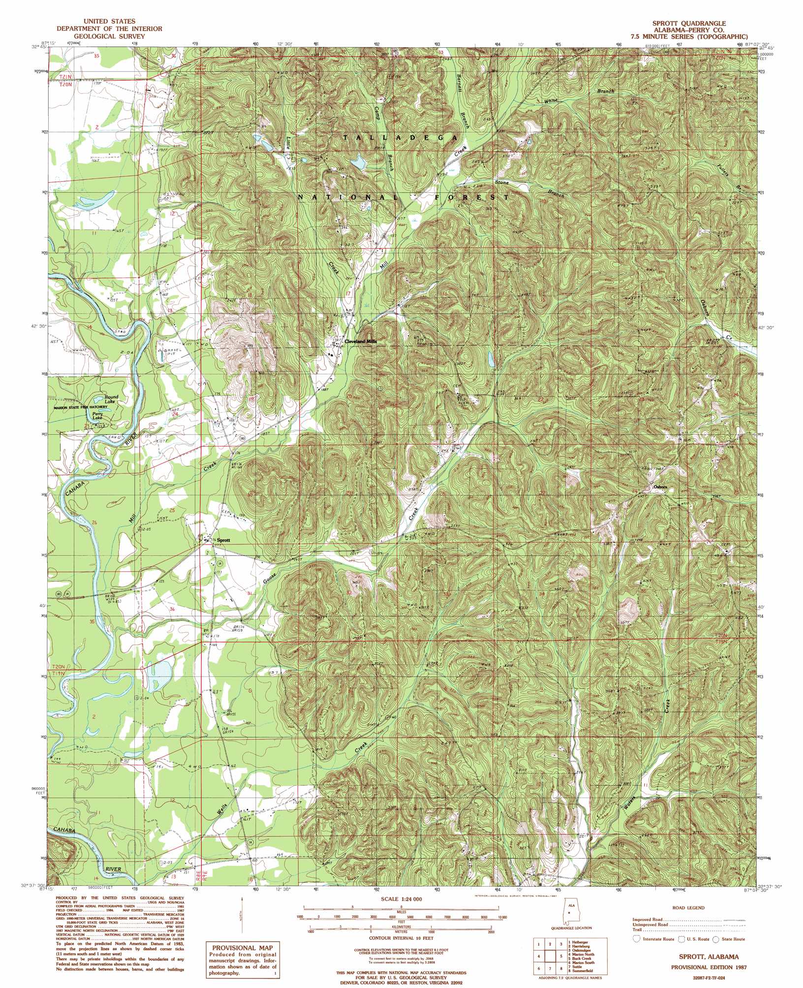
Sprott Topo Map Alabama
To zoom in, hover over the map of Sprott
USGS Topo Quad 32087f2 - 1:24,000 scale
| Topo Map Name: | Sprott |
| USGS Topo Quad ID: | 32087f2 |
| Print Size: | ca. 21 1/4" wide x 27" high |
| Southeast Coordinates: | 32.625° N latitude / 87.125° W longitude |
| Map Center Coordinates: | 32.6875° N latitude / 87.1875° W longitude |
| U.S. State: | AL |
| Filename: | o32087f2.jpg |
| Download Map JPG Image: | Sprott topo map 1:24,000 scale |
| Map Type: | Topographic |
| Topo Series: | 7.5´ |
| Map Scale: | 1:24,000 |
| Source of Map Images: | United States Geological Survey (USGS) |
| Alternate Map Versions: |
Sprott AL 1987, updated 1987 Download PDF Buy paper map Sprott AL 2002, updated 2004 Download PDF Buy paper map Sprott AL 2011 Download PDF Buy paper map Sprott AL 2014 Download PDF Buy paper map |
| FStopo: | US Forest Service topo Sprott is available: Download FStopo PDF Download FStopo TIF |
1:24,000 Topo Quads surrounding Sprott
Payne Lake |
Pondville |
Centreville West |
Centreville East |
Randolph |
Hogglesville |
Heiberger |
Harrisburg |
Oakmulgee |
Maplesville West |
Morgan Springs |
Marion North |
Sprott |
Buck Creek |
Plantersville |
Scott Station |
Marion South |
Suttle |
Summerfield |
Jones |
Uniontown East |
Browns |
Marion Junction |
Selma |
Burnsville |
> Back to 32087e1 at 1:100,000 scale
> Back to 32086a1 at 1:250,000 scale
> Back to U.S. Topo Maps home
Sprott topo map: Gazetteer
Sprott: Lakes
Middle Lake elevation 44m 144′Perry Lake elevation 44m 144′
Round Lake elevation 44m 144′
Sprott: Populated Places
Cleveland Mills elevation 60m 196′Osborn elevation 143m 469′
Sprott elevation 54m 177′
Theo elevation 61m 200′
Sprott: Streams
Barnett Branch elevation 68m 223′Camp Branch elevation 62m 203′
Little Creek elevation 57m 187′
Mill Creek elevation 72m 236′
Mill Creek elevation 43m 141′
Stone Branch elevation 65m 213′
White Branch elevation 72m 236′
Sprott digital topo map on disk
Buy this Sprott topo map showing relief, roads, GPS coordinates and other geographical features, as a high-resolution digital map file on DVD:
Gulf Coast (LA, MS, AL, FL) & Southwestern Georgia
Buy digital topo maps: Gulf Coast (LA, MS, AL, FL) & Southwestern Georgia
 & Southwestern Georgia map DVD")