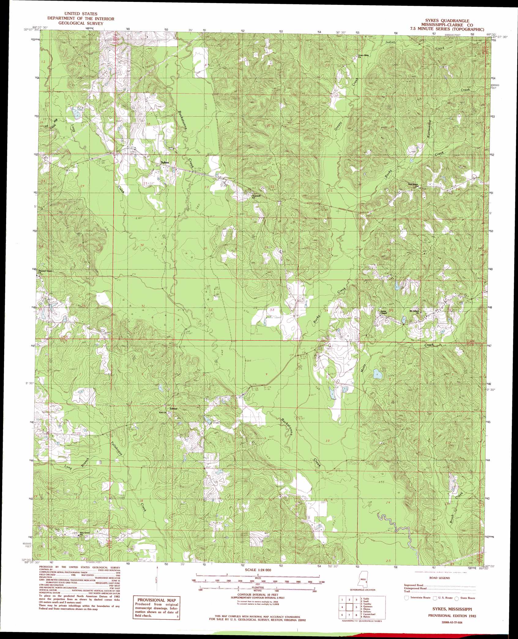
Sykes Topo Map Mississippi
To zoom in, hover over the map of Sykes
USGS Topo Quad 32088a5 - 1:24,000 scale
| Topo Map Name: | Sykes |
| USGS Topo Quad ID: | 32088a5 |
| Print Size: | ca. 21 1/4" wide x 27" high |
| Southeast Coordinates: | 32° N latitude / 88.5° W longitude |
| Map Center Coordinates: | 32.0625° N latitude / 88.5625° W longitude |
| U.S. State: | MS |
| Filename: | o32088a5.jpg |
| Download Map JPG Image: | Sykes topo map 1:24,000 scale |
| Map Type: | Topographic |
| Topo Series: | 7.5´ |
| Map Scale: | 1:24,000 |
| Source of Map Images: | United States Geological Survey (USGS) |
| Alternate Map Versions: |
Sykes MS 1983, updated 1983 Download PDF Buy paper map Sykes MS 2012 Download PDF Buy paper map Sykes MS 2015 Download PDF Buy paper map |
1:24,000 Topo Quads surrounding Sykes
Meehan |
Meridian South |
Vimville |
Whynot |
Ward |
Stonewall |
Sable |
Snell |
Yantley |
Lisman |
Wautubbee |
Quittman |
Sykes |
Hinton |
Land |
Hale |
De Soto |
Carmichael |
Melvin |
Toxey |
Eucutta |
Shubuta |
Matherville |
Isney |
Silas |
> Back to 32088a1 at 1:100,000 scale
> Back to 32088a1 at 1:250,000 scale
> Back to U.S. Topo Maps home
Sykes topo map: Gazetteer
Sykes: Bridges
Davis Bridge elevation 85m 278′Johnson Bridge (historical) elevation 81m 265′
Slay Bridge elevation 80m 262′
Sykes: Populated Places
Linton elevation 107m 351′Sykes elevation 97m 318′
Sykes: Streams
Greasy Creek elevation 89m 291′Indian Creek elevation 96m 314′
Ivy Mill Creek elevation 88m 288′
Long Branch elevation 86m 282′
Long Creek elevation 82m 269′
Motts Creek elevation 76m 249′
Rattlesnake Creek elevation 99m 324′
Rocky Creek elevation 79m 259′
Sykes digital topo map on disk
Buy this Sykes topo map showing relief, roads, GPS coordinates and other geographical features, as a high-resolution digital map file on DVD:
Gulf Coast (LA, MS, AL, FL) & Southwestern Georgia
Buy digital topo maps: Gulf Coast (LA, MS, AL, FL) & Southwestern Georgia
 & Southwestern Georgia map DVD")