Whynot Topo Map Mississippi
To zoom in, hover over the map of Whynot
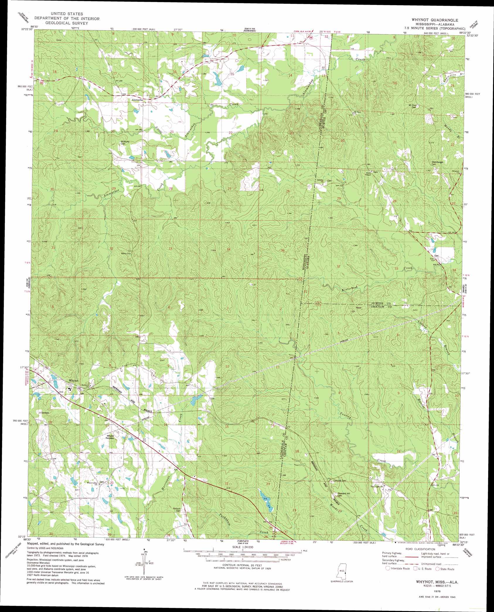
USGS Topo Quad 32088c4 - 1:24,000 scale
| Topo Map Name: | Whynot |
| USGS Topo Quad ID: | 32088c4 |
| Print Size: | ca. 21 1/4" wide x 27" high |
| Southeast Coordinates: | 32.25° N latitude / 88.375° W longitude |
| Map Center Coordinates: | 32.3125° N latitude / 88.4375° W longitude |
| U.S. States: | MS, AL |
| Filename: | o32088c4.jpg |
| Download Map JPG Image: | Whynot topo map 1:24,000 scale |
| Map Type: | Topographic |
| Topo Series: | 7.5´ |
| Map Scale: | 1:24,000 |
| Source of Map Images: | United States Geological Survey (USGS) |
| Alternate Map Versions: |
Whynot MS 1978, updated 1978 Download PDF Buy paper map Whynot MS 2012 Download PDF Buy paper map Whynot MS 2015 Download PDF Buy paper map |
1:24,000 Topo Quads surrounding Whynot
Daleville |
Lauderdale |
Tamola |
Boyd |
Livingston |
Meridian North |
Toomsuba |
Kewanee |
York |
Bellamy |
Meridian South |
Vimville |
Whynot |
Ward |
Gaston |
Sable |
Snell |
Yantley |
Lisman |
Jachin |
Quittman |
Sykes |
Hinton |
Land |
Butler |
> Back to 32088a1 at 1:100,000 scale
> Back to 32088a1 at 1:250,000 scale
> Back to U.S. Topo Maps home
Whynot topo map: Gazetteer
Whynot: Dams
Ben Dearman Catfish Ponds Dam elevation 158m 518′Chatham Pond Dam elevation 127m 416′
R Dempsey Lake Dam elevation 111m 364′
W D Reynolds Lake Dam elevation 133m 436′
W E Harbor Pond Dam elevation 80m 262′
W T Simmons Pond Dam elevation 83m 272′
Whynot: Populated Places
Alamucha elevation 96m 314′Whynot: Streams
Little Alamuchee Creek elevation 73m 239′Little Creek elevation 71m 232′
Whynot digital topo map on disk
Buy this Whynot topo map showing relief, roads, GPS coordinates and other geographical features, as a high-resolution digital map file on DVD:
Gulf Coast (LA, MS, AL, FL) & Southwestern Georgia
Buy digital topo maps: Gulf Coast (LA, MS, AL, FL) & Southwestern Georgia
 & Southwestern Georgia map DVD")