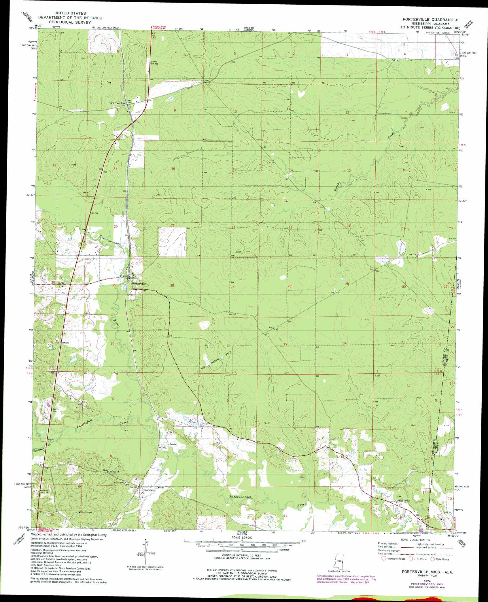
Porterville Topo Map Mississippi
To zoom in, hover over the map of Porterville
USGS Topo Quad 32088f4 - 1:24,000 scale
| Topo Map Name: | Porterville |
| USGS Topo Quad ID: | 32088f4 |
| Print Size: | ca. 21 1/4" wide x 27" high |
| Southeast Coordinates: | 32.625° N latitude / 88.375° W longitude |
| Map Center Coordinates: | 32.6875° N latitude / 88.4375° W longitude |
| U.S. States: | MS, AL |
| Filename: | o32088f4.jpg |
| Download Map JPG Image: | Porterville topo map 1:24,000 scale |
| Map Type: | Topographic |
| Topo Series: | 7.5´ |
| Map Scale: | 1:24,000 |
| Source of Map Images: | United States Geological Survey (USGS) |
| Alternate Map Versions: |
Porterville MS 1974, updated 1978 Download PDF Buy paper map Porterville MS 1974, updated 1987 Download PDF Buy paper map Porterville MS 2012 Download PDF Buy paper map Porterville MS 2015 Download PDF Buy paper map |
1:24,000 Topo Quads surrounding Porterville
Gholson |
Shuqualak |
Paulette |
Panola |
Warsaw |
De Kalb |
Townsend |
Scooba |
Geiger |
Gainesville |
Lauderdale Nw |
Oak Grove |
Porterville |
Emelle |
Epes West |
Daleville |
Lauderdale |
Tamola |
Boyd |
Livingston |
Meridian North |
Toomsuba |
Kewanee |
York |
Bellamy |
> Back to 32088e1 at 1:100,000 scale
> Back to 32088a1 at 1:250,000 scale
> Back to U.S. Topo Maps home
Porterville topo map: Gazetteer
Porterville: Crossings
Yanceys Ferry (historical) elevation 57m 187′Porterville: Dams
Billy Harry Pond Dam elevation 65m 213′Weyerhauser Lumber Company Lake Dam elevation 60m 196′
Weyerhauser Lumber Company Pond Dam elevation 66m 216′
Porterville: Populated Places
Beckville (historical) elevation 70m 229′Enondale elevation 61m 200′
Narkeeta (historical) elevation 55m 180′
Old Narkeetah (historical) elevation 62m 203′
Porterville elevation 61m 200′
Sucarnoochee elevation 68m 223′
Porterville: Post Offices
Dial Post Office (historical) elevation 51m 167′Porterville Post Office elevation 62m 203′
Porterville: Streams
Blackwater Creek elevation 55m 180′Pawticfaw Creek elevation 52m 170′
Porterville digital topo map on disk
Buy this Porterville topo map showing relief, roads, GPS coordinates and other geographical features, as a high-resolution digital map file on DVD:
Gulf Coast (LA, MS, AL, FL) & Southwestern Georgia
Buy digital topo maps: Gulf Coast (LA, MS, AL, FL) & Southwestern Georgia
 & Southwestern Georgia map DVD")