De Kalb Topo Map Mississippi
To zoom in, hover over the map of De Kalb
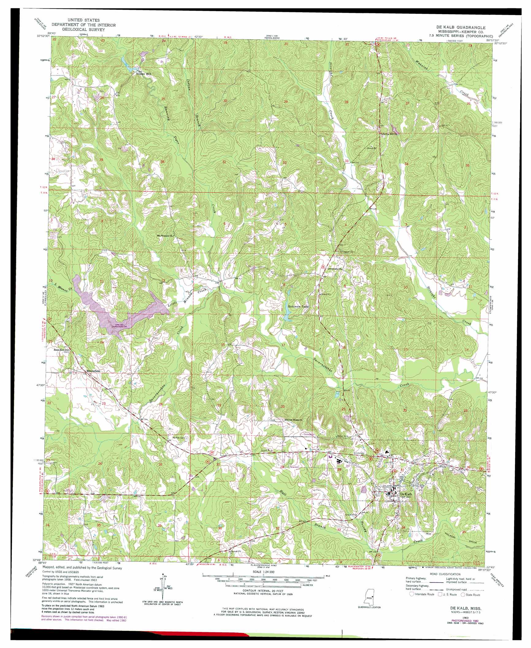
USGS Topo Quad 32088g6 - 1:24,000 scale
| Topo Map Name: | De Kalb |
| USGS Topo Quad ID: | 32088g6 |
| Print Size: | ca. 21 1/4" wide x 27" high |
| Southeast Coordinates: | 32.75° N latitude / 88.625° W longitude |
| Map Center Coordinates: | 32.8125° N latitude / 88.6875° W longitude |
| U.S. State: | MS |
| Filename: | o32088g6.jpg |
| Download Map JPG Image: | De Kalb topo map 1:24,000 scale |
| Map Type: | Topographic |
| Topo Series: | 7.5´ |
| Map Scale: | 1:24,000 |
| Source of Map Images: | United States Geological Survey (USGS) |
| Alternate Map Versions: |
De Kalb MS 1963, updated 1964 Download PDF Buy paper map De Kalb MS 1963, updated 1978 Download PDF Buy paper map De Kalb MS 1963, updated 1982 Download PDF Buy paper map De Kalb MS 2012 Download PDF Buy paper map De Kalb MS 2015 Download PDF Buy paper map |
1:24,000 Topo Quads surrounding De Kalb
Boon |
Fearns Springs |
Mashulaville |
Macon |
Mcleod |
Vernon |
Preston |
Gholson |
Shuqualak |
Paulette |
Owl Creek |
Lynville |
De Kalb |
Townsend |
Scooba |
House |
Moscow |
Lauderdale Nw |
Oak Grove |
Porterville |
Post |
Center Hill |
Daleville |
Lauderdale |
Tamola |
> Back to 32088e1 at 1:100,000 scale
> Back to 32088a1 at 1:250,000 scale
> Back to U.S. Topo Maps home
De Kalb topo map: Gazetteer
De Kalb: Dams
George Sciples Mill Pond Dam elevation 110m 360′Harry H Russell Pond Dam elevation 110m 360′
De Kalb: Populated Places
Bloomfield elevation 122m 400′Bogue Toocolo Chitto (historical) elevation 93m 305′
De Kalb elevation 141m 462′
Holihtasha (historical) elevation 140m 459′
Sciples Mill elevation 107m 351′
De Kalb: Reservoirs
Bateman Lake elevation 101m 331′De Kalb: Streams
Hull Branch elevation 101m 331′Indian Branch elevation 100m 328′
Little Minnow Creek elevation 91m 298′
Running Tiger Creek elevation 92m 301′
De Kalb digital topo map on disk
Buy this De Kalb topo map showing relief, roads, GPS coordinates and other geographical features, as a high-resolution digital map file on DVD:
Gulf Coast (LA, MS, AL, FL) & Southwestern Georgia
Buy digital topo maps: Gulf Coast (LA, MS, AL, FL) & Southwestern Georgia
 & Southwestern Georgia map DVD")