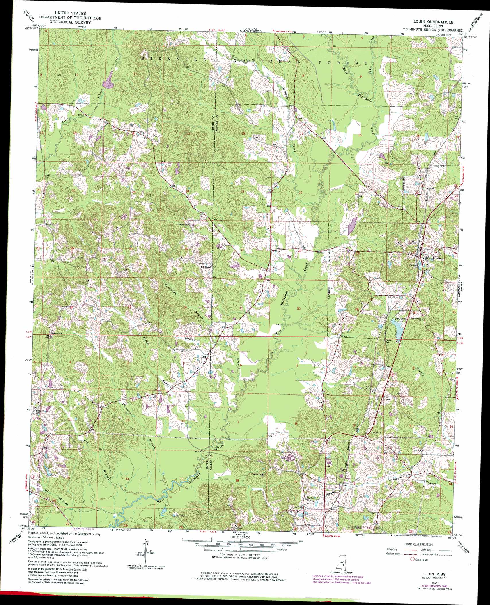
Louin Topo Map Mississippi
To zoom in, hover over the map of Louin
USGS Topo Quad 32089a3 - 1:24,000 scale
| Topo Map Name: | Louin |
| USGS Topo Quad ID: | 32089a3 |
| Print Size: | ca. 21 1/4" wide x 27" high |
| Southeast Coordinates: | 32° N latitude / 89.25° W longitude |
| Map Center Coordinates: | 32.0625° N latitude / 89.3125° W longitude |
| U.S. State: | MS |
| Filename: | o32089a3.jpg |
| Download Map JPG Image: | Louin topo map 1:24,000 scale |
| Map Type: | Topographic |
| Topo Series: | 7.5´ |
| Map Scale: | 1:24,000 |
| Source of Map Images: | United States Geological Survey (USGS) |
| Alternate Map Versions: |
Louin MS 1968, updated 1970 Download PDF Buy paper map Louin MS 1968, updated 1982 Download PDF Buy paper map Louin MS 2012 Download PDF Buy paper map Louin MS 2015 Download PDF Buy paper map |
| FStopo: | US Forest Service topo Louin is available: Download FStopo PDF Download FStopo TIF |
1:24,000 Topo Quads surrounding Louin
Pulaski |
Forest |
Lake |
Newton |
Hickory |
Homewood |
Pineville |
Clear Springs |
Montrose North |
Hero |
Raleigh |
Louin Sw |
Louin |
Montrose South |
Paulding |
Cohay |
Center Ridge |
Bay Springs |
Lake Como |
Waldrup |
Mize |
Taylorsville |
Soso |
Moss |
Sandersville |
> Back to 32089a1 at 1:100,000 scale
> Back to 32088a1 at 1:250,000 scale
> Back to U.S. Topo Maps home
Louin topo map: Gazetteer
Louin: Dams
Pineview Lake Dam elevation 116m 380′Ward Lake Dam elevation 125m 410′
Louin: Populated Places
Burns (historical) elevation 135m 442′Hamlet (historical) elevation 139m 456′
Louin elevation 128m 419′
Stevens elevation 125m 410′
Louin: Reservoirs
Greentree Reservoir elevation 109m 357′Pineview Lake elevation 115m 377′
Louin: Streams
Buchanan Branch elevation 98m 321′Floyd Branch elevation 91m 298′
Gammage Creek elevation 94m 308′
Joe Branch elevation 88m 288′
Otak Creek elevation 98m 321′
Rosson Branch elevation 92m 301′
Thompson Branch elevation 90m 295′
Louin digital topo map on disk
Buy this Louin topo map showing relief, roads, GPS coordinates and other geographical features, as a high-resolution digital map file on DVD:
Gulf Coast (LA, MS, AL, FL) & Southwestern Georgia
Buy digital topo maps: Gulf Coast (LA, MS, AL, FL) & Southwestern Georgia
 & Southwestern Georgia map DVD")