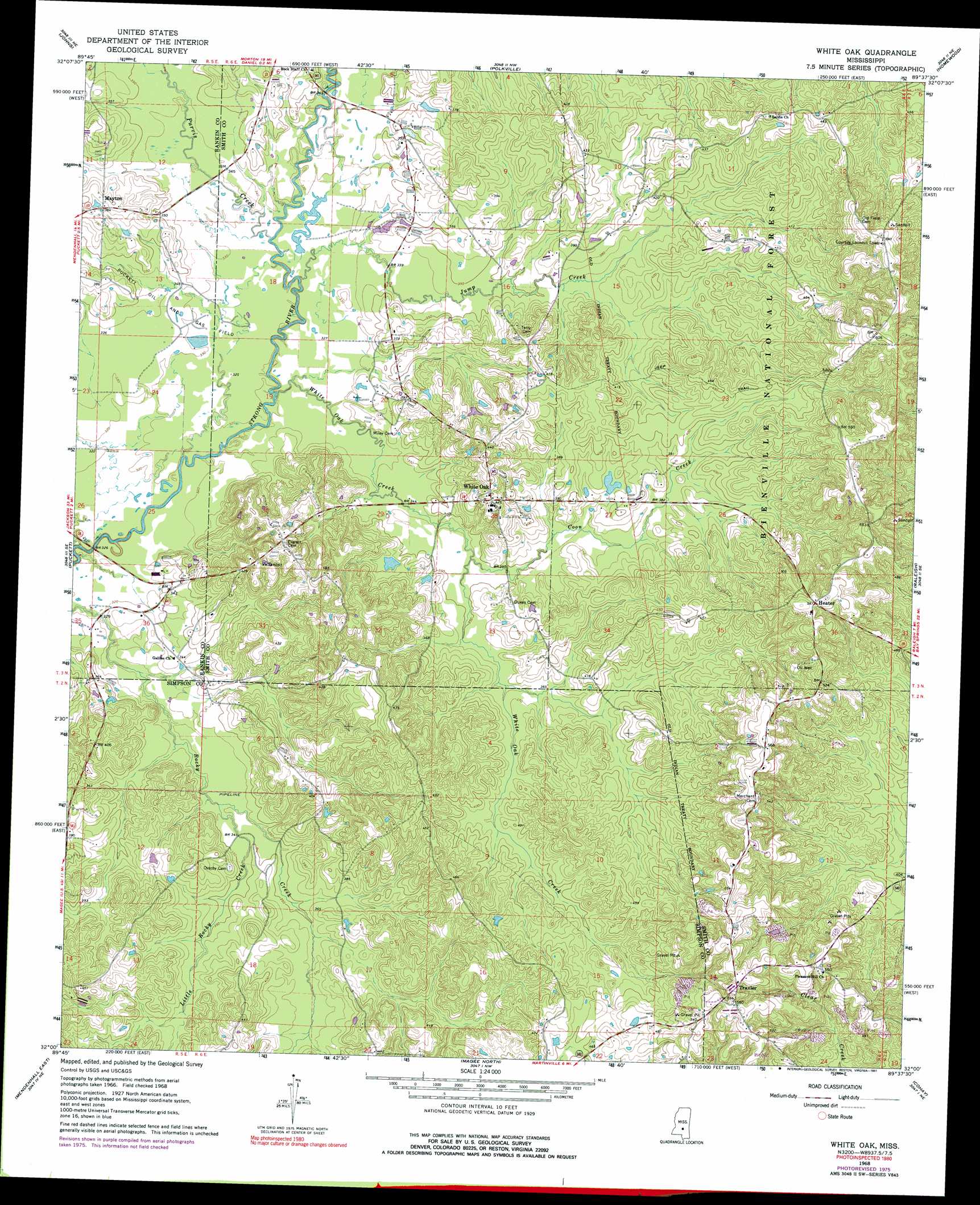
White Oak Topo Map Mississippi
To zoom in, hover over the map of White Oak
USGS Topo Quad 32089a6 - 1:24,000 scale
| Topo Map Name: | White Oak |
| USGS Topo Quad ID: | 32089a6 |
| Print Size: | ca. 21 1/4" wide x 27" high |
| Southeast Coordinates: | 32° N latitude / 89.625° W longitude |
| Map Center Coordinates: | 32.0625° N latitude / 89.6875° W longitude |
| U.S. State: | MS |
| Filename: | o32089a6.jpg |
| Download Map JPG Image: | White Oak topo map 1:24,000 scale |
| Map Type: | Topographic |
| Topo Series: | 7.5´ |
| Map Scale: | 1:24,000 |
| Source of Map Images: | United States Geological Survey (USGS) |
| Alternate Map Versions: |
White Oak MS 1935 Download PDF Buy paper map White Oak MS 1968, updated 1970 Download PDF Buy paper map White Oak MS 1968, updated 1976 Download PDF Buy paper map White Oak MS 1968, updated 1991 Download PDF Buy paper map White Oak MS 2000, updated 2002 Download PDF Buy paper map White Oak MS 2012 Download PDF Buy paper map White Oak MS 2015 Download PDF Buy paper map |
| FStopo: | US Forest Service topo White Oak is available: Download FStopo PDF Download FStopo TIF |
1:24,000 Topo Quads surrounding White Oak
Brandon |
Pelahatchie |
Morton |
Pulaski |
Forest |
Puckett Nw |
Johns |
Polkville |
Homewood |
Pineville |
Braxton |
Puckett |
White Oak |
Raleigh |
Louin Sw |
Mendenhall West |
Mendenhall East |
Magee North |
Cohay |
Center Ridge |
Shivers |
Mendenhall Se |
Magee South |
Mize |
Taylorsville |
> Back to 32089a1 at 1:100,000 scale
> Back to 32088a1 at 1:250,000 scale
> Back to U.S. Topo Maps home
White Oak topo map: Gazetteer
White Oak: Dams
Cook Lake Dam elevation 112m 367′W C Overby Lake Dam elevation 100m 328′
White Oak: Oilfields
Puckett Oil and Gas Field elevation 103m 337′White Oak: Populated Places
Galilee elevation 104m 341′Gunn elevation 120m 393′
Heater elevation 171m 561′
Mayton elevation 116m 380′
Traxler elevation 173m 567′
White Oak elevation 130m 426′
White Oak: Ridges
Heater Ridge elevation 158m 518′White Oak: Streams
Coon Creek elevation 104m 341′Jump Creek elevation 95m 311′
Little Rocky Creek elevation 101m 331′
Purvis Creek elevation 95m 311′
White Oak Creek elevation 97m 318′
White Oak digital topo map on disk
Buy this White Oak topo map showing relief, roads, GPS coordinates and other geographical features, as a high-resolution digital map file on DVD:
Gulf Coast (LA, MS, AL, FL) & Southwestern Georgia
Buy digital topo maps: Gulf Coast (LA, MS, AL, FL) & Southwestern Georgia
 & Southwestern Georgia map DVD")