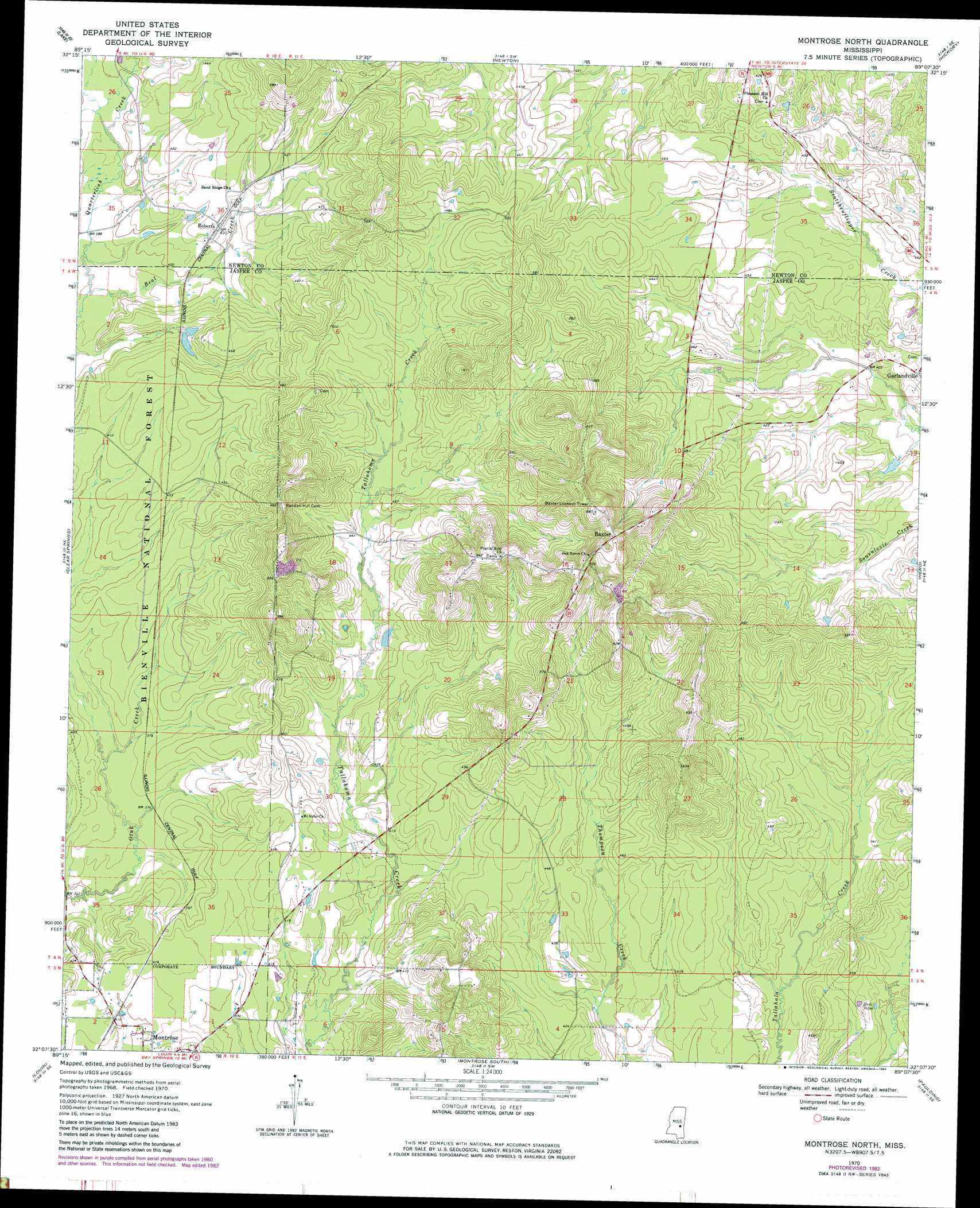
Montrose North Topo Map Mississippi
To zoom in, hover over the map of Montrose North
USGS Topo Quad 32089b2 - 1:24,000 scale
| Topo Map Name: | Montrose North |
| USGS Topo Quad ID: | 32089b2 |
| Print Size: | ca. 21 1/4" wide x 27" high |
| Southeast Coordinates: | 32.125° N latitude / 89.125° W longitude |
| Map Center Coordinates: | 32.1875° N latitude / 89.1875° W longitude |
| U.S. State: | MS |
| Filename: | o32089b2.jpg |
| Download Map JPG Image: | Montrose North topo map 1:24,000 scale |
| Map Type: | Topographic |
| Topo Series: | 7.5´ |
| Map Scale: | 1:24,000 |
| Source of Map Images: | United States Geological Survey (USGS) |
| Alternate Map Versions: |
Montrose North MS 1970, updated 1972 Download PDF Buy paper map Montrose North MS 1970, updated 1982 Download PDF Buy paper map Montrose North MS 2000, updated 2002 Download PDF Buy paper map Montrose North MS 2012 Download PDF Buy paper map Montrose North MS 2015 Download PDF Buy paper map |
| FStopo: | US Forest Service topo Montrose North is available: Download FStopo PDF Download FStopo TIF |
1:24,000 Topo Quads surrounding Montrose North
Harperville |
Conehatta |
Decatur Nw |
Decatur |
Duffee |
Forest |
Lake |
Newton |
Hickory |
Chunky |
Pineville |
Clear Springs |
Montrose North |
Hero |
Rose Hill |
Louin Sw |
Louin |
Montrose South |
Paulding |
Pachuta |
Center Ridge |
Bay Springs |
Lake Como |
Waldrup |
Heidelberg |
> Back to 32089a1 at 1:100,000 scale
> Back to 32088a1 at 1:250,000 scale
> Back to U.S. Topo Maps home
Montrose North topo map: Gazetteer
Montrose North: Parks
Mitts Refuge elevation 122m 400′Montrose North: Populated Places
Baxter elevation 195m 639′Jewells Hill (historical) elevation 193m 633′
Roberts elevation 133m 436′
Verba elevation 127m 416′
Montrose North: Streams
Beal Creek elevation 114m 374′Montrose North digital topo map on disk
Buy this Montrose North topo map showing relief, roads, GPS coordinates and other geographical features, as a high-resolution digital map file on DVD:
Gulf Coast (LA, MS, AL, FL) & Southwestern Georgia
Buy digital topo maps: Gulf Coast (LA, MS, AL, FL) & Southwestern Georgia
 & Southwestern Georgia map DVD")