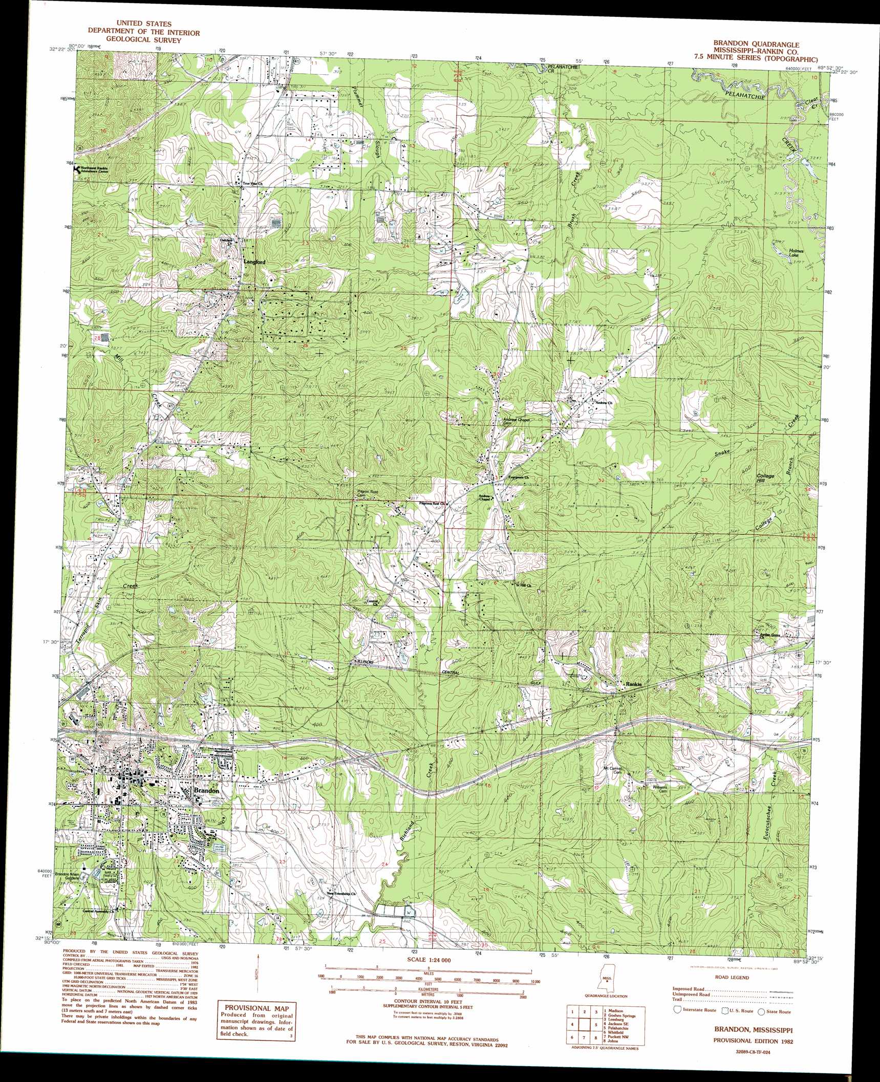
Brandon Topo Map Mississippi
To zoom in, hover over the map of Brandon
USGS Topo Quad 32089c8 - 1:24,000 scale
| Topo Map Name: | Brandon |
| USGS Topo Quad ID: | 32089c8 |
| Print Size: | ca. 21 1/4" wide x 27" high |
| Southeast Coordinates: | 32.25° N latitude / 89.875° W longitude |
| Map Center Coordinates: | 32.3125° N latitude / 89.9375° W longitude |
| U.S. State: | MS |
| Filename: | o32089c8.jpg |
| Download Map JPG Image: | Brandon topo map 1:24,000 scale |
| Map Type: | Topographic |
| Topo Series: | 7.5´ |
| Map Scale: | 1:24,000 |
| Source of Map Images: | United States Geological Survey (USGS) |
| Alternate Map Versions: |
Brandon MS 1982, updated 1983 Download PDF Buy paper map Brandon MS 2012 Download PDF Buy paper map Brandon MS 2015 Download PDF Buy paper map |
1:24,000 Topo Quads surrounding Brandon
Charlton |
Canton |
Shoccoe |
Sharon Se |
Ludlow |
Ridgeland |
Madison |
Goshen Springs |
Leesburg |
Forkville |
Jackson |
Jackson Se |
Brandon |
Pelahatchie |
Morton |
Florence |
Whitfield |
Puckett Nw |
Johns |
Polkville |
Whites |
Star |
Braxton |
Puckett |
White Oak |
> Back to 32089a1 at 1:100,000 scale
> Back to 32088a1 at 1:250,000 scale
> Back to U.S. Topo Maps home
Brandon topo map: Gazetteer
Brandon: Bridges
Trickum Bridge (historical) elevation 96m 314′Brandon: Crossings
Interchange 59 elevation 122m 400′Brandon: Dams
Kennedy Lake Dam elevation 107m 351′Brandon: Flats
Holmes Lake elevation 96m 314′Brandon: Populated Places
Brandon elevation 147m 482′Easthaven elevation 133m 436′
Langford elevation 120m 393′
Rankin elevation 135m 442′
Value elevation 117m 383′
Brandon: Springs
Brandon Springs elevation 117m 383′Brandon: Streams
Brush Creek elevation 93m 305′Clear Creek elevation 95m 311′
College Branch elevation 103m 337′
Brandon digital topo map on disk
Buy this Brandon topo map showing relief, roads, GPS coordinates and other geographical features, as a high-resolution digital map file on DVD:
Gulf Coast (LA, MS, AL, FL) & Southwestern Georgia
Buy digital topo maps: Gulf Coast (LA, MS, AL, FL) & Southwestern Georgia
 & Southwestern Georgia map DVD")