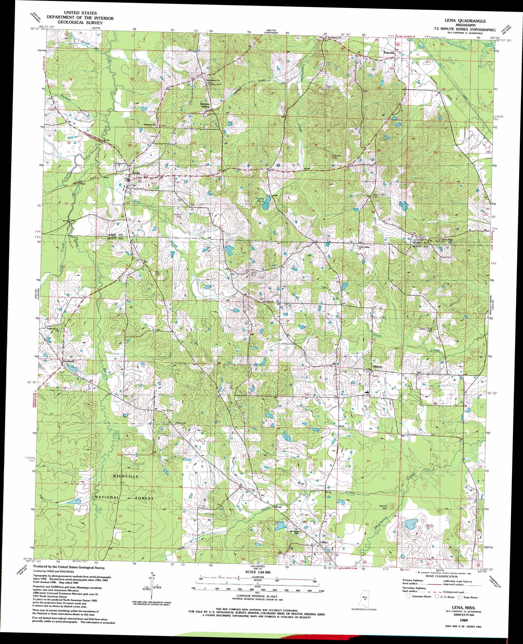
Lena Topo Map Mississippi
To zoom in, hover over the map of Lena
USGS Topo Quad 32089e5 - 1:24,000 scale
| Topo Map Name: | Lena |
| USGS Topo Quad ID: | 32089e5 |
| Print Size: | ca. 21 1/4" wide x 27" high |
| Southeast Coordinates: | 32.5° N latitude / 89.5° W longitude |
| Map Center Coordinates: | 32.5625° N latitude / 89.5625° W longitude |
| U.S. State: | MS |
| Filename: | o32089e5.jpg |
| Download Map JPG Image: | Lena topo map 1:24,000 scale |
| Map Type: | Topographic |
| Topo Series: | 7.5´ |
| Map Scale: | 1:24,000 |
| Source of Map Images: | United States Geological Survey (USGS) |
| Alternate Map Versions: |
Lena MS 1989, updated 1989 Download PDF Buy paper map Lena MS 2000, updated 2002 Download PDF Buy paper map Lena MS 2012 Download PDF Buy paper map Lena MS 2015 Download PDF Buy paper map |
| FStopo: | US Forest Service topo Lena is available: Download FStopo PDF Download FStopo TIF |
1:24,000 Topo Quads surrounding Lena
Camden |
Thomastown |
Conway |
Renfroe |
Edinburg |
Farmhaven |
Ofahoma |
Carthage |
Mcafee |
Madden |
Sharon Se |
Ludlow |
Lena |
Walnut Grove |
Sebastopol |
Leesburg |
Forkville |
Hillsboro |
Harperville |
Conehatta |
Pelahatchie |
Morton |
Pulaski |
Forest |
Lake |
> Back to 32089e1 at 1:100,000 scale
> Back to 32088a1 at 1:250,000 scale
> Back to U.S. Topo Maps home
Lena topo map: Gazetteer
Lena: Dams
B Horowitz Pond Dam elevation 127m 416′B R Gunn Pond Dam elevation 128m 419′
H Boils Pond Dam elevation 128m 419′
K Gunn Pond Dam elevation 140m 459′
L Gatewood Pond Dam elevation 117m 383′
L Lyle Pond Dam elevation 119m 390′
Willie Dumas Pond Dam elevation 120m 393′
Lena: Lakes
Dumas Pond elevation 118m 387′Lena: Populated Places
Abdan elevation 113m 370′Cash elevation 126m 413′
Contrell elevation 121m 396′
Lena elevation 104m 341′
Lillian elevation 127m 416′
Midway elevation 137m 449′
Tuscola elevation 109m 357′
Lena: Streams
Colombo Creek elevation 103m 337′Good Hope Branch elevation 104m 341′
Haley Creek elevation 113m 370′
Lost Creek elevation 106m 347′
Mullens Branch elevation 104m 341′
Slay Creek elevation 104m 341′
Lena: Summits
Island Hill elevation 119m 390′Lena digital topo map on disk
Buy this Lena topo map showing relief, roads, GPS coordinates and other geographical features, as a high-resolution digital map file on DVD:
Gulf Coast (LA, MS, AL, FL) & Southwestern Georgia
Buy digital topo maps: Gulf Coast (LA, MS, AL, FL) & Southwestern Georgia
 & Southwestern Georgia map DVD")