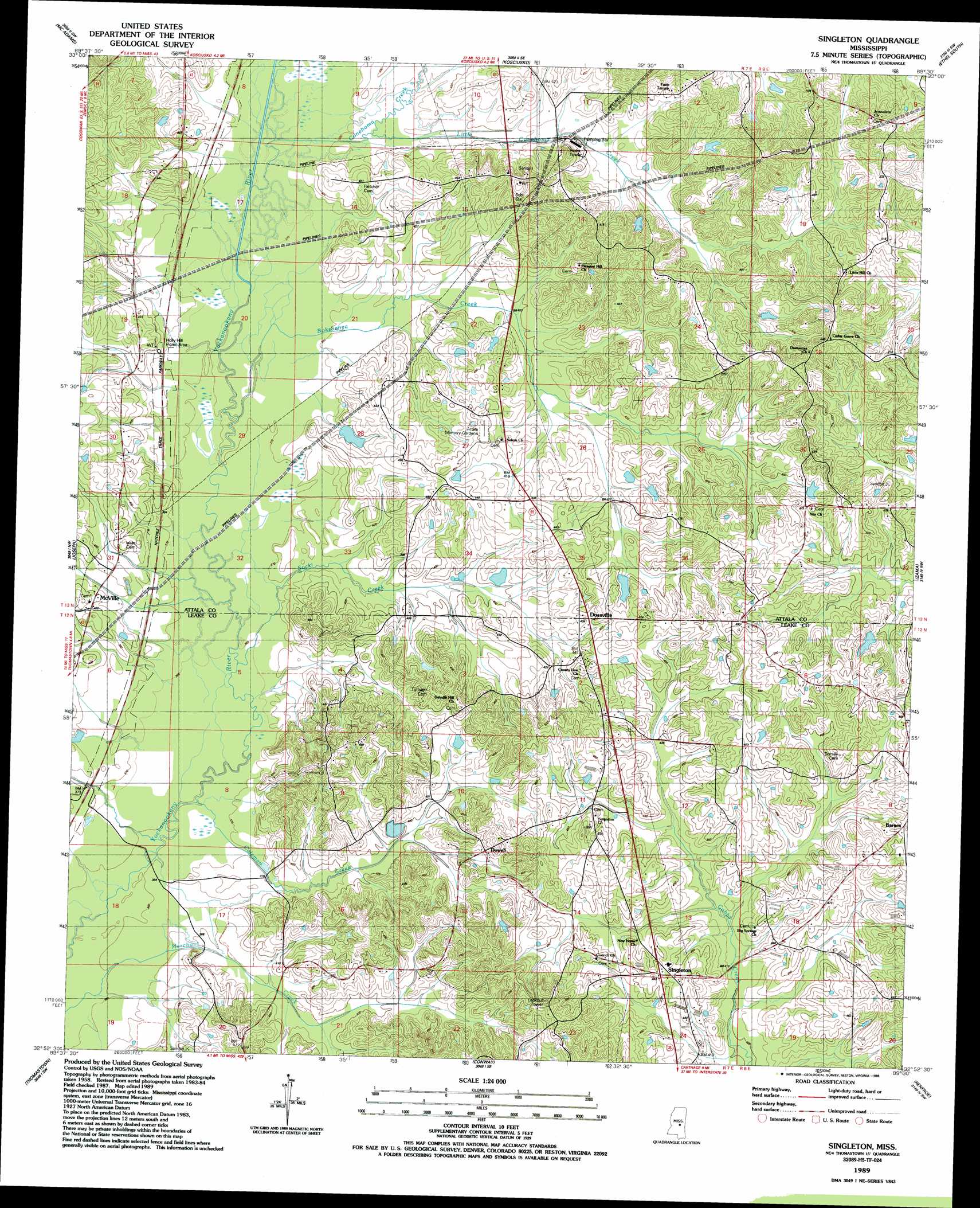
Singleton Topo Map Mississippi
To zoom in, hover over the map of Singleton
USGS Topo Quad 32089h5 - 1:24,000 scale
| Topo Map Name: | Singleton |
| USGS Topo Quad ID: | 32089h5 |
| Print Size: | ca. 21 1/4" wide x 27" high |
| Southeast Coordinates: | 32.875° N latitude / 89.5° W longitude |
| Map Center Coordinates: | 32.9375° N latitude / 89.5625° W longitude |
| U.S. State: | MS |
| Filename: | o32089h5.jpg |
| Download Map JPG Image: | Singleton topo map 1:24,000 scale |
| Map Type: | Topographic |
| Topo Series: | 7.5´ |
| Map Scale: | 1:24,000 |
| Source of Map Images: | United States Geological Survey (USGS) |
| Alternate Map Versions: |
Singleton MS 1989, updated 1989 Download PDF Buy paper map Singleton MS 2012 Download PDF Buy paper map Singleton MS 2015 Download PDF Buy paper map |
1:24,000 Topo Quads surrounding Singleton
West |
Hesterville |
Kosciusko Ne |
Ethel North |
Mccool |
Durant |
Mcadams |
Kosciusko |
Ethel South |
Ethel Se |
Newport |
Joseph |
Singleton |
Zama |
Four Corners |
Camden |
Thomastown |
Conway |
Renfroe |
Edinburg |
Farmhaven |
Ofahoma |
Carthage |
Mcafee |
Madden |
> Back to 32089e1 at 1:100,000 scale
> Back to 32088a1 at 1:250,000 scale
> Back to U.S. Topo Maps home
Singleton topo map: Gazetteer
Singleton: Dams
Chipley Lake Dam elevation 127m 416′McKay Lake Dam elevation 129m 423′
Singleton: Populated Places
Barnes elevation 156m 511′Dossville elevation 132m 433′
Dowell elevation 130m 426′
Knox elevation 132m 433′
McVille elevation 122m 400′
Nile elevation 147m 482′
Singleton elevation 141m 462′
Singleton: Streams
Bokshenya Creek elevation 113m 370′Coleman Creek elevation 110m 360′
Conehoma Creek elevation 114m 374′
Little Conehoma Creek elevation 116m 380′
Socki Creek elevation 110m 360′
Singleton digital topo map on disk
Buy this Singleton topo map showing relief, roads, GPS coordinates and other geographical features, as a high-resolution digital map file on DVD:
Gulf Coast (LA, MS, AL, FL) & Southwestern Georgia
Buy digital topo maps: Gulf Coast (LA, MS, AL, FL) & Southwestern Georgia
 & Southwestern Georgia map DVD")