Star Topo Map Mississippi
To zoom in, hover over the map of Star
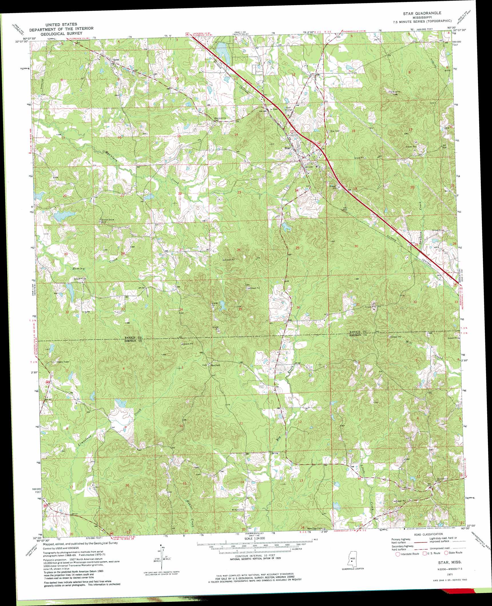
USGS Topo Quad 32090a1 - 1:24,000 scale
| Topo Map Name: | Star |
| USGS Topo Quad ID: | 32090a1 |
| Print Size: | ca. 21 1/4" wide x 27" high |
| Southeast Coordinates: | 32° N latitude / 90° W longitude |
| Map Center Coordinates: | 32.0625° N latitude / 90.0625° W longitude |
| U.S. State: | MS |
| Filename: | o32090a1.jpg |
| Download Map JPG Image: | Star topo map 1:24,000 scale |
| Map Type: | Topographic |
| Topo Series: | 7.5´ |
| Map Scale: | 1:24,000 |
| Source of Map Images: | United States Geological Survey (USGS) |
| Alternate Map Versions: |
Star MS 1971, updated 1973 Download PDF Buy paper map Star MS 1971, updated 1982 Download PDF Buy paper map Star MS 2012 Download PDF Buy paper map Star MS 2015 Download PDF Buy paper map |
1:24,000 Topo Quads surrounding Star
Clinton |
Jackson |
Jackson Se |
Brandon |
Pelahatchie |
New Byram |
Florence |
Whitfield |
Puckett Nw |
Johns |
Terry |
Whites |
Star |
Braxton |
Puckett |
Crystal Springs |
Hopewell |
Harrisville |
Mendenhall West |
Mendenhall East |
Shady Grove |
Georgetown |
Schley |
Shivers |
Mendenhall Se |
> Back to 32090a1 at 1:100,000 scale
> Back to 32090a1 at 1:250,000 scale
> Back to U.S. Topo Maps home
Star topo map: Gazetteer
Star: Airports
Falcon Field elevation 116m 380′Star: Dams
Bishops Lake Dam elevation 101m 331′Corley Lake Dam elevation 109m 357′
Crenshaw Lake Dam elevation 109m 357′
Fridge Lake Dam elevation 106m 347′
Lake Shores Lake Dam elevation 101m 331′
Ridgway Management Lake Dam elevation 121m 396′
Star: Populated Places
Anse elevation 120m 393′Comeby (historical) elevation 122m 400′
Dane (historical) elevation 110m 360′
Gama elevation 140m 459′
Rexford elevation 128m 419′
Star elevation 128m 419′
Star digital topo map on disk
Buy this Star topo map showing relief, roads, GPS coordinates and other geographical features, as a high-resolution digital map file on DVD: