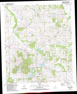
Charlton Topo Map Mississippi
To zoom in, hover over the map of Charlton
USGS Topo Quad 32090e2 - 1:24,000 scale
| Topo Map Name: | Charlton |
| USGS Topo Quad ID: | 32090e2 |
| Print Size: | ca. 21 1/4" wide x 27" high |
| Southeast Coordinates: | 32.5° N latitude / 90.125° W longitude |
| Map Center Coordinates: | 32.5625° N latitude / 90.1875° W longitude |
| U.S. State: | MS |
| Filename: | o32090e2.jpg |
| Download Map JPG Image: | Charlton topo map 1:24,000 scale |
| Map Type: | Topographic |
| Topo Series: | 7.5´ |
| Map Scale: | 1:24,000 |
| Source of Map Images: | United States Geological Survey (USGS) |
| Alternate Map Versions: |
Charlton MS 1988, updated 1989 Download PDF Buy paper map Charlton MS 2012 Download PDF Buy paper map Charlton MS 2015 Download PDF Buy paper map |
1:24,000 Topo Quads surrounding Charlton
> Back to 32090e1 at 1:100,000 scale
> Back to 32090a1 at 1:250,000 scale
> Back to U.S. Topo Maps home
Charlton topo map: Gazetteer
Charlton: Dams
C L Hardaman Lake Dam elevation 60m 196′Cedar Hill Lake Dam elevation 99m 324′
G E Morgan Lake Dam elevation 94m 308′
Hopping Lake Dam elevation 85m 278′
J W Hartfield Lake Dam elevation 116m 380′
Kendall Quinn Lake Dam elevation 90m 295′
O J Andy Lake Dam elevation 84m 275′
Persimmon-Burnt Corn Watershed Five Dam elevation 76m 249′
R W Stribling Lake Dam elevation 94m 308′
Stribling Lake Dam elevation 92m 301′
Tate Lake Dam elevation 60m 196′
Charlton: Lakes
Cedar Hill Lake elevation 91m 298′Lake Ta-ho elevation 70m 229′
Charlton: Populated Places
Anderson elevation 84m 275′Annandale elevation 113m 370′
Charlton elevation 79m 259′
Livingston elevation 88m 288′
Mannsdale elevation 106m 347′
Richton elevation 77m 252′
Stokes elevation 73m 239′
Charlton: Reservoirs
Stribling Lake elevation 93m 305′Charlton digital topo map on disk
Buy this Charlton topo map showing relief, roads, GPS coordinates and other geographical features, as a high-resolution digital map file on DVD:


