Cane Bayou Topo Map Mississippi
To zoom in, hover over the map of Cane Bayou
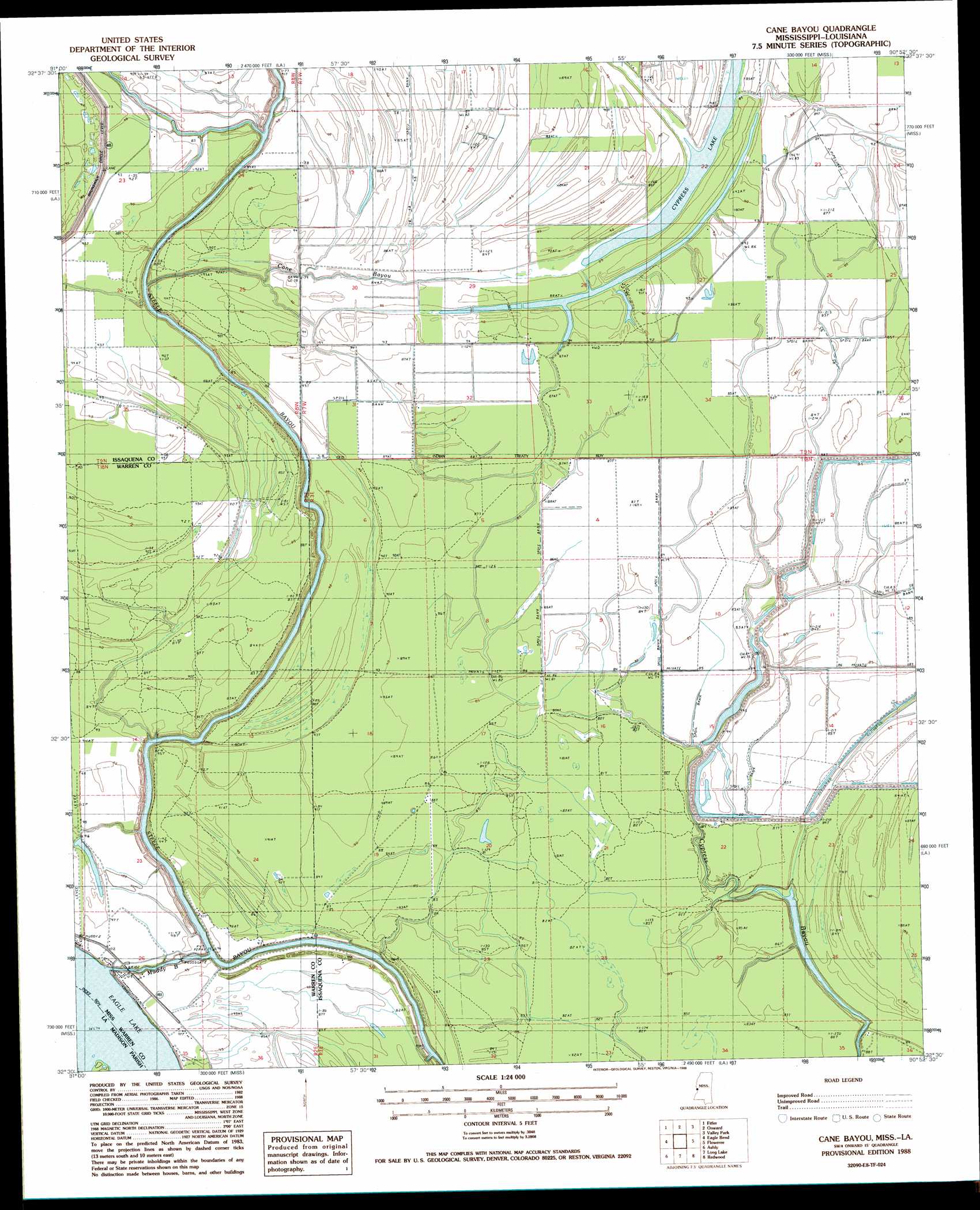
USGS Topo Quad 32090e8 - 1:24,000 scale
| Topo Map Name: | Cane Bayou |
| USGS Topo Quad ID: | 32090e8 |
| Print Size: | ca. 21 1/4" wide x 27" high |
| Southeast Coordinates: | 32.5° N latitude / 90.875° W longitude |
| Map Center Coordinates: | 32.5625° N latitude / 90.9375° W longitude |
| U.S. States: | MS, LA |
| Filename: | o32090e8.jpg |
| Download Map JPG Image: | Cane Bayou topo map 1:24,000 scale |
| Map Type: | Topographic |
| Topo Series: | 7.5´ |
| Map Scale: | 1:24,000 |
| Source of Map Images: | United States Geological Survey (USGS) |
| Alternate Map Versions: |
Cane Bayou MS 1988, updated 1988 Download PDF Buy paper map Cane Bayou MS 2012 Download PDF Buy paper map Cane Bayou MS 2015 Download PDF Buy paper map |
1:24,000 Topo Quads surrounding Cane Bayou
Lake Providence |
Whiting Bayou |
Cary |
Red Rock |
Holly Bluff |
Transylvania |
Fitler |
Onward |
Valley Park |
Lucre |
Sondheimer |
Eagle Bend |
Cane Bayou |
Floweree |
Eldorado |
Tallulah |
Ashly |
Long Lake |
Redwood |
Oak Ridge |
Fortune Fork |
Mound |
Vicksburg West |
Vicksburg East |
Bovina |
> Back to 32090e1 at 1:100,000 scale
> Back to 32090a1 at 1:250,000 scale
> Back to U.S. Topo Maps home
Cane Bayou topo map: Gazetteer
Cane Bayou: Guts
Muddy Bayou elevation 23m 75′Cane Bayou: Islands
Australia Island Number Onehundred and One elevation 23m 75′Cane Bayou: Lakes
Cypress Lake elevation 26m 85′Cane Bayou: Streams
Cane Bayou elevation 21m 68′Willow Bayou elevation 28m 91′
Cane Bayou digital topo map on disk
Buy this Cane Bayou topo map showing relief, roads, GPS coordinates and other geographical features, as a high-resolution digital map file on DVD: